How would Sonnelands’ South Hill property look if it was fully developed?
Earlier on Wednesday we ran a map with an item on the proposed amendment request submitted on behalf of the family of John and Holly Sonneland. That earlier printed map is the existing land use for the 30 acres the Sonnelands own on Spokane's South Hill.
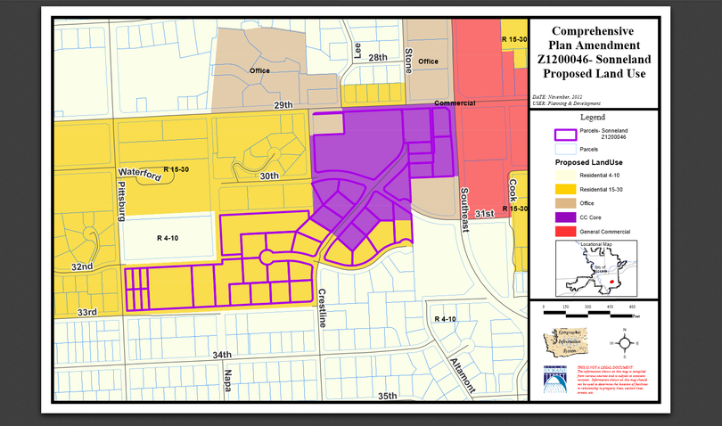
Here is another map from the city that shows the proposed, requested uses for the same property. The large purple block would be centers and corridors designated for mixed use. The darker yellow area to the left and below, bordered with purple lines, would remain residential, but it would change in nature.
As our other SR news story (ran on May 22) reported, the Sonnelands say they didn't submit the full 30-acre rezone request. They say a local developer, Steve Schmautz, went forward for a full rezone, rather than what the Sonnelands wanted, a smaller, less-than-eight-acre rezone of their property.
This map shows that if the full project moved forward, one request to the city would change the residential parcels, currently zoned single-family residential, to R15-30, allowing for up to 30 units per acre.
The original documents accompanying the request did note that the project, if developed, would not build apartments at that density, but closer to 10 units per acre. The Sonnelands, again saying that type of development is several years off, if at all, say they don't want a high-density residential development.