No surprise: Avalanche danger significant in region’s mountains

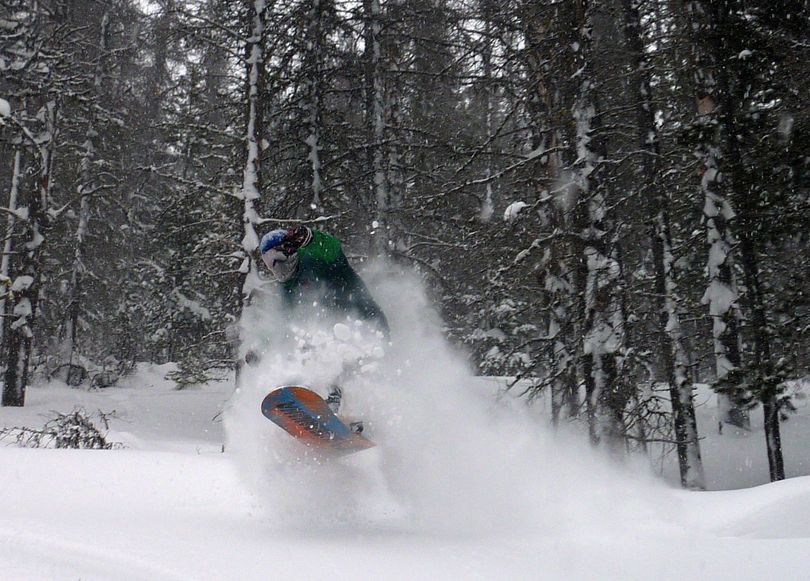
WINTER SPORTS -- Today's avalanche advisory from the Idaho Panhandle Avalanche Center includes a lot of important details for anyone headed out of bounds to enjoy snow the recent storms have heaped on the backcountry.
But no one should be surprised at the bottom line: There's significant danger in many areas.
Heavy snowfall in the region has been acccompanied by high westerly winds. "In the mountains surrounding the Silver Valley and the St. Joe Mountains this has created unstable slabs in the new snow and also stressed an old weak layer from a Christmas surface hoar layer," the report says.
"To the north the mountains have received slightly less snow but there are two weak layers to be cautious of. The avalanche danger will increase due to new snow and rising temperatures. "
Read on for the entire report:
|
AVALANCHE ADVISORY
|
|
U.S. FOREST SERVICE |
FORECASTER: Davis |
|
IDAHO PANHANDLE AVALANCHE CENTER |
EFFECTIVE DATE: 01/20/2012 |
|
DATE ISSUED: 01/20/2012 0730 |
OUTLOOK: 01/21-22/2012 |
|
This report does not apply to local ski areas within the forecast region and the hazard rating will remain valid through midnight January 20, 2012. Special thanks to Idaho Parks and recreation for sponsoring this avalanche advisory. |
Thanks Silver Mountain Ski Patrol and Schweitzer Mountain Patrol for their cooperation with the forecasters field day and all the observers who attended the two events. |
|
WEATHER |
|
TODAY: 80% chance of snow across the forecast region with 1-3 inches possible. Temperatures in the mid to high 20s and calm winds. Temperatures have been on the rise since earlier this week.TONIGHT: 100% chance of snow with 3-5 inches expected for the mountains of the Silver Valley and 5-9 inches in the Selkirk/Cabinet region. Temperatures will remain in the mid 20s and S/SW winds will increase. OUTLOOK: Severe weather is expected with Saturday bringing a 100% chance of 3-5 inches and SW winds increasing with gusts into the 30mph range. Expect this weather to continue into the evening with a significant chance of several more inches of accumulation and strengthening westerly winds. Expect dangerous avalanche conditions to exist caused by new snow and heavy wind-loading. Avalanche danger will increase with the expected weather for the outlook period. |
|
|
Selkirk and Cabinet mountains: In the Cabinet Mountains yesterday Oly and I dug pits on SE and North aspects during our travel up to Lunch Peak. On southerly aspects we found about 10 inches of wind scoured snow from this week overlying a firm crust. Shears were clean at this layer but required moderate force to fail. On northerly and easterly aspects snow was deeper due to wind-loading and we revealed a weak layer at 2 feet deep from surface hoar being buried on Tuesday. This layer will be your main concern today and this weekend as it is further stressed from more snow and warming temperatures. The Xmas surface hoar layer is still very weak and buried 4 feet deep, but the weakness is bridged by a supportive crust. It could be triggered in higher elevations areas. Avalanche danger is rated CONSIDERABLE on wind-loaded aspects steeper than 30 degrees above 5,500 feet. The avalanche danger as MODERATE on non wind-loaded slopes less than 35 degrees.
St. Regis Basin and Silver valley: Due to the serious weather in the Silver Valley and up the St. Joe this week avalanche forecasters have had a difficult time reaching the higher elevations. Dan did make it to Lookout Pass where he observed many signs of high avalanche danger. Dan observed numerous smaller slides on the railroad grade and up toward the FAA towers. Winds have been consistently strong this week and wind-loading on lee aspects will be deep. Dan revealed two layers of concern. The upper weak layer is buried about 10-12 inches and is weak sugary snow overlying a crust. Shear tests show easy results, buried surface hoar, and the potential for avalanches to be large. Triggering this weak layer could in turn trigger the weak surface hoar layer which is three feet deep. Dan’s shear tests revealed clean, easy shears. Dave Alley at Silver Mountain reports avalanches 2-3 feet deep from control work on the mountain yesterday. Avalanche danger is rated HIGH on wind-loaded aspects steeper than 30 degrees above 4,500 feet. The avalanche danger as CONSIDERABLE on non wind-loaded slopes less than 30 degrees. Avalanches in the mountains surrounding the Silver Valley and the St. Joe’s will be likely today and the danger will increase this weekend due to accumulating snow and strong westerly winds. Slightly less snow to the north but avalanche danger is on the rise there as well. Look for signs of instability like shooting cracks and listen for whumphing which means failing weak layers. Avalanches are bulls-eye information meaning stay off similar slopes and check for weak layers constantly while traveling. Be careful out there this weekend. |
|
|
The next avalanche advisory will be issued January 27th. |
|


