Avalanche advisory: dangers lurk under tempting powder
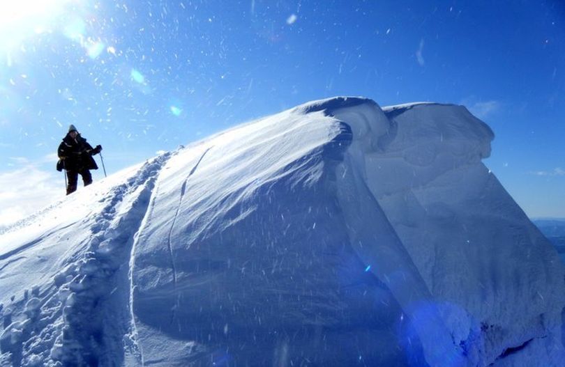
WINTER SPORTS -- Despite the recent sunshine, good powder snow is lingering on north aspects in the region's mountains. Skiers, boarders and snowmobilers heading out to enjoy the late winter snow must be wary of several factors, says Kevin Davis, Idaho Panhandle Avalanche Center director.
"Be aware of generating some good sized sluffs and a weak layer 6-12 inches deep from Sundays snowfall," he said in the avalanche advisory just posted this morning.
"Exposed faces have firmer surface snow due to wind and sun. Watch your terrain selection as the sun heats up steep sunny slopes today as this could create some stability problems as the surface layers heat up.
"Deep surface hoar layer still showing signs of weakness and I think we’ll have to deal with this one for the rest of the winter.
"Spring conditions could reveal some climax avalanches as the pack starts to go isothermal. New snow comes in with wind starting Saturday night."
Read on for the detailed report on snow conditions throughout the region, were avalanche warnings are moderate to considerable.
|
AVALANCHE ADVISORY
|
|
U.S. FOREST SERVICE |
FORECASTER: Davis |
|
IDAHO PANHANDLE AVALANCHE CENTER |
EFFECTIVE DATE: 03/09/2012 |
|
DATE ISSUED: 03/09/2012 0730 |
OUTLOOK: 03/10-11/2012 |
|
This report does not apply to local ski areas within the forecast region and the hazard rating will remain valid through midnight March 9th, 2012. Special thanks to Idaho Parks and recreation for sponsoring this Avalanche advisory. |
Watch solar gain on sunny slopes today. New snow in the forecast Saturday night into Sunday. Wind-loaded slopes will become treacherous since new snow comes with a lot of wind and warming; think heavy over light, bad. Thanks for snow observations this week. |
|
WEATHER |
|
TODAY: Sunny to partly sunny across the forecast region. Temperatures will be rising into the 40s but a S/SW wind at 10-13mph, with gusts up to 22mph will keep things firmed on exposed aspects.TONIGHT: Maybe a skiff of snow with temperatures dropping to the freezing level or just below and S/SW winds on the march up to 15mph with stronger gusts. SATURDAY: Possibly 1 inch of new snow with temperatures above freezing. Watch the freezing level which could rise above 6,000 feet. S/SW winds will be increasing. By Saturday evening you’ll see a better than average chance of 1-3 inches of new snow to the North and 3-5 inches to the south. Snow continues for Sunday with 2-4 inches North and 4-8 inches south. This snow comes with a lot of wind and warming temperatures Sunday. The avalanche danger will increase for the outlook period. |
|
|
Selkirk and Cabinet mountains:We’re seeing a difference in snow conditions with regard to aspect with the S, W, and E aspects being much firmer due to warming by the sun. Also, exposed aspects have a firmer wind-slab and these exist on any open face. I got shallow releases on this wind-slab on a NW aspect. Stability tests revealed a similar pack on all aspects with a weak layer at the change in density new snow from Sunday night on a SE aspect about 6-8 inches deep. Jake Adams got an easy shear on this layer on the east face of Big Blue, Schweitzer backcountry on Wednesday. Concern will be warming on this layer on E, S, and W aspects today. On the north we found this same layer at 1.5 feet deep and it sheared with moderate force. On all aspects the surface hoar layer is still intact, under a firm 4-5 foot deep slab, shears with energy, and you should consider it a nagging problem. Hard to trigger, but if it goes, you don’t want to be there. It will be a problem as we enter the warm spring thaw cycle. Avalanche danger is rated MODERATE on all wind-loaded aspects steeper than 35 degrees above 5,000 feet. Avalanche danger will ramp up to CONSIDERABLE during the heat of the day today, especially on slopes in direct sun.
St. Regis Basin and Silver valley: Carole and Dan found a weak layer at a melt freeze crust with the most recent snow on top up in the Basin that was failing with moderate force. Silver Mountain Ski Patrol found generally stable conditions in the out of bounds areas around the resort yesterday but the change in density in the recent snow did still show some weakness and where more wind-effected and in the sun today will become weaker. Further south on Round Top, Ed found the same weakness in the recent snow. Deeper in the pack Ed expressed concern for the buried surface hoar since it fails cleanly, with energy, and propagates easily. Carole didn’t mention seeing the surface haor but got consistent shears at about the same 3-4 foot depth. Big consequences if you trigger this layer. Avalanche danger is rated MODERATE on all wind-loaded aspects steeper than 35 degrees above 5,000 feet. Avalanche danger will ramp up to CONSIDERABLE during the heat of the day today, especially on slopes in direct sun. |
|
The next avalanche advisory will be issued March 16th. Karl Dietrich, accomplished local mountaineer and owner of Dietrich Coffee Roasters, will present a slide show of some of his favorite alpine climbs, some first ascents, from Canada’s BC and Alberta. Show is March 29that 6PM at Laughing Dog Brewery in Ponderay and presented by the Friends of the Idaho Panhandle Avalanche Center. See you there! |
|
|
Contact: Kevin Davis (208) 265-6686, Ed Odegaard (208) 245-6209, or John Olson (208) 265-6635 This message is available by calling (208) 765-7323 or toll-free at 1-866-489-8664. E-mail address: kevingdavis@fs.fed.us, eodegaard@fs.fed.us, jrolson@fs.fed.us, ebmorgan@fs.fed.us
|
|

