Appalachian Trail proposal seeks link to Gulf of Mexico
HIKING -- A proposed extension of the Appalachian Trail could add add a few hundred miles of foot trail -- and possibly a canoeing option -- to link the trail all the way south to the Gulf of Mexico.
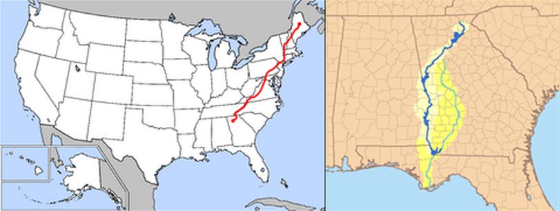
The nonprofit organization Trust for Public Land has been working for years to acquire land along the Chattahoochee River in the southeastern United States, where the Appalachian Trail (AT) ends at its southernmost point. The organization intends to make this land available to the National Park Service and other partners for an extension of the AT that would lead all the way to the Gulf of Mexico.
Currently, the 2,184-mile AT begins in the middle of Maine and ends in northern Georgia. It crosses the Chattahoochee River’s uppermost headwaters. Curt Soper, the Georgia-Alabama state director of the Trust for Public Land, told ABC News that the non-profit envisions Appalachian hikers being able to continue on a trail down along the river to the Gulf of Mexico at the shores of Florida.
