Virtual fly-through reveals scope of Washington wildfires
WILDFIRES -- The video below is a Google Earth virtual fly-through of most wildfires burning in Eastern Washington, updated through noon today, Aug. 24. The fires are having a growing impact on closing public road and trail access to private and public lands and recreation areas throughout the region.
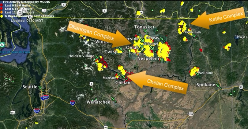
Kenji Kato posted the YouTube video from information compiled from public MODIS+VIIRS Fire Data from the US Forest Service for the Chelan Complex Fire, the Okanogan Complex Fire and other fires in North Central Washington State.
The fly-through starts above the United States, then zooms in on the Pacific Northwest, then Central Washington, before flying in on the fire areas.
Raw data, including Google Earth data, used to create this video can be downloaded from the US Forest Service here.
