Spokane’s bicycle greenways
This week, I wrote an article about bikes and pavement, and all the new bikeways coming to town this year.
In the story, I told of the planned Cincinnati Greenway, the first of three greenways the city is considering designating in coming years. For those unaware, a greenway is a street with slow-moving, low-volume vehicular traffic that prioritizes bicycle and pedestrian traffic. Usually, the streets run through neighborhoods.
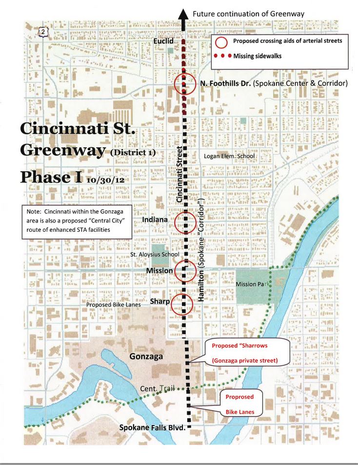
Though the Cincinnati Greenway is on the books, it doesn't have funding yet. When complete, it will connect two new bike routes and will create a nine-mile long bikeway between the East Central and Nevada-Lidgerwood neighborhoods. What I didn't mention in the story is the city, and a neighborhood coalition, has discussed other potential options for Spokane greenways.
The South Hill Coalition - which is made up of the Cliff-Cannon, Comstock, Lincoln Heights, Manito/Cannon Hill, Rockwood and Southgate neighborhoods - put together a "Connectivity and Livability Strategic Plan" last year. The plan included ideas for greenway network connecting the neighborhoods on the South Hill.
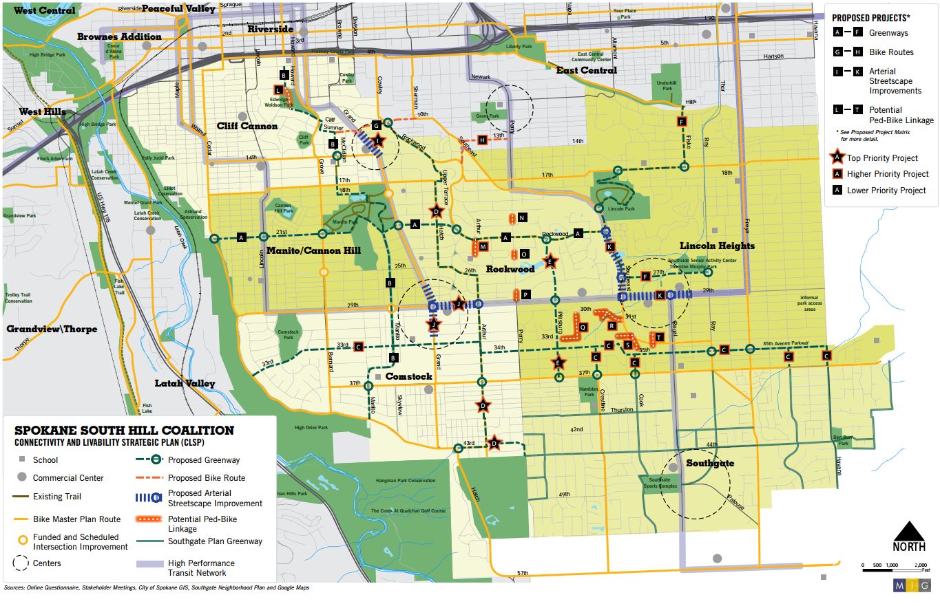
One route would let cyclists ride from the Bluffs, at West 21st Avenue, all the way to Underhill Park in East Central. Another route would connect the Rocket Market on 43rd to Rockwood Boulevard.
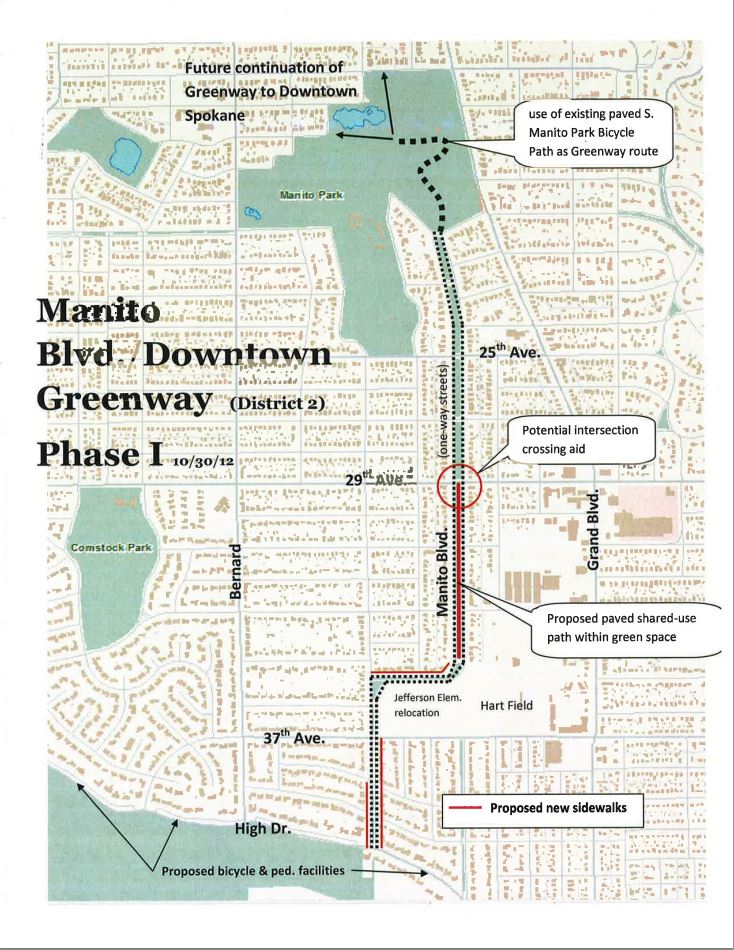
Also, a couple of years ago, the city did a report on four greenways: Aside the aforementioned Cincinnati, city staffers looked at Manito Boulevard, Walton Avenue and Everett Avenue.
The Manito Greenway would start at the Bluffs and cruise to Manito Park. In my humble opinion, this route is already kind of a greenway, and the only tough connection is at 29th.
The Walton Greenway, on the north side of town, would run east-west one block north of Garland. It would cross Division at Clark Park.

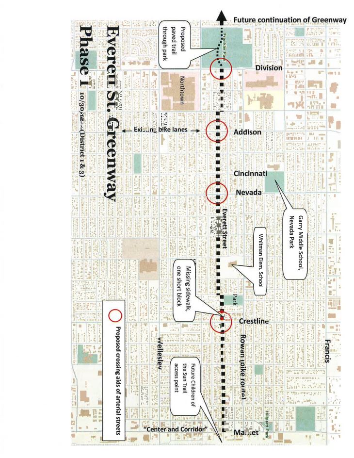
Everett Greenway would also run east-west, just south of Rowan Avenue.
What do you think? Are Spokane's first greenways gold? Or do they make you subside to grief?