Power Generation
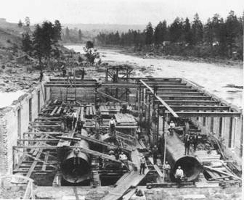
This photo was taken November 12, 1890 and what’s significant about this story is that the turbines (already installed in this picture) were put in place before the concrete arch supports for the floors, and the floors themselves were poured (concrete). The demand for power in Spokane was so great that shortly after this photo was taken, the penstocks were connected and the electric dynamos (as they were called then) were lowered into place and two units were put into service.
This photo was taken November 12, 1890 and what’s significant about this story is that the turbines (already installed in this picture) were put in place before the concrete arch supports for the floors, and the floors themselves were poured (concrete). The demand for power in Spokane was so great that shortly after this photo was taken, the penstocks were connected and the electric dynamos (as they were called then) were lowered into place and two units were put into service.
Spokane Falls is the name given to a series of waterfalls located on the Spokane River in downtown Spokane that provided a source of power for the early industrial development of the region. Of the many dams and diversions built to harness the river’s energy, from the early 1880s forward, two developments remain in use today.
The original Monroe Street generating station was constructed at the Lower Falls in 1889-91, by a small investment group known as the “The Washington Water Power Company,” formed in Spokane in March 1889. The project consisted of a rock and timber-crib diversion dam with large tubes or “penstocks” that carried water to the turbine generators in the powerhouse at the foot of the Falls.
The generators were purchased from Edison General Electric Company and produced direct current or DC electricity. The capacity of the powerhouse, originally designed at 1,100 kW was doubled in 1897, and a second powerhouse producing alternating current or AC power was constructed in 1903, doubling the capacity again. Although the original powerhouse was removed from service early in 20th Century, the second powerhouse was a Spokane landmark until it was replaced in 1990. The present powerhouse is situated deep in the native basalt under the site of the original powerhouse and has one Kaplan-type turbine and generator with a generating capacity of 14.8 MW, 14,800 kW or sufficient energy to power about 15,000 homes. The original rock crib diversion dam was variously upgraded until it partially washed out in 1972, and was replaced with the present concrete dam and intake structure.
The Upper Falls had been the site of many smaller power developments prior to the construction of the Upper Falls generating station in 1920–22 by The Washington Water Power Company. The dam for this powerhouse, known as the Division Street Control Works, diverts water from the main channel of the Spokane River into the original south channel where the intake gates for the powerhouse were constructed.
The Upper Falls station was the last project built on the Spokane River by the Washington Water Power Company. The Upper Falls station incorporated the Company’s first vertical-design turbine, one of the first installed in the Western U.S.
Powered by a Francis-type turbine, the Upper Falls station has a generating capacity of 10 MW, 10,000 kW or sufficient energy to power 10,000 homes.
Though the original Francis turbine and generator have been rehabilitated on several occasions, the equipment is still in operation after 90 years of service. Both Upper Falls and Lower Falls dams are operated by the power company Avista.
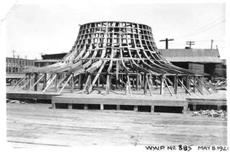
Upper Falls Powerhouse – Framing for the concrete form for the Francis Turbine.
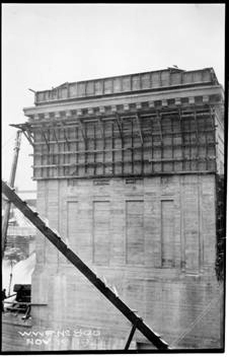
Upper Falls Powerhouse – nearing completion.
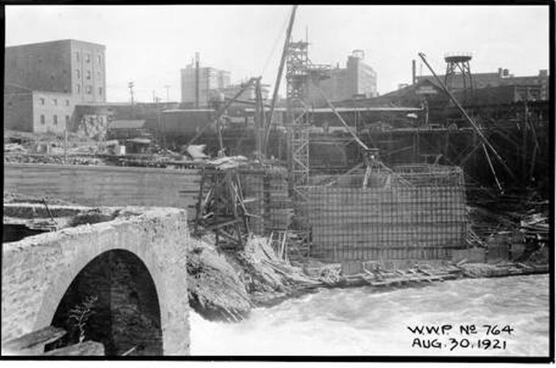
Upper Falls Powerhouse under construction. The brick foundation at the left of the photo was originally the Crystal Springs laundry.
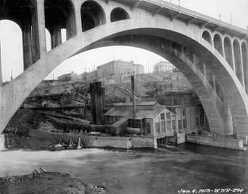
This photo shows the ‘new’ 1903 powerhouse in the foreground, with the original powerhouse attached to the rear.
Directions to the next stop: Spokane Falls & the Lincoln Street Bridge
1 ft away
Head southeast on W Main Ave