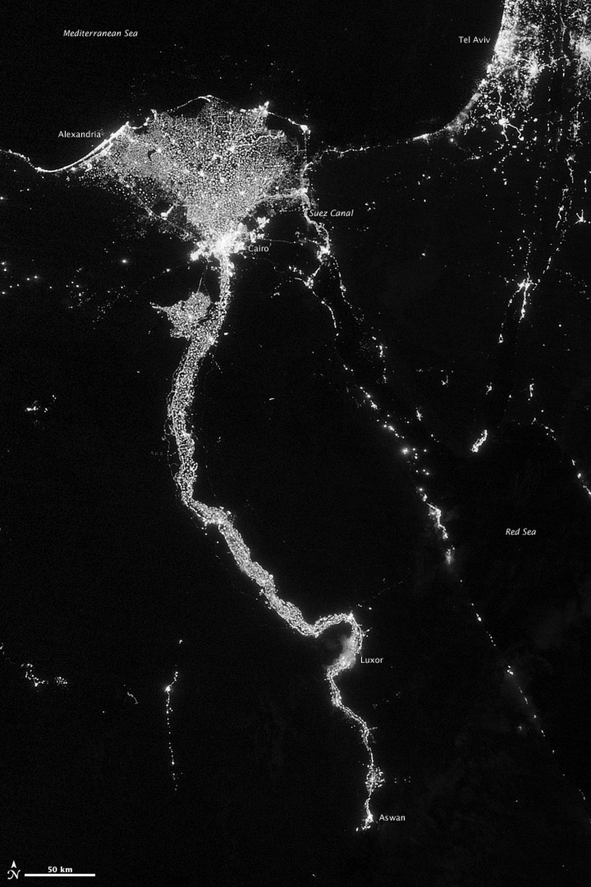
In this image from Oct. 13, 2012 provided by NASA, the Nile River valley and delta is seen at night from a composite assembled from data acquired by the Suomi NPP satellite. The image was made possible by the new satellite�s �day-night band� of the Visible Infrared Imaging Radiometer Suite (VIIRS), which detects light in a range of wavelengths from green to near-infrared and uses filtering techniques to observe dim signals such as city lights, gas flares, auroras, wildfires, and reflected moonlight. The Nile River Valley and Delta comprise less than 5 percent of Egypt�s land area, but provide a home to roughly 97 percent of the country�s population. Nothing makes the location of human population clearer than the lights illuminating the valley and delta at night. The city lights resemble a giant calla lily, just one with a kink in its stem near the city of Luxor. Some of the brightest lights occur around Cairo, but lights are abundant along the length of the river. Bright city lights also occur along the Suez Canal and around Tel Aviv. Away from the lights, however, land and water appear uniformly black. This image was acquired near the time of the new Moon, and little moonlight was available to brighten land and water surfaces.
Section:Photo