
Three Flags Highway
Google maps list U.S. 395 as the Three Flags Highway. It dates back to the 1930s early motoring days on the stretches of 395 in Calif., Nevada and Ore.
Section:Picture story
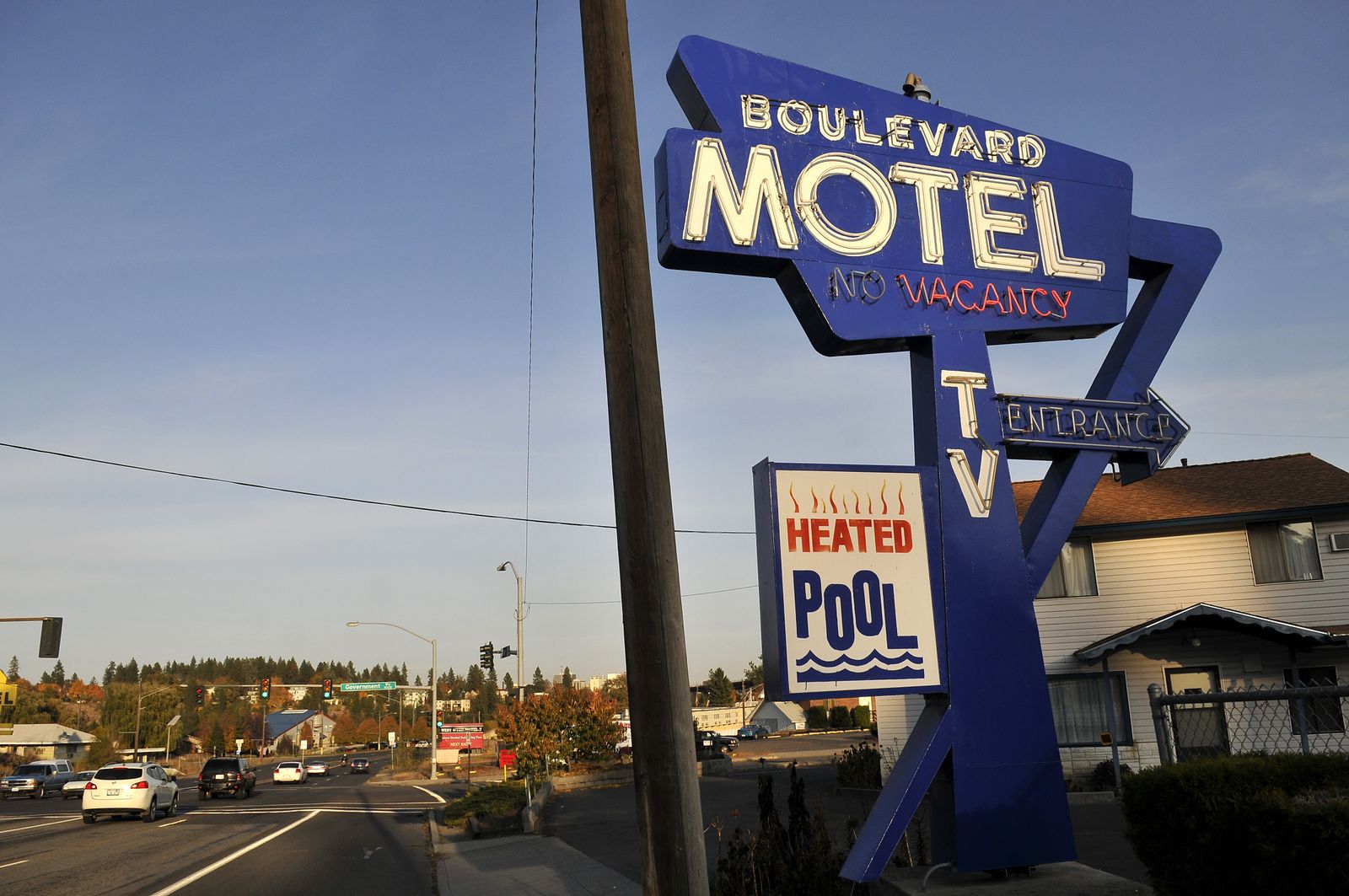
The Boulevard Motel on Sunset Blvd. west of downtown Spokane is one of many that dot the Three Flags Highway, a designation given to a pre-WWII route mapped out from Mexico to Canada.
Jesse Tinsley The Spokesman-Review Buy this photo
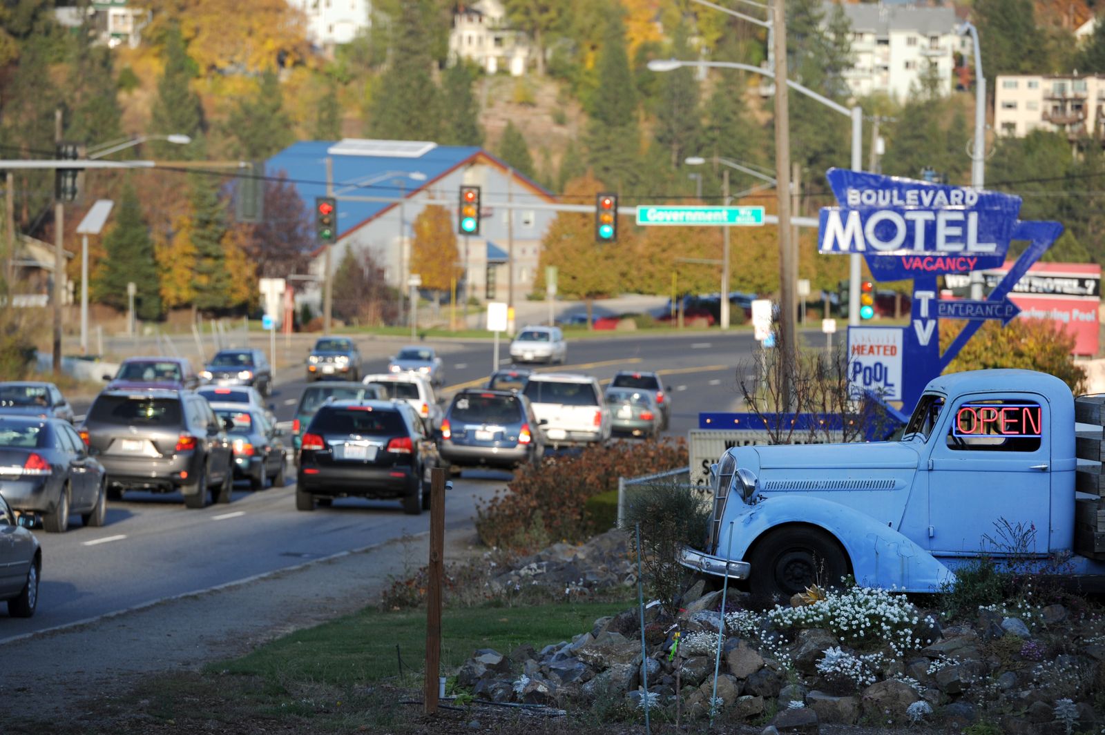
An old truck stationed at Blue Ox Coffee sits just west of the Boulevard Motel on Sunset Blvd. The classic motel is one of many that dot the Three Flags Highway, a designation given to a pre-WWII route mapped out for motorists from Mexico to Canada.
Jesse Tinsley The Spokesman-Review Buy this photo
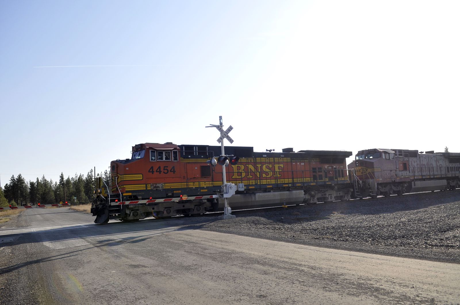
A Burlington Northern train passes through Tyler, Washington Thursday, Oct. 27, 2011. It is likely that cars following the original Three Flags Highway map in the 1930s crossed the tracks in the small town on the western edge of Spokane County.
Jesse Tinsley The Spokesman-Review Buy this photo
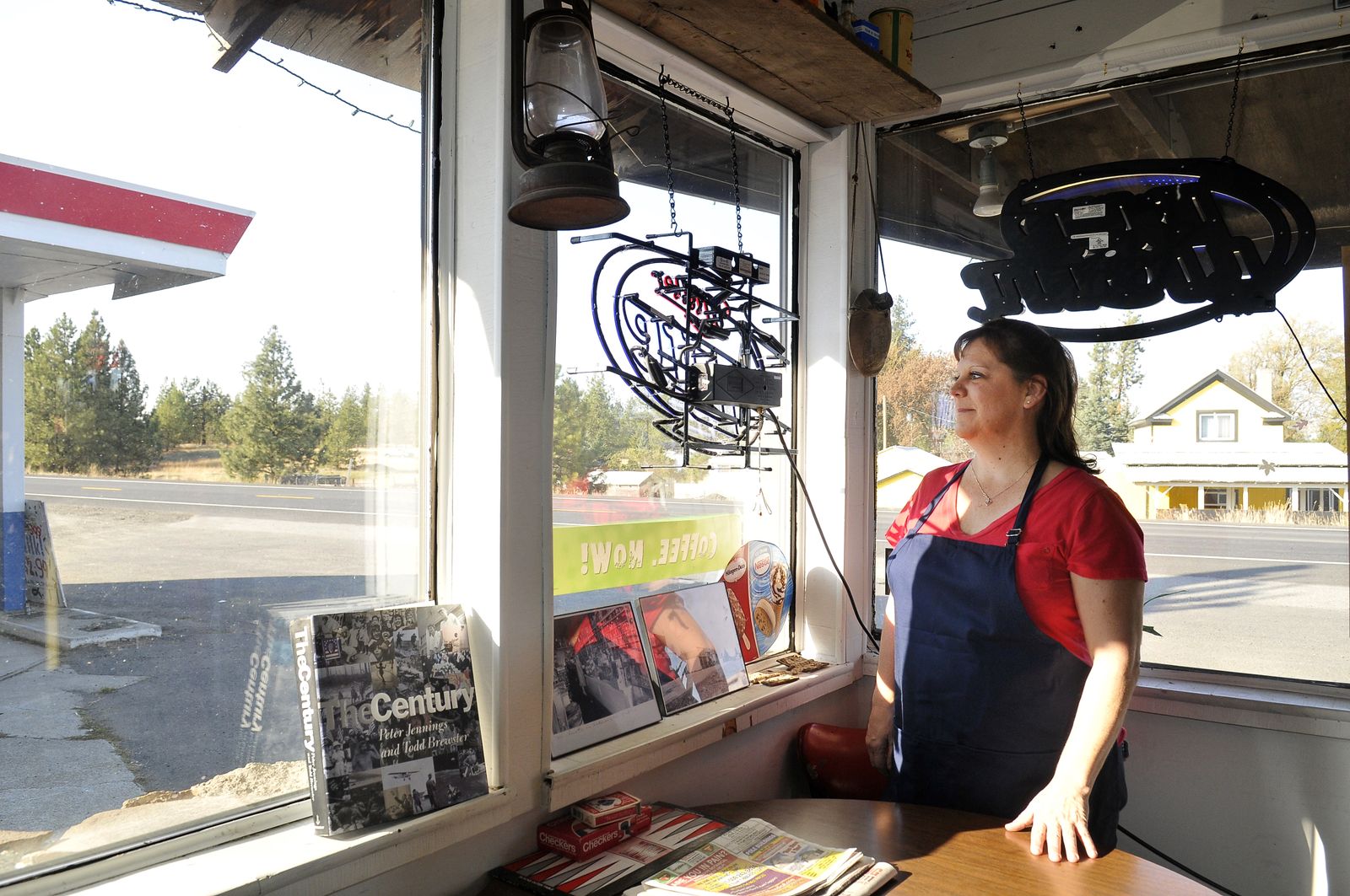
Diana Dickinson runs the Tyler Store in Tyler, Washington which sits along state highway 904 west of Cheney. The store was probably along or very near the old Three Flags Highway, a mapped route from Mexico to Canada originating before WWII. The route was heavily promoted by business interests in California, though it was never as famous as Route 66.
Jesse Tinsley The Spokesman-Review Buy this photo
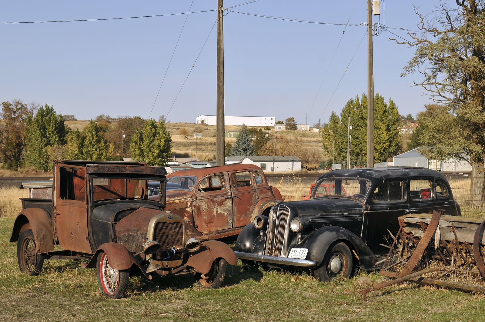
Cars that may have traveled the Three Flags Highway, a mapped auto route from Mexico to Canada, reside in an empty lot in Sprague, Washington where the pre-interstate route passed on its way to the Tri-Cities, Oregon and California.
Jesse Tinsley The Spokesman-Review Buy this photo
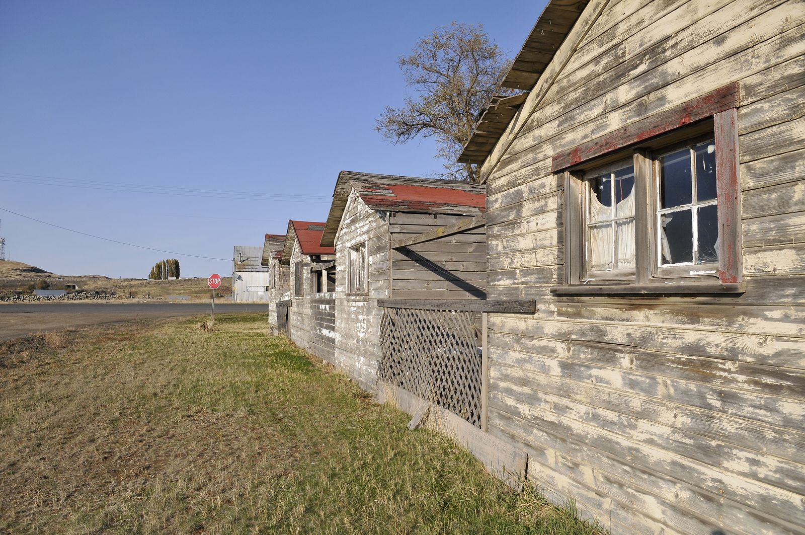
Tiny cabins sit empty by the road through Sprague, Washington Thursday, Oct. 27, 2011. They likely housed travelers along the Three Flags Highway, a name given to a mapped driving route from Mexico to Canada before WWII.
Jesse Tinsley The Spokesman-Review Buy this photo
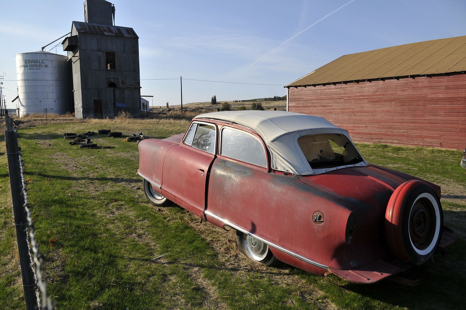
A tiny Nash Rambler convertible sits by the main street through Sprague, Washington, which was likely part of the Three Flags Highway, a mapped driving route from Mexico to Canada. The route was heavily promoted in California, but almost forgotten in Washington.
Jesse Tinsley The Spokesman-Review Buy this photo