New storm may bring flurry of car accidents
For area law enforcement, Monday might have been just a warm-up for today.
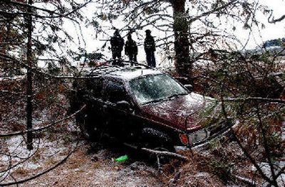
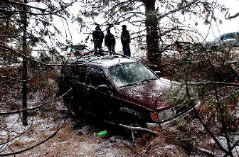
Though less than an inch of snow fell across Eastern Washington and North Idaho, accidents were scattered around the region, particularly in the Spokane Valley.
About 20 accidents were reported Monday morning in Spokane County. Washington State Patrol troopers will increase their patrols this morning, and Spokane Police will be on alert.
“People smarten up and drive a little more cautiously, usually, after the first day of icy roads,” said police spokesman Dick Cottam.
State troopers were also busy during the Thanksgiving Day weekend, arresting 30 drunken drivers and dealing with many minor traffic incidents, said trooper Jeff Sevigney.
More snow is on the way, according to the National Weather Service.
Forecasters said Monday they expected 3 to 5 inches in the Spokane area. The surrounding mountains could see up to a foot of snow.
“This looks like a pretty good one,” said meteorologist Bob Tobin. “This unsettled weather is going to last.”
Forecasters anticipated snow through most of today, with some showers continuing into the night. After a break on Wednesday, scattered showers should continue through the weekend and temperatures should stay below freezing, Tobin said.
This week’s storms will add to mountain snowpacks, which after last year’s dismal amounts have many farmers, skiers and winter sports enthusiasts hoping for a return to normal.
As of Monday afternoon, snowpack in Idaho’s Panhandle and in Northeast Washington was about 85 percent of normal for this date, according to measurements gathered by the Natural Resources Conservation Service. Just north of Spokane, Quartz Peak had 13 inches of snow Monday afternoon.
But long-range forecasts recently released by the University of Washington’s Climate Impacts Group say above-average winter temperatures are likely.
Nearly 3 feet of snow already cover some North Idaho peaks, including 33 inches on Schweitzer Mountain, according to electronic sensors placed by the U.S. Department of Agriculture.
The highest reaches of the Selkirk and Cabinet mountain ranges are averaging about 30 inches of snow, said Kevin Davis, an avalanche forecaster with the U.S. Forest Service in Sandpoint.
Snowmobiles already are being spotted on some trails, including in the Pack River drainage near Sandpoint.
“They’re getting out to a few places,” Davis said, adding that most trailheads remain bare.
City plow crews will be ready to roll – as soon as there’s at least an inch of snow on the ground. Then plows will hit major arterials first, followed by residential streets.