Boundary County plays waiting game

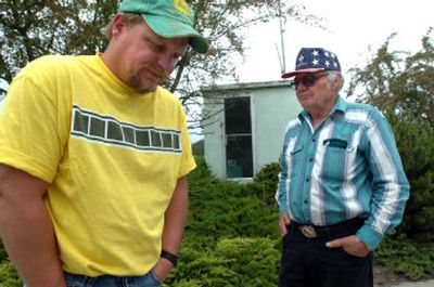
BONNERS FERRY – Thirty-five acres of Dallas Amoth’s winter wheat crop is underwater, and he’s losing more each day as the Kootenai River gets higher. In a farmer’s world, acreage equates to cash. So far, Amoth, a generational farmer, estimates his loss at $700 per acre or about $24,000.
It’s the same story for other Boundary County farmers, who grow everything from pink beans to canola and hops on the valley’s 35,000 acres. Agriculture is the second largest industry in the county behind timber, earning millions of dollars each year and supporting hundreds of families. Local officials already fear $2.5 million in lost crops, and the river isn’t expected to crest at about two feet above flood stage until tonight. The river rose about a foot Friday night, the result of heavy rains and the record amount of water the U.S. Army Corps of Engineers released from Libby Dam in Montana.
Emergency officials are monitoring the river and have volunteers and sandbags ready to go when and if the river reaches 1,765 feet in elevation, which is one foot above flood stage.
That’s just the level that damage, such as eroding riverbanks, will begin to occur – not when the river will actually leave its banks.
Each new inch of water in the river means potentially more crop damage and a hit to pocketbooks already stretched by the high cost of diesel and fertilizer. That’s why farmers in this fertile trench that stretches 30 miles to the Canadian border can’t take their eyes from the Kootenai River that snakes north, bisecting the valley.
“We have a $200,000 question mark hanging in front of us right now,” Amoth said outside City Hall, where locals were briefed Saturday morning on the latest predictions. “At the current water level we’re surviving.”
But he realizes the water will rise before it starts to recede and that the high water forecasts could last until July, when snow in the high mountains finally melts.
It’s not actual flooding that affects this prized farmland, which often produces yields equal to the Palouse hills of Washington’s Whitman County. And nobody fears that downtown Bonners Ferry will flood like before the Libby Dam was built in 1974.
According to Boundary County historical records, 1948 was the last time a rowboat could reach every business and house in downtown Bonners Ferry because floodwaters were two feet deep and Main Street was a thoroughfare used by boats.
Water seeping under the extensive dike system that follows the river into Canada is the true concern. When the Kootenai River reaches the elevation of 1,758 feet, or six feet below flood stage, water flows under the dikes and the groundwater rises. That leaves standing water in the fields, which saturates the plants’ roots. In these conditions, grains, like wheat, turn yellow and don’t make seeds.
Although standing water isn’t immediately apparent when driving the valley roads, yellow streaks stick out from the green carpet of fields, a flag of lost dollars.
Amoth’s farmland is outside the dikes, meaning it’s not protected by the great berms of soil and rocks constructed from the 1920s through the 1940s to keep the river off the crops.
About 2,000 acres of the valley isn’t protected by the dikes and is experiencing the most damage.
Inside the dikes, farmers have fought seepage problems for nearly four weeks since the water first went above 1,758 feet elevation. Many are trying to pump out the water. Bonners Ferry Mayor Darrell Kerby said that the duration of saturation causes the most difficulty for local farmers.
Because the valley is a former lakebed, the very reason the soils are so fertile, farmers usually can’t get crop insurance.
Another potential catastrophe is the reality that some of these old, unmaintained dikes will break, literally wiping out thousands of acres and putting many farmers out of business.
“We’d be flooded out, and I would have to go to work for Les Schwab,” said Randy Peterson, who farms about 2,000 acres with his father, Larry.
Farmers stopped maintaining the dikes after Libby Dam was constructed. Over 30 years, the dikes have dried out and produced the perfect home for gophers to burrow in. These tunnels weaken the berms.
It’s unlikely the water would ever get high enough to flow over the top of the dikes, which sit at an elevation of about 1,780 feet in downtown Bonners Ferry.
Instead, Bob Olson, president of the Kootenai Valley Reclamation Association that includes the 14 local drainage districts, said the prolonged high water could saturate the soil levees, causing them to fail.
“Admittedly some of the dikes haven’t been maintained,” Olson said. “But there was no need.”
The last time Boundary County experienced similar high water was 1996 and 1997, but Olson said this year is looking worse.
And the unpredictability of what might occur in the next few days is making farmers and emergency officials equally anxious.
“There are variables no one can control,” Kerby said. “God is literally in charge.”