Officials meet to prepare for melting

With temperatures warming into the weekend, there’s a new worry about all this snow: Where will it all go?
Local, state and federal officials from the Inland Northwest met Thursday in Coeur d’Alene to plan for flooding as temperatures are expected to reach as high as 40 degrees this weekend.
Flooding in urban areas, and swollen creeks and streams are the most likely problems, forecasters say.
While no rivers are expected to approach flood stage, Thursday’s meeting focused on planning for worst-case scenarios.
Though snowpack is expected to hold in higher elevations, authorities are bracing for a meltdown in lower elevations.
In the Coeur d’Alene area, the snowpack is three to four times the normal depth, said Bob Haynes of the Idaho Department of Water Resources.
“That gives you a picture of the potential we have for flooding,” Haynes said.
Four factors increase the likelihood of flooding, according to John Livingston, meteorologist in charge of the National Weather Service in Spokane. It takes a heavy snowpack, warm weather, increased precipitation and wind (blowing wind melts snow).
Missing from the forecast are precipitation and wind, Livingston said. But he reminded those at Thursday’s meeting that a forecast is just a forecast.
“Inexact,” he said.
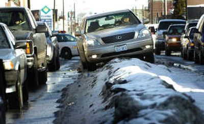
Highway districts and street crews throughout the region say massive snow berms have cut some roads down to a single lane, obscured stop signs and created obstacles for traffic. Berms also can block drainage.
In the Spokane area, flooded roads and high water are expected this weekend on Hangman, California and Rock creeks.
The city of Hayden expects storm drains to overflow and is checking the Hayden Dike in anticipation of flooding.
The city has volunteers lined up Saturday to clear fire hydrants and catch basins, and Crawford Park will be manned 8 a.m. to 5 p.m. daily for residents to dispose of snow.
In the Rathdrum area, Meyer Road could see some flooding because of drainage from neighboring farmland, and flooding of Rathdrum Creek is a concern.
Excess snow in the Silver Valley is being dumped into the Coeur d’Alene River because officials say they’ve run out of room to pile it elsewhere.
Shoshone County Commissioner Sherry Krulitz said, “If it warms up, we’re in trouble. In Mullan, you don’t jump off the roofs, you walk off.”
The Kootenai River is the biggest concern in Boundary County. The river has exceeded flood stage five of the past 11 years.
Benewah County is using boats to break ice in the St. Joe River.
The Coeur d’Alene Tribe’s Wellness Center is in imminent danger of flooding, tribal officials said. The tribe is asking Kootenai County for sandbags to shore up Plummer Creek by the center in Plummer.