Tribes join water monitoring effort
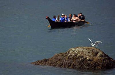

EVERETT – The canoes will be hand-carved from cedar.
Tribal members will scoop paddles studded with abalone shell into the water to move forward.
Cultural revival has always been the prime hallmark of the annual summer Canoe Journey, when American Indian tribal members from around the Coast Salish region use their ancient travel routes to meet for the biggest potlatch of the year.
This year, there will be room for science, too.
Canoes traveling on five or six of the major journey routes on their way to Cowichan, B.C., will take along water quality testing systems. Using GPS technology and water probes provided through a partnership with the U.S. Geological Survey, the canoe pullers will sample the water that has been their lifeblood for centuries.
The result will be a rare picture of the health of the region’s waterways, culled almost simultaneously from hundreds of locations.
“We’ll get a snapshot that we’ll be able to compare each year to measure climate change,” said Eric Grossman, a geologist with the U.S. Geological Survey.
Tribal leaders from the Northwest and from Canada recently formally approved the plan. Then they met at the Coast Salish Gathering on the Tulalip Indian Reservation.
“There’s been a disconnect between modern science and Native science,” said Jon Waterhouse, director of the Yukon River Inter-Tribal Watershed Council.
But in terms of testing water quality, the Indian way is ideal, Waterhouse said.
“You can’t do this with a motorboat,” he said. “You need to be going as slow as about 5 miles per hour. That’s perfect for a canoe.”
Tribal members will be trained to use probes worth about $20,000 each to take the water samples to test for water temperature, salinity, oxygen and pH levels, dissolved solids and nitrate levels, Grossman said.
At the same time, the tribal members will imprint each sample with data from a GPS unit, Grossman said. At the end of the journey, the tribes and the U.S. Geological Survey will be able to map out data captured almost simultaneously along hundreds of points in the Puget Sound region.
“This is a very unique and very rare opportunity to measure water quality simultaneously,” Grossman said. “It’s hard to mobilize a high number of boats, and here we’ll have 88 canoes simultaneously looking at what’s happening.”
Most importantly, Grossman said, the partnership between the U.S. Geological Survey and the Coast Salish tribes combines modern and traditional sciences.
“Our historic scientific records go back 50 to 100 years, but theirs goes back thousands of years,” Grossman said.
Waterhouse first used a water test probe last year, when he embarked on a two-month canoe journey along the Yukon River.
“We took samples every 30 minutes for about 1,500 miles,” Waterhouse said.
The samples revealed an increase of carbon dioxide, he said. Scientists believe the rivers are absorbing permafrost melt.
“Now, we have more questions than answers,” he said.
Waterhouse hopes the samples that tribal members take this summer will help reveal the rate of Earth’s climate change.
Waterhouse hopes the data will also include an element that isn’t recognized by many modern scientists: oral history, as told by elders the tribal members meet along the way.
On the journey along the Yukon River, Waterhouse brought a video camera and interviewed elders about the environmental changes they’ve witnessed.
He plans to encourage tribal members to do the same.
“We have this valuable information,” he said. “It was dormant for a long time, but now the Native people are leading the way.”