Region shedding its winter coat
Forecasters predict highs ‘well into the 70s’ early next week

After a winter that saw record snowfall, including a 4-inch storm in the first week of April, the forecast for the coming week ought to bring some serious relief: temperatures in the 70s by Sunday.
National Weather Service forecasters said that a strong high pressure system is expected to form across the Rocky Mountain states later this week and set the stage for gradually rising temperatures and highs about 15 degrees above normal for late April.
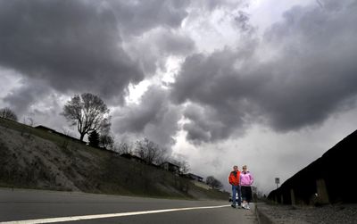
But the region should see one more day of cool weather and a chance of snow showers today. Thunderstorms are possible as well. Highs today may only reach the upper 40s across the Inland Northwest and lows tonight could drop into the upper 20s.
Any snow accumulation this morning would add to the record 97.7 inches that has fallen in 2008-’09. “After that, things start to warm up,” said Ron Miller, forecaster for the weather service in Spokane.
He said computer forecast models suggest that high pressure strengthens into Monday and next Tuesday with temperatures “well into the 70s” by then and possibly reaching the 80s in the Columbia Basin.
Spokane’s record highs for Sunday and Monday are 81 and 83, respectively.
Forecasters said they expect highs on Sunday of 74 in Spokane and Coeur d’Alene, 73 in Sandpoint, 72 in Pullman and 76 in Colville.
The normal high for today in Spokane is 57.
The warm weather could cause streams and rivers to rise from snowmelt in the mountains, but no flooding is expected.