Fall spectacle on Sherman Pass
Sites and towns along route like ‘beads on a necklace’
In the fall, Sherman Pass, a 35-mile stretch of Washington highway from Kettle Falls to Republic becomes a corridor of color. From the first hill’s crest, travelers are greeted by miles of golden and rust-hued trees and flora mixed in with evergreens. In October, one can even expect to meet snow.
This roadway was designated by the U.S. government as the Sherman Pass Scenic Byway in 1990, after serving as a Washington State Scenic Byway for 23 years. It is open year-round and is the state’s tallest maintained pass, at 5,575 feet above sea level. The pass was named for Civ Gen. Williams Tecumsah Sherman, who traveled across the mountains to the new Northwest forts and settlements in the late 1800s.
“The region has a rich history in mining, logging, and fur trapping,” says Jann Bodie, a retired Colville National Forest landscape architect who worked on plans to improve the byway. “American Indian tribes are thought to have first used the route about 6,000 years ago, perhaps traveling to and from rich fishing grounds at Kettle Falls. Interpretive centers along the route now make a great place to stretch legs and learn of the area’s past.”
Tree species on the eastern side of the pass include lodge-pole pine, ponderosa, western larch, cedar, aspen, alder, and cottonwood. The geology is marked by startling natural rock outcroppings. The forests on the western side of the pass were burned in the 1988 White Mountain Fire, but pockets of mature fir and larch trees still stand, creating a mosaic.
“I think it’s beautiful. It’s still pristine, untouched. If you want to get back to nature, it’s there,” says David Keeley, a project manager for the City of Kettle Falls also who helped plan improvements to the byway.
Several years ago Federal Highways, Washington Department of Transportation, Washington Department of Fish and Wildlife, Colville National Forest, and other agencies collaborated on a plan to bring visibility to byway.
The improvements, which are still being completed, included adding interpretive centers and signage, improving trail heads, paving accessible trails, and building a train depot style building in Kettle Falls that serves as a gateway and information hub.
“The interpretive sites have made a big impact,” Keeley says. “We set it up so there’s enough to do, so if you stay at night in Kettle Falls, you can spend the whole day exploring the pass, and spend the evening in Republic.”
Interpretive sites include the White Mountain Fire Interpretive Site, Kettle Crest Interpretive Site and Trailhead, Sherman Overlook, Growden Heritage Site, Bangs Mountain Picnic Overlook, Sherman Creek Trailhead and Log Flume Heritage Site.
“The pass is open year-round because of its wonderful winter activity: back-country skiing, snowmobiling, and snowshoeing,” Bodie says. “Nobody knows what’s up here. … When I first got here, people told me there’s a joke about ‘the forgotten corner’ that goes way back to the Calvary.”
Bodie calls Sherman Pass and small towns connected by it ‘beads on a necklace.’ Signs show travelers where they are in relation to other routes, including the International Selkirk Loop, a 280-mile drive encircling the Selkirk Mountains in Northeast Washington, North Idaho, and Southeast British Columbia. “It shows where you are within the beads on the necklace,” she says.
Stops along the byway include:
*The new mock train depot in Kettle Falls that is manned year-round, seven days a week by members of the city, the U.S. Forest Service, National Park Service, Chamber of Commerce, and Discover Your Northwest. Visitors will find maps and information about the various activities and routes in the area and can buy permits. It is located in the center of town, near the corner of U.S. 395 and Juniper Street.
“We haven’t had one day where it hasn’t been busy,” Keeley says. “People come from all different countries … a lot of weekenders, people passing through, people looking for property.”
* Though not part of the official byway, the Sherman Creek Fish Hatchery sits at the mouth of Sherman Creek where it empties into Lake Roosevelt on the eastern end of the pass.
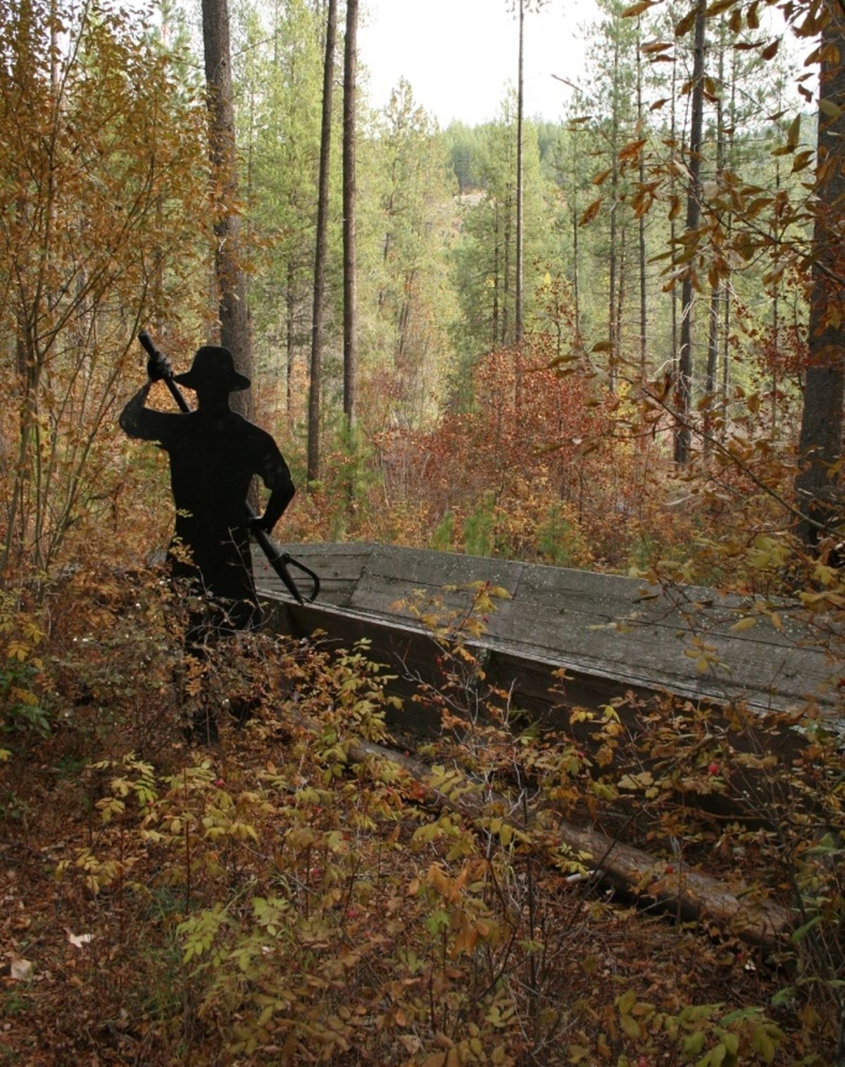
* The Log Flume Heritage Site where remnants of the old log flume still stand and a trail leads down to Sherman Creek. The Sherman Creek Campground sits nearby.
* The Growden Heritage Site tells of the Civilian Conservation Corps and its activities there in the 1930s and 40s. The site currently is a state rest area.
* Near the crest of the pass, travelers will then encounter the White Mountain Interpretive Site, which has views all the way to Canada and the Cascades on clear days. It contains twin stone-and-wood structures, one facing east and one facing west toward the fire site. “You see two entirely different landscapes,” Bodie says.
* Finally, travelers will reach the terminus in Republic, where they can visit the Stonerose Interpretive Center, named for the 50 million-year-old rose-like fossil it houses.