Snowfall ending; rain arrives later today
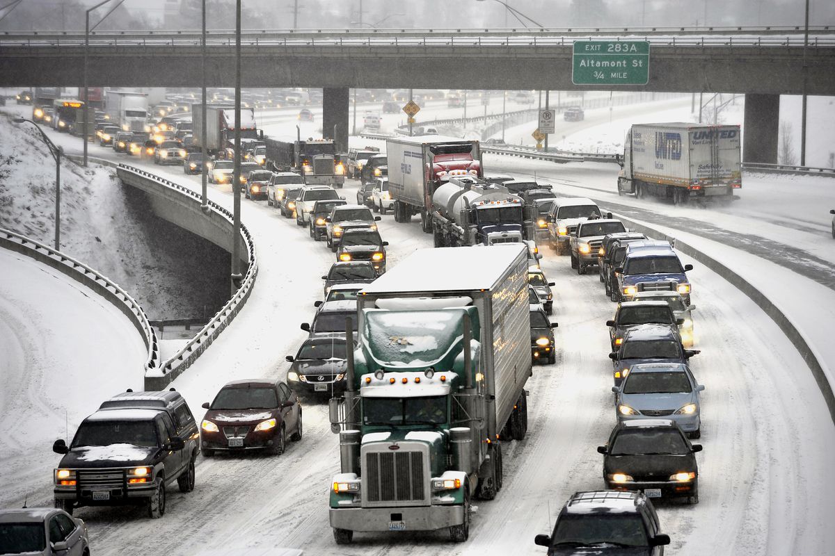
Moderate snow fell across the Inland Northwest this morning, halting the morning commute for more than an hour on westbound Interstate 90 in downtown Spokane.
Radar at noon showed the storm winding down after 4 to 5 inches was measured across the urban area of Spokane.
Snowfall switched to a short period of light freezing drizzle by noon. The temperature at Spokane International Airport went from the low 20s during the snow storm this morning to 33 by 1 p.m.
Earlier, traffic westbound on Interstate 90 was stopped and backed up through downtown to at least the Hamilton Street exit by 8 a.m.
Washington State Patrol said the problem was caused by a collision involving a semi truck and two vehicles about 6:36 a.m., which blocked two of three lanes. The backup kept getting longer until lanes were reopened.
Traffic was moving again by 9 a.m.
During the traffic jam, a lot of the inbound freeway traffic appeared to be exiting onto Second Avenue and Hamilton Street to avoid the congestion to the west.
A slowdown was also reported earlier on I-90 near Sprague Avenue.
Elsewhere, traffic was moving slowly, but a number of collisions were being reported.
Forecasters said they expect a total of 4 to 7 inches of snow across the Spokane and Coeur d’Alene areas by the time the snow fully subsides this afternoon. Up to 7 inches could fall in Coeur d’Alene.
About 3 inches of snow was on the ground on Spokane’s North Side at 7 a.m.
A winter storm warning remained in effect for the region until 4 p.m., and forecasters said snow should end about that time.
The storm is forecast to change to rain tonight after the cold air is scoured from lower elevations. Forecasters said that a quarter to a half inch of rain is expected tonight.
Some flight delays were occurring at Spokane International Airport, but no cancellations were posted just before 9 a.m.
Schools in Moses Lake were delayed by two hours.
Cold air entrenched across the Inland Northwest was slow to budge this morning. Forecasters said colder air was likely to keep highs just below freezing in the Spokane area today.
A stream of moist Pacific air flooding in overhead has been bringing the snow and will displace the cold air later today and tonight. A high of 31 will be followed by a low of 31 tonight and a high on Thursday of 40 in Spokane.
A series of rain storms with highs in the lower and middle 40s could spur a fast melt of snow across the lower and middle mountain elevations, triggering flooding in the Idaho Panhandle and Palouse, forecasters said.
Mainly snow is expected at ski area elevations and upper slopes.
The Idaho Panhandle National Forest issued a high avalanche alert this morning for the mountains of the region.
At 7 a.m. Spokane International Airport was reporting moderate snow and ice fog with a temperature of 20. The temperature was 22 at 10 a.m.
Elsewhere at 7 a.m., it was 21 at Felts Field with light snow, 18 in Coeur d’Alene, 18 in Deer park and 28 in Pullman.