Severe thunderstorms pound Spokane, CdA
Toppled trees and high winds leave 59,000 people without power
Severe thunderstorms in the Spokane area and to the east of Coeur d’Alene were moving quickly to the north after sweeping across the area shortly after 4 p.m.
The storms were part of a broader swath of severe storms that extended from southeast Washington into the fire zones of Central Washington and northward toward the Canadian border.
Sustained winds of 50 to 70 mph were reported from the storm that moved west of downtown Spokane along the West Plains just after 4 p.m. and then across northwest Spokane into the north part of Spokane County. A long line of storms formed north of Spokane and continued and continued across a broad swath on a fast track into Canada.
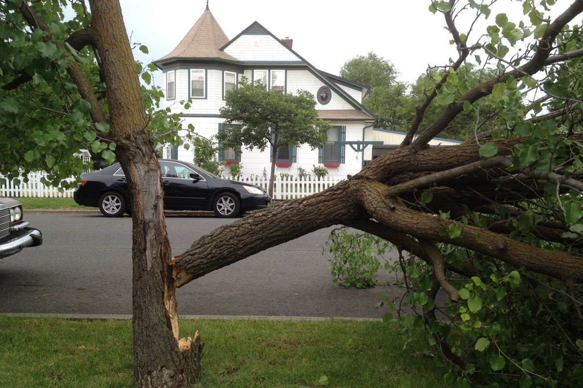
“I thought we were in a tornado,” said Krystle Schneider, who lives in a Northwest Spokane neighborhood hit hard by the storm.
Homes across the street and next door to Schneider’s home on Crown Avenue near Assembly were struck by large trees. Several large pine trees on her block toppled and blocked the street.
More than 39,000 Avista Utilities customers were without power at 6:30 p.m. Another 20,700 Inland Power and Light customers lost power. Another 6,500 customers were without power from Kootenai Electric Cooperative.
Avista spokeswoman Mary Tyrie said it was too early to know this evening how soon it will be until power is restored. All available crews were being dispatched. “This is a significant outage and lots of lines are down,” she said.
The high winds apparently triggered much of the havoc that enveloped below and around the powerful storm cell that came through Spokane. Nickel-sized hail was reported by the National Weather Service.
Early reports from Riverside indicated that a manufactured home park there had heavy damage from falling trees. Extrication crews were called to Deer Park-Milan Road near the homes.
Trees fell on 20 trailers at Riverside Village Mobile Home Park displacing more than 35 families, said Spokane County Fire District No. 4 Capt. Megan Hill. A relief center is being set up at Riverside High School.
Spokane International Airport had a peak gust of 67 mph while the weather service office northwest of Airway Heights had a 60 mph gust.
In Kootenai County, one person was injured when a tree crashed into an RV at the Silverwood RV Park, the sheriff’s office said. The extent of injuries was not specified.
But the damage from storm was repeated across a broad swath of Kootenai Coiunty.
Emergency crews responded to numerous fires. Some of them were small and put out quickly, but others took hold and continued to burn, including ones at Scribner Road and along the Little Spokane River near Mill Road.
Downed power lines as well as trees and branches were disrupting traffic and slowing emergency response.
U.S. Highway 2 was backed up at the traffic light at Farwell Road went out.
Trees and debris blocked numerous roads. Firefighters were stopped trying to get to some of the fires and they had to cut through the downed trees to open the way.
One tree blocked state Highway 291 at Rutter Parkway. Of the numerous trees downed on Waikiki Road, one was reported to be smoking.
The city of Spokane had numerous downed trees and power lines. Traffic lights went out at 29th Avenue and Grand Boulevard. Trees were down at Driscoll Boulevard and Rowan Street and at Wellesley Avenue and Helena Street. A power line was down near Francis Avenue and Taft.
In North Idaho, a tree was reportedly down on train tracks near Ohio Match Road.
Avista Corp initially reported that 8,800 customers were without power in north Spokane, Colville and the Palouse.
That number quickly swelled to 16,000 customers without power as the storm went north and then to 18,600 just before 5 p.m. and then nearly 20,000 a short time later. By 5:40 p.m, the outage count stood at almost 22,000 and then 26,000 at 5:50 p.m.
The weather service reported more than 5,500 lightning strikes in Eastern Washington and North Idaho.
Spokane and Coeur d’Alene were placed under severe thunderstorm warnings prior to the storms striking.
By 6 p.m., the line of storms was well organized and moving across the Canadian border.
Across the region, fire crews were responding to Scribner Road on a fire southwest of Spokane.
One firefighter reported the base of a tree burning along Cornwall Road.
As the Spokane-area storm moved to the north, fires and power outages were occurring in its path.
Earlier in the day, the weather service posted a severe thunderstorm warning for an area from southeast Washington northward to Pullman and portions of the Palouse through 3:30 p.m.
Pullman saw hail the size of Ping-Pong balls, the weather service reported.
As the thunderstorms migrated northward, they were forecasted to strike in a large area of Eastern Washington and North Idaho. The forecast turned out to be correct.
Forecaster Ron Miller at the weather service said the Inland Northwest sees strong thunderstorms similar to the ones today about once every seven years. However, the last strong thunderstorm here was in 2012.
The storms were aided by warm sunny weather this morning, just ahead of an advancing low pressure area off the Pacific Ocean.
The warmth carried plenty of moisture in the air. When the low pressure area arrived during peak daytime heating in the afternoon, it sent the warm air skyward allowing it to generate the damaging storms.
“This one was pretty much perfect timing,” Miller said.
In Central Washington, flash floods from heavy thunderstorms are being reported along the Entiat River in the vicinity of one of the Central Washington fire scars.
Two flash flood warnings were issued this afternoon for mountain an area northeast of Wenatchee and second area near Winthrop in the vicinity of the Carlton Complex fires in Okanogan County.
One flash flood brought down debris at mile 11 at the Entiat River and boulders were dislodged during a storm near Tommy Creek earlier today, the weather service said.
Flash flooding was reported in the burned over area at the Carlton Complex. In addition, hail the size of quarters was reported.
The Central Washington flash flood warnings remain in effect until 7:15 p.m.