High desert expedition
Key to drive through southeast Oregon is to get out and experience it

One second the pale brown and white pronghorns were staring at the truck. The next they were dashing across the gray-green landscape and making a beeline for a ridge.
The high desert is a magical place during spring, and a chance to spot wildlife such as pronghorns, mule deer, coyotes and hawks, and to listen to a symphony of meadowlarks, sandhill cranes and blackbirds.
The landscape is blooming with green grasses and intricate colors provided by wildflowers.
Spring is definitely the time to take a scenic drive out in the high desert of Southwest Idaho and Southeast Oregon.
This remote country doesn’t have much traffic aside from occasional rockhounds, ATVers and ranchers towing stock trailers.
Most of the roads are good in dry weather, aside from being bumpy and dusty, and they take you to a lot of wild country between 90 minutes and several hours from Boise.
The key to a trip to the high desert is to get out of the car and soak up the sights, smells and sounds.
Stop and walk up a canyon, or sit beside a creek in a meadow. If there’s a small reservoir or pothole, sit down and wait for something to happen.
It will. Blackbirds will start contesting you for territory. A hawk may ride the thermals above you. Shorebirds will definitely squawk at you.
And those pronghorns? They may just come back to see what you’re all about, especially if you are downwind of them, and the inquisitive animals can’t figure you out.
Just be still and let desert life happen around you.
Besides sitting and listening, take along a wildflower guide book. You’ll want to photograph flowers and know what you’re looking at.
Owyhee Byway
The 100-mile Owyhee Uplands National Back Country Byway is one of the most scenic desert drives in Southwest Idaho.
It is known locally as Mud Flat Road, and it’s the primary access to the central Owyhee County canyonlands.
You’ll pass by rimrock plateaus, through canyons abundant with sagebrush and bunch grass, and climb to elevations with stands of juniper and mahogany.
As you drive, you’ll see mountains in the distance, such as the Jarbidge, Steens and Owyhee ranges.
Notes: A round trip on the byway from Boise takes a full day – dawn to dusk.
There are no services for 100 miles between Grand View at the start of the byway and Jordan Valley, Oregon, at the end.
The road can be traveled in a passenger car in good weather, but it gets slick and muddy when wet.
Getting there: Start at Grand View, south of Boise.
From Idaho 78, just east of Grand View, take off on Mud Flat Road. It travels about 92 miles in Idaho and 12 miles in Oregon to Jordan Valley. From Jordan Valley, you can take U.S. 95 back to Marsing and the Treasure Valley.
Information: id.blm.gov/bruneau; id.blm.gov/owyhee; id.blm.gov/recreation.
Jordan Craters
The craters are northwest of Jordan Valley and look like a black shadow on the vast green and brown landscape of Southeast Oregon.
As you draw closer while driving on the Jordan Craters road from U.S. 95, you’ll start to make out a huge geological feature called Coffee Pot Crater. It looks far off, but keep going. The road will eventually get you there.
It’s the only feature in the craters that is accessible by motor vehicle.
It covers about two-thirds of a square mile and is described as a “well-preserved, steep-sided crater” by the U.S. Bureau of Land Management.
As you explore Jordan Craters on foot, you’ll see splatter cones and a vast lava field.
Notes: There aren’t any facilities there for camping. You can camp in dispersed areas nearby.
Getting there: Drive south on U.S. 95 from Marsing. Look for the road to Jordan Craters. It’s about 8 miles before you get to Jordan Valley. Follow BLM Jordan Craters access signs 25 miles to the recreation site.
Birch Creek
This is a remote scenic area in the Owyhee River Canyon, northwest of Jordan Valley.
The unique thing about the area is that in the middle of the dry, rocky landscape are two historic ranches at a BLM recreation site.
It is also the take-out for river trips on the Owyhee River from Rome downstream. You won’t see many boaters this time of the year because of low water.
The canyon is an oasis of green in the desert with camping available.
It’s a good side trip from Jordan Craters, and you might see bighorn sheep, deer, chukars and other wildlife.
Notes: There is one source for drinking water at the recreation site with a five-unit campground and restroom.
Getting there: Use the same directions to Jordan Craters, but take the turnoff to Birch Creek. Follow the BLM signs for 28 miles off U.S. 95.
Information: blm.gov/or/districts/vale.
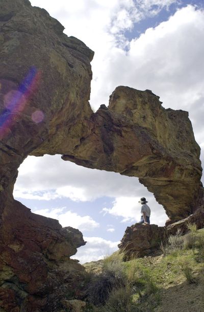
Leslie Gulch
This pastel-colored canyon in the Owyhee Breaks off Owyhee Reservoir is breathtaking, with spires, walls and pinnacles. Nature has carved the rock structures in the volcanic ash and soils of the remote canyon.
The geology and photography will be your main focus, but don’t forget the wildflowers and wildlife, such as bighorn sheep and chukars.
You’ll find a campground with a restroom near Owyhee Reservoir. There are plenty of off-trail hikes in slot canyons and also on the ridgelines of the Owyhee Breaks.
Notes: Camping and fires are limited to the 12-unit Slocum Creek campground. No drinking water is available, but there is a vault toilet. Outhouses are also located along the road.
Overnight hikers must camp outside of the Area of Critical Environmental Concern, according to the BLM. All motorized vehicles and bicycles are limited to existing roads and parking areas.
Getting there: Head south on U.S. 95 from the Marsing area. At about 8 miles, take the McBride Creek Road to Rockville, then a mile north to Leslie Gulch Road and then 15 miles west.
Information: blm.gov/Vale.
Succor Creek State Park
This natural area is in a deep, rocky canyon south of Adrian, Oregon. It is frequented by rock hounds and wildlife watchers.
The road follows a cut in the canyon and soon your vehicle seems miniature among the rock walls.
Notes: There are 15 primitive, walk-in camping spots and some day-use areas at the state park along Succor Creek.
No drinking water is available, but there is a vault toilet.
You can hike along the canyon rims above the campground, or just drive up the road and see steep canyon walls. The Succor Creek Bridge in Succor Creek State Natural Area is open to pedestrians. The bridge over the creek is closed to vehicles or ATVs.
Getting there: Take the rough 15-mile dirt road off Oregon 201 between Adrian, Oregon, and the Idaho border.
Information: oregonstateparks.org. Search for Succor Creek State Park.
Antelope Reservoir
The reservoir is located southwest of Jordan Valley and doesn’t get much use.
However, it’s well-known to local bird watchers when its waters attract migrating birds in spring. It’s a short distance from pavement and an easily accessible place to get away from it all.
You may see antelope and surely a variety birds in the spring.
Notes: The BLM campground has four camping sites for tents or RVs (no hookups). There is a restroom. Boat anglers fish the reservoir for trout when there’s enough water.
Getting there: Take U.S. 95 about 12 miles south of Jordan Valley, Oregon, and turn on the clearly marked Antelope Reservoir Road. It’s a mile to the campground.