Wind, heat, fire made a deadly weather mix in 2015
Heat, wind, smoke and snow – 2015 weather will be remembered for extreme events that led to at least five deaths in Washington.
Two women were killed in Spokane County from falling trees in the Nov. 17 windstorm that set a record for power outages and wind damage across the region.
That came after more than a million acres of forest and other wildlands were scorched by wind-driven fires in Washington. Hundreds of thousands of acres burned in North Idaho and the central Panhandle as well.
Hundreds of homes were damaged or destroyed by weather this year.
Greg Koch, forecaster for the National Weather Service in Spokane, said mild and dry conditions through the early months of 2015 became a significant contributor to the wildfires.
Critically low snowpacks melted off early and left forests and other wildlands tinder dry. It was Spokane’s second-warmest year on record.
Then a record-setting heat wave arrived in early summer with highs of 105 in Spokane and 112 in Moses Lake on June 28.
“That set us up for a brutal August,” Koch said.
The dry, hot conditions “created an environment that got our fire season started four to six weeks earlier than normal,” said Koch, who compiled a list of top regional weather events for the year at wrh.noaa.gov/otx/. Follow the link to 2015 year in pictures.
The same day that high temperatures soared in late June, the Sleepy Hollow fire raged around Wenatchee, destroying 29 residences and three businesses. It was driven by “months of drought combined with record heat and windy conditions,” Koch wrote.
But it was just the start.
On Aug. 13 and 14, triple-digit heat was followed by high winds across the region. Blowing dust caused pileups and forced closures of Interstate 90 and U.S. Highway 395.
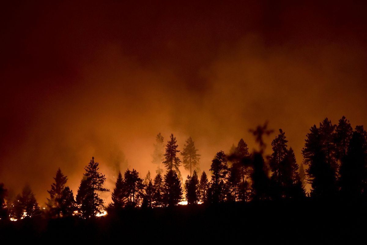
The wind drove wildfires out of control and sent a mixture of thick smoke and dust into the Spokane urban area.
Three firefighters were killed after flames near the Twisp River overtook their crashed vehicle on Aug. 19.
Waves of smoke from the numerous wildfires wafted over the region, depending on the different air currents. Some were vaulted by heat and updrafts high into the sky, causing smoke clouds to partially block the sun and create an eerie orange-brown light on the evening of Aug. 19.
Other weather patterns allowed the smoke to drift along the ground, impacting air quality.
Koch labeled Aug. 20 and 21 a “smoke storm.”
The most concentrated air pollution of the summer occurred during the early evening on Aug. 21 when the hourly air quality index reached the hazardous level of 330. When averaged over 24 hours, the number was still an unhealthy reading of 171 on the air quality index, making Aug. 21 the smokiest day since smoke monitoring began in 1999 in Spokane.
Outdoor events were canceled and outdoor school activities were put on hold until conditions improved.
The windstorm on Aug. 21 that brought the smoke and dust to Spokane fanned the north-central Washington fires, doubling the size of the Okanogan Complex from 88,000 to 162,000 acres.
That windstorm led to evacuation of 5,000 residents and the destruction of 35 homes.
Another windstorm on Aug. 29 cut power to 10,000 Avista Utilities customers, fanned fires once again and led to dust storms that closed I-90 near Vantage. Lewiston had a peak wind gust of 72 mph.
Then on Nov. 17 a windstorm slammed the region, cutting power to more than 250,000 customers served by the region’s seven electric utilities. That was more than half of all homes and businesses.
Avista had 180,000 customers out, compared with 100,000 outages following the devastating 1996 Ice Storm.
The peak wind gust at Spokane International Airport was 71 mph between 3 and 4 p.m. But the wind speed gauge was not working properly for about two hours after 4 p.m. It was the strongest wind recorded in Spokane for a non-thunderstorm event.
After the record heat, wind and smoke, the year is ending with the highest December snowfall since 2008, which became part of a record-setting snow season.
This December is ending with 24.3 inches of snow, compared with 61.5 inches in December 2008.
Mountain snowpacks in the region now stand at about 100 percent of normal in northeast Washington and North Idaho and about 140 percent in the Washington Cascades.
Koch said that is a hopeful sign for ending the extreme drought that fell over the Northwest over the past year. The snow will help with water supplies and for keeping forests moist next spring and summer.
However, the emergence of El Nino this year could change the storm flow and leave the Northwest out of the major storm track during the rest of winter, Koch said. The region still needs more snow, he said.
Spokane has had its second-warmest year on record, with an average temperature of 52.2 degrees. The record was 53 degrees set in 1934. That warm temperature follows a global pattern that’s likely to make 2015 the warmest year on Earth in 136 years of record-keeping.
While global warming is not necessarily the cause of any extreme weather event, it is possible that warm, windy years like 2015 could become more common, Koch said.
“Years like 2015 would become more probable in the world of climate change,” he said.