Rivers, streams and lakes rise to flood stage across Spokane region
POTLATCH, Idaho – Rivers, streams and lakes swollen with snowmelt and rain were rising to flood stage across the Inland Northwest with the peak runoff set to arrive Wednesday and continue into the weekend.
“We’ll start to see in mid- to late afternoon how the rivers are responding and how it’s tracking against the forecast,” said Greg Koch, forecaster for the National Weather Service in Spokane. “Forecasting rivers is tough.”
Spokane International Airport recorded 0.86 inches of rain Monday and Tuesday morning.
The temperature in Spokane reached 60 degrees before 4 p.m. Tuesday, creating good conditions to melt lower-elevation snow.
Greater Spokane Emergency Management also issued a flood warning on its Facebook page for the Palouse River at Potlatch, the St. Joe River at St. Maries, the Coeur d’Alene River and the Little Spokane River.
The Palouse River was expected to reach major flood level Wednesday and Thursday. The water is likely to cover roads, fields, parks and a tree nursery. It may even flow into some buildings.
The flooding also is expected to affect Palouse, where city workers Tuesday removed equipment from their shops that are next to the raging river in Palouse.
On Tuesday afternoon, the river was about 9 inches below flood stage and was expected to crest at 4.3 feet above flood stage.
The slow rise of the stream left some people with doubts.
Quintin Kemper, at Bagoutt Motors adjacent to river in Palouse, said, “I don’t think there’s enough snow left” to cause major flooding.
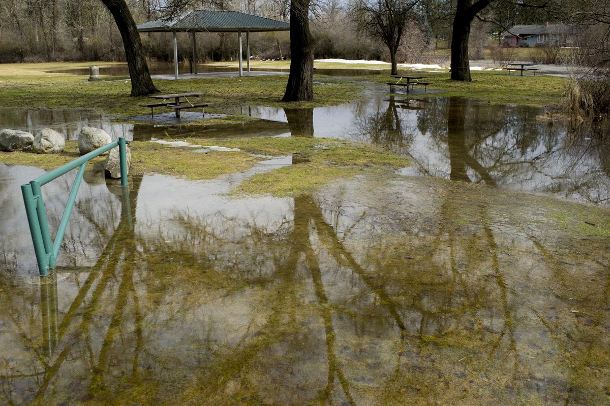
The Little Spokane River at Dartford was expected to go into minor flooding at 6.5 feet Wednesday and Thursday. Flooding was already occurring at Pine River Park on Tuesday.
Koch said Dartford hasn’t had a significant flood since the late 1990s, which makes it difficult to gauge how it could affect nearby residents.
“What I would encourage people to do is to monitor that river hydrograph and frequently check the water,” he said. “Pay attention to what the current stage of the river is and what our current forecast is to make a determination if the river could impact their property, or points of access for getting in or out of their house.”
The St. Joe River at St. Maries could reach moderate flood stage Thursday and is expected to crest between 36 and 37 feet, which has not occurred since 2008. Extensive field flooding is expected.
The weather service said “sections of the St. Joe River Road may be inundated. Water will be up to some homes in the trailer park on St. Maries River Road. Water will approach the flood gates in the levee at the Aqua Park.”
The U.S. Army Corps of Engineers in Seattle dispatched two teams of flood experts to help in St. Maries and along the Coeur d’Alene River, the agency said.
The Corps supplied a pump to Kootenai County to move floodwaters.
The Spokane River at Spokane also is under a flood warning, with water levels at 23 feet, about 2 feet above the historical mean. The river floods at 27 feet, something it hasn’t done since 2012.
Forecasters were calling for the Spokane River to crest over the weekend into Monday just below flood stage at about 30,000 cubic feet per second.
“We do have problems from time to time with flooding on the Spokane River,” Koch said. “But generally it’s slower to evolve. It takes weeks.”
Hangman Creek was expected to crest Wednesday below flood stage.
Elsewhere, Lake Coeur d’Alene was expected to rise to flood stage early next week at a lake elevation of 2,133 feet.
The Coeur d’Alene River at Cataldo also is expected to reach minor flood stage Wednesday through Friday.
The South Fork of the Palouse River was expected to reach minor flood stage Friday in Pullman and then drop quickly.
Paradise Creek in Moscow, which flooded last week, is rising again this week.
Across the Palouse small creeks and fields are filled with water. Some erosion is evident.
In Oakesdale, a city worker hooked up pumps to keep creek water from entering the city’s wastewater plant.
Nearby, a few inches of water from McCoy Creek washed over state Highway 27 but receded by Tuesday afternoon.
Farmers said that with the snow melting off their fields, they are having problems with mud and soft driving conditions, which is limiting work.
In Spokane County, Graham Road north of Salnave Road was closed Tuesday due to flooding 3 to 4 feet deep.
Greenwood Drive from Indian Canyon to Rimrock Drive was closed for flooding Tuesday.
Also, Cameron Road from Ritchey to Culver roads was flooded and washed out. Aspen Meadows Drive at Lois Drive was closed.
Other road closures were on Cornwall Road from Yale to Beyers roads; Dunn Road from Day to Day-Mt. Spokane roads; and Betz Road from state Highway 904 east to Andrus Road.
Blanchard Road from Chapman to Ross Creek roads was reopened.