Popular Spokane-area hiking trails expanded, improved
Hikers and mountain bikers are out for a pleasant surprise when they make their next visit to some of the Spokane area’s most popular trail systems.
Agencies and growing stable of trained volunteers have been quietly chipping away in recent years at improving old trails and building new ones on county, state and federal areas.
The results are impressive at destinations such as Riverside State Park, Spokane County conservation areas and Fishtrap Lake, all of which are currently green and bright with blooming wildflowers. Many of the new trails are ripe for exploring this week. Four choice 5-milers are highlighted here.
Riverside State Park
“There’s always some trail work going on in Riverside,whether it’s the horse and hiking groups or Evergreen East (mountain bike club),” said John Ashley, State Parks North Operations manager.
The most notable recent improvements are worth checking out for a 5-mile or longer day hike to Knothead, a granite outcropping above the Little Spokane River.
Drive to the Little Spokane River Painted Rocks Trailhead off Rutter Parkway (Washington Discover Pass required). Hike the trail past the vault toilet and continue north. The singletrack merges into a dirt road. Keep glancing up the rocky slopes to the left where the timber on the slope was burned in a 2015 wildfire. After about a half-mile, the slopes light up in May with yellow blooms of heartleaf arnica.
Continue up a canyon on the doubletrack to a trail maker and turn left onto singletrack trail toward Knothead.
The singletrack trail soon begins switchbacking up the slope on a route built just before the wildfire by a National Trails Day volunteer project sponsored by REI.
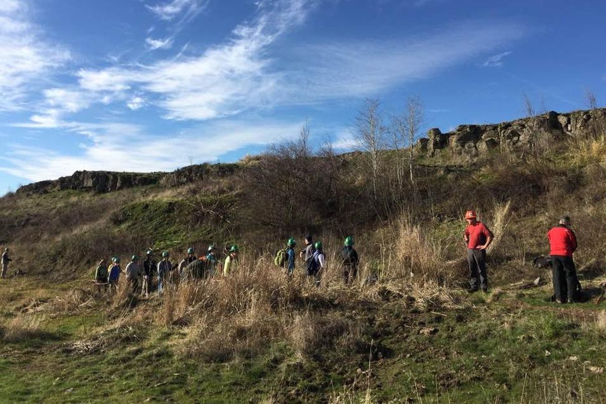
Notice the wide fire line that was bulldozed steeply down the slope in 2015. This month, volunteers organized by the Washington Trails Association devoted three days to rehabilitating 750 lineal feet of the fire line with native grass seed covered by burlap-like jute cloth to hold the soil, seed and moisture.
Sticks and debris were scattered over the cloth for more erosion control and to gradually naturalize the dozer cut as the vegetation matures. This effort was a follow-up to post-fire rehabilitation by the state Department of Natural Resources that did not hold up.
WTA also rebuilt the singletrack and added drainage where needed. On May 11-13 alone, 32 WTA volunteers logged 304 hours of work assisted at one time or another by five Riverside State Park employees.
The switchbacks top out and join the doubletrack again near the ridge. Turn left, hike up the doubletrack to a bench. Bear right on a spur to the Knothead outcroppings for views over the upper end of Lake Spokane.
The Little Spokane River’s confluence with the Spokane River is immediately below Knothead. Look upstream to faintly see the area of Nine Mile Falls. Look downstream to see the Spokane River widening in the pool backed up from Long Lake Dam.
Backtrack down the spur and turn left from the bench for a round-trip hike of about 5 miles back to Painted Rocks trailhead.
Better yet, make the total trek an excellent 6.4-mile triangular loop by turning right at the bench below Knothead.
Hike down about 2 miles, taking advantage of more trails built over the past three years by WTA and the Spokane Mountaineers.
Three unmarked spurs lead to rock outcroppings with great views of the serpentine Little Spokane River below.
The main trail down crosses a paved road. Farther down, you’ll reach the paved road again. Hike on it a short way and take a sharp left on the Little Spokane River Trail. This leads 1.6 miles back to your vehicle at Painted Rocks.
Spokane County Conservation Areas
The 15 conservation areas acquired and protected so far by the Spokane County Conservation Futures Program since 1994 are providing hikers, mountain bikers and, in most cases, equestrians with extraordinary “backyard” trail opportunities.
The trails are a work in progress. The most extensive trail work in recent years has been at Iller Creek Unit of the Dishman Hills Conservancy in Spokane Valley, said Paul Knowles, county parks planner who’s overseen huge recent improvements in trails and trailheads.
But even at Iller Creek, despite efforts to design the trails for sustainability, the effects of a record year of precipitation has taken a toll this spring with some major erosion issues on trails near the creek.
“Whatever we do with trails is temporary,” said Holly Weiler, Washington Trails Association East Side project coordinator. “Mother Nature allows some jobs to last longer than others.”
WTA and the Spokane Mountaineers are heavily involved in several major efforts on county conservation areas including the Glenrose area, where trailhead parking has not yet been developed. Major trail work for the Mica Peak area is being planned for fall, but large numbers of visitors already are using the existing forest roads for hiking and biking.
Two major efforts worth checking out now include Liberty Lake and Antoine Peak, which rises north of East Valley High School.
WTA crews were out on Antoine this week building drainage and finishing touches on a singletrack trail they started in October that connects with existing doubletrack for 2.6 miles to the summit. The single track is a huge improvement over the logging roads, offering more views over Spokane Valley and toward Mount Spokane.
“We’re planning a huge transformation at Antoine Peak, eventually replacing 20 miles of former logging road and informal dirt bike and ATV tracks and turning the system into 11-12 miles of trails in a series of loops and routes to the summit,” Knowles said.
To check out the new singletrack and a 5.2-mile round trip to the top, drive to Antoine’s east-side trailhead: From the junction with Barker Road, drive east on Trent Avenue/SR 290 for 1 mile. Turn north on Campbell Road and drive 1.6 miles. Turn left on Lincoln Road and drive 0.6 mile to the trailhead.
Hike up the trail to the kiosk, which has a map that has not been updated. The old doubletrack route goes to the right. The new singletrack heads to the left. It’s steep at first, but soon finds room to be gentle as it works its way up the mountain, merging in some stretches with doubletrack.
Here’s the rub: There’s no signage and it can be confusing to follow. Take time to explore the route.
“Every agency we work with – county, state, federal – has different signage requirements and that’s why they are responsible for it,” Weiler said. “Depending on their staffing and funding, it can take a while to happen after we’ve built the trail.”
Liberty Lake County Park also has benefited from extensive ongoing trail improvements to the 9-mile loop trail through the Cedar Grove to the falls up to Hughes Cabin and back to where it starts at the county park campground.
Back Country Horsemen volunteers have built bridges and blasting has been done to improve the trail to Liberty Creek Falls.
A sweet 5-mile loop especially enjoyed by families has been improved from the trailhead along Liberty Creek to the Cedar Grove. Hike the main trail 1.3 miles and bear left on the newly realigned Split Creek Trail. Hike 0.9 mile to the junction with the main trail near the Cedar Grove. Enjoy a snack near the stately old-growth cedars next to the creek and return to the trailhead on the main trail to form a loop.
BLM’s Fishtrap Lake
The U.S. Bureau of Land Management’s Fishtrap Lake Recreation Area is being dressed up with another reason to make it a favorite scablands destination for hiking, biking and horse riding, especially during spring and fall.
Spokane Mountaineers and WTA have completed most of an 8-mile loop of single track accessible from three trailheads on the west side of Fishtrap Lake near Sprague. Save for signage and some drainage issues that will be addressed, most of the route is ready for use.
An easy-to-follow 5-mile loop combining new and old routes at the south end of the trail system offers a sample of what the area offers hikers.
From Spokane, drive approximately 25 miles west on Interstate 90 and take Fishtrap Exit 254. Head south over the Interstate and drive 3.7 miles on Sprague Highway. Turn left toward Miller Ranch. Drive 0.2 mile and turn right. Drive 0.8 mile to the trailhead parking area informally known as the Farmer’s Landing access. The new trail begins at the first gate on the left (north side of the vault toilet).
Go through the gate and follow the new singletrack built by volunteers for roughly a mile. Go through a gate and continue up a draw to a plateau. Where the singletrack bears left as a cattle trail, leave it this time (to be explored another time.) Bear right and follow the vertical markers on a doubletrack trail.
Follow this route to a trail junction marked by a rusting cover for an old cattle salt lick. Using the map with this story, you can turn left, hike a short way and then turn right on the new singletrack that goes south along the lakeshore.
If that route finding is challenging to you, simply turn right at the rusting feeder cover and follow the marked doubletrack trail to continue the clockwise loop.
Look left for a glimpse of Fishtrap Lake through the snags burned in the 2014 Watermelon Fire. I saw bitterroots blooming there last weekend.
At a T junction, divert for the loop by turning left on the spur leading a short way to Farmer’s Landing and a pleasant picnic spot on the shore of Fishtrap Lake. Expect to see waterfowl. I also saw at least four river otters in the lake last week, one of which was munching on a trout.
Then backtrack to the junction and continue the loop. The trail leaves the trees and rises into open spaces. Waterfowl can be abundant in seasonal wetlands. Soon the trail loops back to the parking area.
Expect to spend two or three hours on this hike, which is enjoyable as a stroll or a powerwalk.
And if your legs beg for more, extend the trip to explore more of the new singletrack.
Still not satiated? Cross Fishtrap Road at the north end of the Fishtrap Loop and hike another 5-plus miles round trip to Hog Lake. That will add enough mileage to the day to leave the buffest hikers in hog heaven.