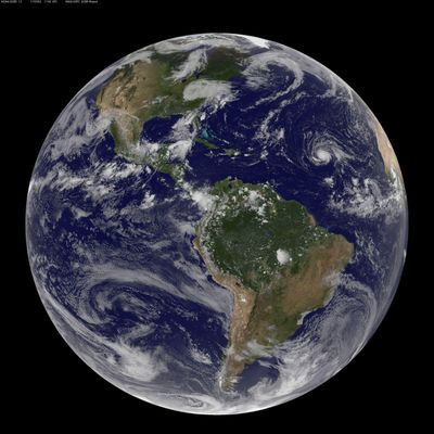
Caribbean islands begin preparations for Hurricane Irma

SAN JUAN, Puerto Rico – Islands at the eastern end of the Caribbean Sea made preparations Sunday for approaching Hurricane Irma, a Category 3 storm that could threaten the area beginning Tuesday.
Hurricane watches were posted for Antigua and Barbuda, Anguilla, Monserrat, St. Kitts and Nevis, St. Martin, Guadeloupe and the British Virgin Islands.
The U.S. National Hurricane Center said the storm could near that region late Tuesday. It said islands farther north, including the U.S. Virgin Islands and Puerto Rico, should monitor the progress of the storm.
The Antigua and Barbuda weather service said Irma was expected to bring heavy rains, rough surf and high winds to islands along the northern edge of the Antilles.
Long-range forecasts indicated Irma likely would curve to the northwest beginning late Monday and skirt to the north of those islands on a path that could potentially take it to the U.S. East Coast, but it was too early to make a definitive prediction.
Antigua’s prime minister, Gaston Browne, urged people to take preventative measures in case the storm should hit, including cleaning drains and removing objects that could be sent airborne by high winds. Workers began pruning trees and shrubs to reduce chances for branches to tear down power and phone lines.
“The passage of a hurricane is not a matter to be taken lightly, but we must not panic,” Browne said in a statement.
The U.S. hurricane center said Irma had maximum sustained winds of 115 mph Sunday night and some strengthening was expected over the next two days. The storm was centered about 710 miles east of the Leeward Islands and moving west-southwest at 14 mph.
Puerto Rico’s governor, Ricard Rossello, said government agencies in the U.S. territory were prepared to deal with any emergencies caused by the storm.
“We have established protocols for the safety of all,” he said at a news conference, while he also urged islanders to take precautions.
In the Dominican Republic, Public Works Minister Gonzalo Castillo said workers there were clear away road works and also clean out blockages of sewer drains. He said President Danilo Medina would lead a meeting with emergencies agencies on Monday to discuss storm preparations.