Getting There: The steep climb from Poverty Flats to Peaceful Valley
There’s been an emphasis on the “peace” in Peaceful Valley for the last few months.
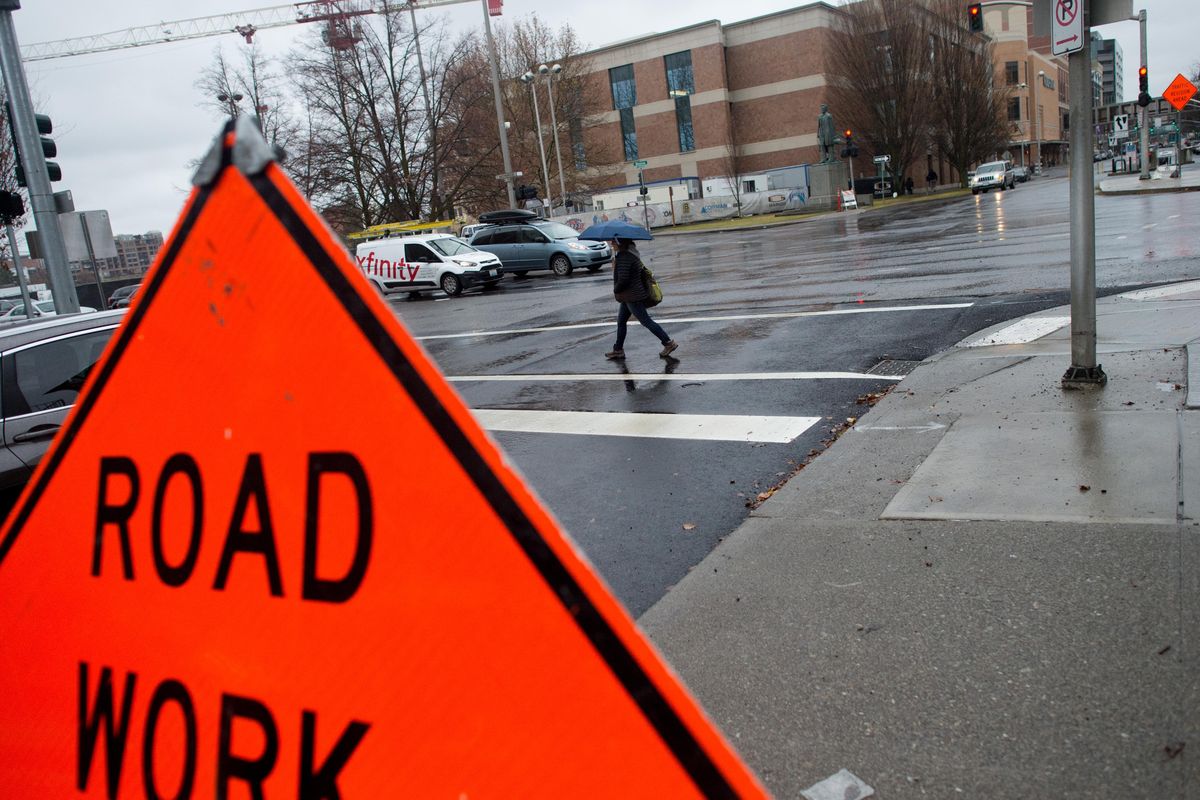
The main route into the central neighborhood, Main Avenue, has been shut for an extensive $3.7 million project connected to the city’s work to stop sewage from entering the Spokane River. Wayfaring strangers were few. The neighborhood went from having two auto routes – Main in the east, Clarke Avenue in the west – to one, and suddenly became a large cul-de-sac of a community.
Of course, for some commuters the work surely made them feel less like doves and more like Arctic terns, famous for their long migrations.
For instance, a trip from the Peaceful Valley Community Center to the downtown Spokane Public Library is about four-tenths of a mile on Main. With the primary route closed, that trip stretched to more than three miles.
May it be soothing to those with tired wings to know that the inhabitants of what was once called Poverty Flats had it worse. Much worse. The neighborhood is about as close as a neighborhood can get to the city center. But commuting, even by foot, from the area was enormously difficult.
In the early days of the white settlement of Spokane, Peaceful Valley remained what it had been for millennia: a bustling, if seasonal, salmon fishing camp. But its proximity to the downtown business district quickly changed its character.
In those days, the 1880s, the Northern Pacific Railroad and Spokane and Inland Empire Railroad owned large portions of Peaceful Valley, which stopped people from building homes there. But even after the railways began selling off parcels, the neighborhood’s isolating geography kept it undeveloped. The only way in or out of it was steep, switchback trails.
When the city’s streetcar network was first being built in 1888, no tracks came down the steep slopes of Browne’s Addition or from downtown to Peaceful Valley, and never would, probably because no one lived there. At least, no one considered important lived there.
The neighborhood was referred to as Spring Flats at the time, but the name quickly transformed to reflect the shacks that sprung up in the ignored forest. Migratory workers and poor immigrant families gravitated to the area for its closeness to the growing city, but if they had a conception of keeping out of sight of the town’s decision-makers, they were soon disabused of that notion.
In 1891, the Spokane Falls Review ran an article headlined, “Clearing Poverty Flat.”
“Poverty Flat, the district immediately below the falls upon the south bank of the river, which has been for some time inhabited by families in very humble circumstances, is being rapidly cleared of its former denizens and their families and restored to its primeval character,” it read. The work was done at the request of town founders J.J. Browne and A.M. Cannon and under the auspices of the city’s health board, “who are soon to invoke the assistance of the scavenging department.”
Though the article noted that the “families are scattering to all parts of the city in search of new homes,” the work to clear the land of poor folk wouldn’t last.
A man named C.F. Clough had platted the neighborhood and wanted to sell his property. One problem: the name.
In 1893, The Spokane Review ran an article called, “No More Poverty Flats,” which told of Clough’s work to re-brand the “locality formerly known as Poverty Flats, Spring Flats, etc., to Peaceful Valley.” He got the name from a popular play at the time, and the paper relayed Clough’s concerns that “poverty” didn’t describe the “industrious, hardworking people” who lived there, even if those people preferred the name “West Riverside Addition,” as neighborhood historian, Nancy Gale Compau, wrote.
Industrious and hardworking don’t half describe the people of Peaceful Valley in those days.
“Laboring-class families, most of whom were immigrants, purchased the lots and built their homes in Peaceful Valley,” Compau wrote in a short 1985 essay. “These people were not the financiers who conceived the city, but they were the backbone of the town, literally its builders. The 1903 City Directory shows 77 Peaceful Valley men working in the construction industry. They were stonemasons, carpenters, mill workers, lathers, bricklayers, plumbers, teamsters, lumberjacks and laborers who poured their sweat into long hours at low pay to construct and maintain Spokane.”
Among them were Finnish, German, Swedish and Italian immigrants, as well as two African-American families named Bass and Lipscomb.
What’s more, the commute for these early Peaceful Valley residents was not to be envied.
The children lucky enough to go to school had to climb up “the steep winding paths to attend school in the big, brick Washington School building” in Browne’s Addiction, according to the neighborhood’s historic district nomination.
Paths such as the one children and their mothers, who worked as house servants for the rich people of Browne’s Addition, took were joined by Main Avenue in 1897. Residents had first petitioned the city to build a road “wide enough for the passage of two teams” but then raised enough money to pay for half of its construction.
When finished, Main was steep and unpaved, and it went underneath the existing Monroe Street Bridge. Horse-drawn carriages had a tough time negotiating the road.
In 1902, the hardworking people of Peaceful Valley again asked the city for an improved road, and again met them “more than halfway,” the Spokane Daily Chronicle reported. The city paid the $125 for materials to widen the road and build a four-foot wide sidewalk on the south side of the road. The residents built it.
“It has cost residents of that district two weeks of heavy work, with a gang of about 30 men and will cost them another good hard week of toil before the job is completed,” the Chronicle reported, noting that “citizens of Peaceful Valley” saved the city $2,000 by doing the work themselves.
When today’s Monroe Street Bridge was built, Main’s route to Peaceful Valley was given a better, more shallow grade, but many of the neighborhood’s “north-south streets were so steep they were labeled ‘impassable for teams’ and left in their natural state,” Compau wrote in her master’s thesis in 1985.
Around this time, these north-south streets were renamed. Where before they took the names of the Great Lakes – Huron, Michigan and Ontario – in 1909 they assimilated into the city’s existing street grid with the names Cedar, Maple and Ash.
It wasn’t the last time a transportation project would change the character of Peaceful Valley. In 1958, the “massive Maple Street Bridge was built high overhead and straight through the center of Peaceful Valley,” wrote Jim Kershner in an essay about the neighborhood on HistoryLink.org, adding that “bitterness has lingered for decades” due to the bridge’s construction.
It’s easy to see why.
“Heartsick homeowners, who had lived most of their lives there, saw their homes torn down,” Compau wrote in her thesis. “The empty land left underneath the bridge became a barren, refuse-filled dust bowl. The shadow of the bridge obscured the sun and a steady rain of debris showered down on it, dirtying yards and killing plants and shrubs.”
Though heartburn may have scorched the esophagus of some Peaceful Valley commuters, surely no one is bitter about the recent work. Aside from helping to stop sewage from entering the Spokane River, a point of pride of location for Peaceful Valley residents, the work also brought a section of an envisioned three-mile multiuse trail that will circle through Peaceful Valley, Kendall Yards and around the Spokane Falls.
Surely such a trail will only amplify the neighborhood’s peaceful character, and show Clough’s foresight in renaming it for its hardworking, industrious people.
Got a transportation question? Ask nickd@spokesman.com.
Signs for Centennial Trail
Two new types of sign will greet users of the Centennial Trail, and they’ll soon be seen on the Ben Burr Trail.
Following getting a $5,000 grant from SpokeFest for bicycle education and safety, Friends of the Centennial Trail spent a total of $14,200 to put up the new signs, which began last week.
One tells cyclists to keep right except when passing on the left, and reminds riders to abide by the 15 mph speed limit. The signs are illustrated with icons of bicyclists showing proper passing technique. The group also added new trailhead signage.
The work will retire 150 “old, tired” signs along the trail running through Riverside State Park, which are familiar to users with their brown and white hues, said Loreen McFaul, executive director with the friends group. The city has requested similar signage for its Ben Burr Trail, which connects the East Central neighborhood to the University District.
An example of the new trailhead sign can be seen in the city center in Kendall Yards at the Nest, an official trailhead near the Central Food restaurant. The passing signs can be seen along the trail.
The sign installation follows the work of an urban planning graduate student at Eastern Washington University, who was hired by McFaul’s group to do a “wayfinding” study of the trail.
Now that’s enough to celebrate with a slice of hot pizza.
Don’t drink and drive, don’t use pot and drive
A recent survey done by the Washington Traffic Safety Commission and Montana State University’s Center for Health and Safety Culture found that nine percent of Washingtonians say they’ve driven after drinking and ingesting cannabis.
These people, the commission said, were more likely to believe that using cannabis after drinking “helps sober them up.”
The commission points out that this isn’t true.
The survey also found that 53 percent of respondents said they intervened to prevent someone from driving under the influence of alcohol or cannabis “about half the time.” Another 27 percent said they “usually or always” intervene. The remaining 19 percent said they rarely or never intervene.
Other survey results include:
81 percent are concerned about traffic safety;
78 percent do not drive within two hours of consuming alcohol;
85 percent do not drive within two hours of consuming cannabis;
91 percent do not drive within two hours of consuming both;
83 percent believe it is unacceptable to drive within two hours of consuming alcohol and cannabis.
“These results show that Washingtonians have healthy beliefs, attitudes and behaviors about intervening to prevent driving after consuming alcohol and cannabis, but there are opportunities to improve. Intervening should be normal and appreciated,” said Nicholas Ward, director of the of the Center for Health and Safety Culture, in a statement.
Tips when you park outside for winter
The good people at PEMCO Insurance have created a list of “hacks” for people who park their car outside during the winter months.
Unfreeze a car lock by dabbing a bit of alcohol-containing hand sanitizer over the keyhole and on the car key. Then spray it with WD-40 to prevent freezing in the future.
Melt out your windshield with a spritz of a homemade concoction containing one-third cup water and two-thirds cup rubbing alcohol.
Stop your wipers from freezing to the windshield by putting an old sock on each wiper the night before.
Keep your side mirrors frost-free by slipping a gallon-size zipper bag over the mirror, secured with a rubber band, the night before.
Unfog the inside of your windows by wiping with a clean, old-fashioned chalkboard eraser. Not your gloved hand.
One last tip, not from PEMCO: try taking the bus if winter driving scares you. They’re always heated up by the time passengers board.