Getting There: Spokane’s Mission Avenue Subway was blocked in 1936. Should we have built it?
Drive along Mission and Maxwell avenues in north Spokane, on top of that new layer of asphalt and around the new stripes of paint. It’s nice, smooth pavement with a leafy median. It meanders a bit through neighborhoods.
You’d be forgiven for not knowing the decades of conflict that centered on the street, battles that still resonate today.
Nearly since they became roads, the east-west arterial has struggled with two identities. Engineers and neighbors jockeyed to define the road. Should it be a tree-lined street, safely crossed by kids on foot to reach the old Sinto pool and park? Or should be a highway running through town all the way to Coeur d’Alene?
Following a spring of roadwork, the two roads look different than they did even a year ago, especially Maxwell, the western end of these two streets that act as one arterial.
Driving east, Maxwell, and a bit of Mission, just went through a major redesign, dropping from four lanes of traffic to two, with center-turn and bike lanes.
Keep going east and, after passing Division Street, the buttery-smooth pavement of Mission may soothe you into that state of mind only achieved behind the wheel on a Sunday, a milkshake in the cup holder and an open road through the windshield.
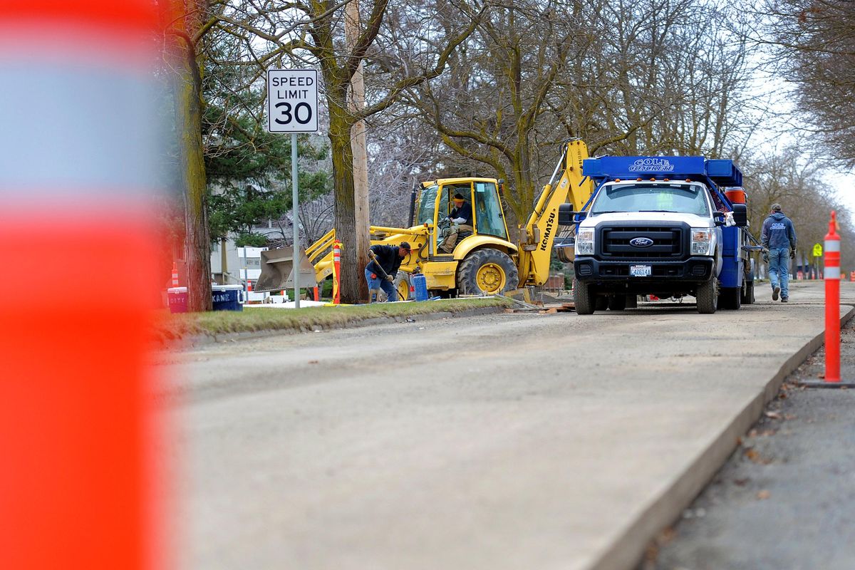
Further east, from just near Hamilton to Spokane Community College, doesn’t look like much now. But transit officials hope their plans for an electric bus line, the Central City Line, will remake this length of Mission, bringing economic development to a part of town that wouldn’t mind it.
Cars, bikes, buses and people. Add in the Spokane River that flows under the Mission Avenue Bridge, and nearby Felts Field, and we’ve got just about all the modes of travel covered.
Of course, it wasn’t always this way. It’s hard to know where the streets got their names, or who first drew them on a map. One of the But the first mentions of Mission in The Spokesman-Review came in 1897, when the City Council authorized the planting of more than 100 locust trees in the median.
It was a sign of a growing city. Neighborhoods and homes were sprouting up. What signified class more than a tree-lined boulevard? Perhaps, maybe, a highway?
In 1911, as motorists clamored for new routes around the region, a “great project” was envisioned to make Mission the “main artery connecting the city with Coeur d’Alene city and the entire Spokane river valley.” The plan included “paving a large part of the avenue, grading the remainder within the city limits and making a splendid country road over still another section just east of the city.”
As traffic increased, the idea for such a highway would remain, though the word wasn’t used to describe Mission at the time. There was one little problem, however.
In 1936, motorists weren’t the only ones who relied on the route. So did the Great Northern Railway, which had tracks crossing Mission just west of the river. Collisions were increasing and plans surfaced to dig a hole underneath the rails for an underpass for cars. By March, the Spokesman was referring to the plan to build a 17-foot deep tunnel under the tracks as the Mission Avenue Subway. The City Council approved the plan and sent it to state highway engineers to design.
With designs complete, the work to build the underpass was to estimated at $125,000 and would be done with federal funding, about $3 million of which was available for such work in Washington state.
But neighbors rallied to stop the work, which required the demolition of an entire block of homes and the removal of dozens of “locust trees 35 years old.”
Illustrations of the subway plans showed what would replace the locusts: geometric topiary. Nearby residents fought against the tree removal, and some wrote a joint letter to the paper decrying the “paper trees” shown in the drawing.
“It seems to us that paper trees and pen and ink landscaping are a poor substitute for those we already have,” the letter read. “Architects’ and engineers’ drawings have a way of creating pleasant illusions.”
A “delegation of Mission Avenue taxpayers” took their concerns even further: “with a burst of verbal gunfire” they confronted the city’s commissioners. At a contentious meeting, they said the underpass would “create a greater menace” to the “children crossing Mission to playground and pool.”
“Making a speedway out of Mission will simply create a greater traffic hazard for our children,” said Mrs. P. J. Tavernia, according to the paper. “Every one going west on Mission is going to take a run for the hill when they come out of that deep hole and will be unable to see a pedestrian until they hit him.”
Instead of an underpass, the delegation recommended elevating the tracks, like those downtown. City commissioners rebuffed the so-called taxpayers, saying the plan was out of their hands. The decision lay with the federal bureau of public works.
Just like that, the following month, in April 1936, the feds withdrew the funding “due to curtailment of relief funds.” Too much had been spent on Great Northern projects elsewhere in the state, and the feds wanted to share its largesse.
On May 12, 1936, the Spokesman’s headline said it all: “Underpass Job is Called Dead.” The idea was never revived.
Fourteen years later, in March 1950, the Spokane Daily Chronicle reported that plans were in the works to transform Mission into an alternate state highway. In 1953, Mission was widened to four lanes.
As a major route with more and more traffic, the conflict with the rail crossing just got worse.
In 1964, the Spokesman called the Mission crossing “one of the worst traffic accident spots in Spokane.” The article recounted the recent deaths and injuries, and warned drivers to be cautious.
Four years later, the paper took the reporting beyond the human toll when, in 1968, it ran an article about a block of eight locust trees being cut down for road widening and a turn lane at Perry Street.
In the 1970s, as the locust trees aged, city workers began to remove and replace them. Spokane Park Director William Fearn said that the city’s “horticultural specialists indicated the trees along Mission are reaching an age where they are becoming brittle and have a tendency to break off and therefore are potentially dangerous.”
In 1982 many of the old trees remained and again became an issue before the city council. Parks Manager Taylor Bressler said the state Department of Natural Resources had authorized $10,000 to inventory the old shade trees lining Spokane’s streets, primarily along Mission, Grand and Boone avenues.
The trees were 80 years old at the time, and the paper said the grant money “looked like a God, mother and apple pie type of proposal – the kind the City Council loves.” Instead, some members turned against the plan, saying the money was better spent elsewhere. Mayor Jim Chase argued in favor of taking stock of the trees, saying the city had to do something about its decaying trees, and the council voted 4-3 to accept the money.
In 1992, the locusts from the early years of Spokane – 18 of them, 60 feet tall – were cut down. They were dying, dangerous and merited their last mention in the paper. Younger trees now stand in their place.
The old trees are a matter for the archives, but the rail crossing continues to make headlines.
The daily traffic count for Mission near the tracks, which are now owned by BNSF Railway, averages around 17,000 cars. Despite such traffic, the city isn’t pressing to separate it from the tracks anymore. Instead, officials are focused on the nearby Centennial Trail.
For a few years now, the city has had plans to build a trail bridge diagonally over Mission Avenue, which would fill what has long been known as the “Mission gap” in the otherwise free-flowing trail.
Cyclists and walkers will be fine. The new trees don’t appear to be in danger. Trains still cross Mission every now and again. And commuters probably don’t know many details of the story they’re driving on.
High, Sharp to close
High Drive and Sharp Avenue will both be closed starting Monday.
The work on High Drive on the South Hill will close the road between 21st and 29th avenues. The $1.5 million project will build a 30-inch combined sewer line, and lay new asphalt pavement.
An eight-foot wide, paved pedestrian pathway will be added to the west side of the street, matching the character of the road south of 29th. Some on-street parking lanes will be removed on both sides of the street. Work is anticipated to be complete in the fall.
The $2 million project on Sharp between Pearl and Hamilton streets will fully close the street through the fall.
Working with engineering students at Gonzaga University, the city is completely remaking the street.
Instead of a high-centered road, the center will now be the low point, and rain water will run to new central swales – rain gardens with trees and other landscaping – that will take the place of the raised concrete curb in the middle of the road between Ruby and Hamilton streets.
Some of Sharp’s blocks will be made with porous asphalt, allowing rain water to seep through the road and enter the earth below. It’s a new method of treating stormwater on-site, allowing the dirt below to “bio-filter” the water before it reaches the river and aquifer, our sole source of drinking water.
Division, Ruby still impacted
Paving work continues to impact traffic on Division and Ruby streets.
The work on the state highway is grinding down and repaving large stretches of the road. Drivers should be alert for utility adjustments and daytime lane restrictions. During evening and overnight hours, motorists can expect multiple lane closures for paving and asphalt grinding.
Trent, MLK remain closed
Work on a roundabout on Trent Avenue has closed the road from Hamilton to Napa.
When complete, the roundabout will be the east end of Martin Luther King, Jr. Way.
The west end of MLK Way is closed as well for construction of the pedestrian and bicycle bridge being built over the BNSF Railway tracks near the University District.
STA’s future is electric
Last week, this column looked at the city of Spokane fleet and it’s lack of electric vehicles. Spoiler alert: It has one electric car out of 1,086 vehicles.
Spokane Transit Authority didn’t respond in time for the story, but they shared the make-up of its fleet.
Currently the transit agency has three, 30-foot-long diesel-electric hybrids, and 25, 40-foot diesel-electric hybrids. That’s out of 147 fixed-route coaches.
They plan to have some fully electric vehicles soon, dependent on the completion of the Central City Line. If and when that occurs, all ten Central City Line vehicles will be electric.