March hikes: Vanishing snow reveals amazing hiking opportunities
Hikers are ditching MICROspikes and snowshoes this month. March is the time they bare their soles to lowland trails where most of the snow has disappeared and buttercups are blooming.
From the Columbia Basin Wildlife Area near Quincy to Mineral Ridge at the northeast end of Lake Coeur d’Alene, trailhead parking lots were packed last weekend. Visitors also flocked to Palouse Falls State Park to watch the official state waterfall plunge 185 feet into the pool below, which can be visited by hikers skilled at negotiating loose rock on steep slopes.
Eastern Washington is especially ripe with early-season routes that lead hikers to many smaller desert waterfalls – as well as thawing lakes that are attracting colorful contingents of migrating waterfowl.
The region’s landscape is shaped by volcanic activity and scoured by the cataclysmic Ice Age Floods that broke loose through ice dams in Montana. These floods from Glacial Lake Missoula swept through the Columbia Plateau at peak rates of up to 10 times the combined flow of all the rivers of the world, according to the Ice Age Floods Institute.
The aftermath has evolved into a rugged magnificence, as visitors see at Dry Falls State Park and other Columbia Basin hiking destinations.
While much of the region’s national forest land and higher peaks such as Mount Spokane will hold snow through May and even longer, several agencies manage vast acreages at lower elevations that are inviting hikers to stretch their legs NOW.
Hikers don’t have to leave Spokane to enjoy the trails at the Dishman Hills Conservancy or Spokane County Conservation Futures areas (www.spokanecounty.org) such as Saltese Uplands. But this is a great time of year to take a day or two and explore farther afield.
Crowds still haven’t arrived at some destinations. For example, only one couple was camping at Sun Lakes-Dry Falls State Park south of Coulee City last weekend as I checked out some the offerings on our wealth of public lands.
State lands managed by the Washington Department of Fish and Wildlife – nearly a million acres – as well as State Parks, along with federal lands managed by the Bureau of Land Management – roughly 430,000 acres – have wild places to explore by foot. All three agencies have websites with basic information about their recreation offerings.
It would take several guidebooks to describe all of the early-season trail options just in Eastern Washington. Since those books already have been researched and published (see sidebar), I’ll highlight a mere sampling of the many special areas worth exploring.
State Wildlife Areas
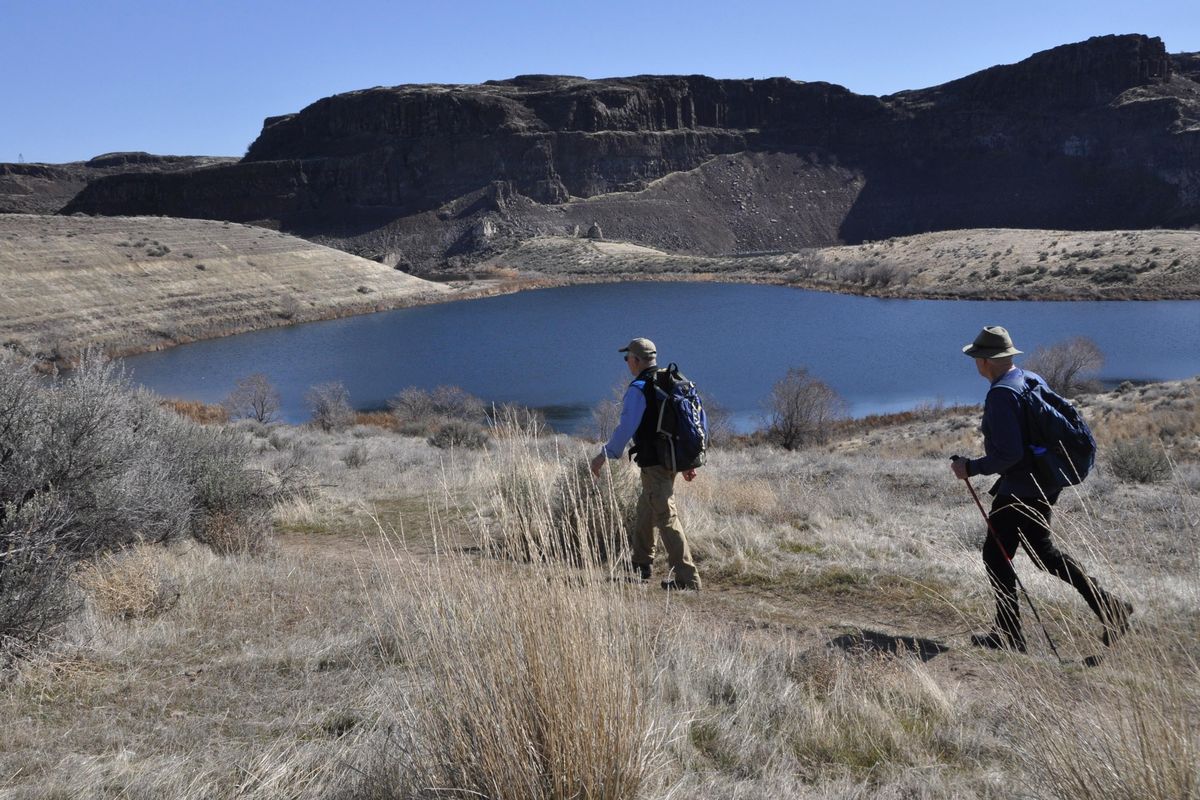
ANCIENT LAKES are a popular spring hiking and backpack camping destination a few miles north of Interstate 90 in the 15,266-acre Quincy Lakes Unit of the Columbia Basin Wildlife Recreation Area.
The five lakes are fed by seepage and more obviously by a three-step waterfall that originates, like most of the pothole lakes in this area, from irrigation runoff.
The desert’s windfall of water pumped up from the Columbia River translates into crops that help feed the world as well as wetlands for wildlife, lakes for fishermen and scenic destinations for hikers.
Hedgehog cacti can be found in the area, along with an array of blooming desert wildflowers in April and May.
Numerous user-made trails allow for exploration of this sageland basin, bordered by basalt cliffs that range up to 800 feet high. One route I found fascinating, about 5 miles, goes like this:
From the north trailhead, follow the main route and bear left at the first major fork to roughly parallel the wall of basalt on the left that leads to the Ancient Lakes.
Drop down to the north lake. Take the rough trail to the left side of the lake to scramble up along the three tiers of waterfalls. Enjoy the tumbling water and spray and then backtrack and follow the trail as it winds around the west side of the next two Ancient Lakes.
Several trails head up and onto a broad open area. Bear east here back toward the horseshoe basin of cliffs and look for a trail that snakes up through a little ramp of non-vertical rocky slope. Follow the trail as it reaches gentle ground and bears right along the upper wall to a large U-shaped notch that can be scaled for a precipitous view to the southwest and down onto Dusty Lake. Dusty is a sweet walk-in trout and bass fishery that opened March 1. Expect to encounter wind in this notch.
Then scramble back down out of the notch and continue on the trail that leads delightfully along the basalt wall westward back to the main wide trail that leads from the trailhead to Dusty Lake. Turn right and follow this main route back to the trailhead.
Dusty Lake and Frenchman Coulee are among several other notable hiking destinations in this area.
Directions: From I-90 west of Moses Lake, take Exit 149. Follow SR 281 Spur and then SR 281 toward Quincy for nearly 5 miles. Turn left onto Road 5 NW. Drive 7.8 miles and turn left onto Road 9 NW. Drive 5.9 miles to the trailhead.
Online: North Fork Asotin Creek offers early season hikers access to the state wildlife lands in the Blue Mountains near Asotin, Washington: bit.ly/2HsP9so
State Parks
Dry Falls is an impressive spectacle from the visitor center overlook along SR 17 south of Coulee City, Washington. Hikers can go a step further as they walk in the depths of the basin to blow their minds at what happened several times through the Ice Age Floods period ranging from 18,000 to 12,000 years ago.
Sun Lakes-Dry Falls State Park south of Banks Lake and Coulee City offers 4,000 acres to explore surrounded by open land managed by ranchers and the U.S. Bureau of Reclamation.
A favorite hike loops about 3.5 miles from the Umatilla Rock trailhead. From the kiosk, hike in and bear left at the fork heading uphill below the south face of Umatilla “Rock,” which, as you’ll soon see, is a long ridge.
Cross the Dry Falls Lake access road and continue on trail down to Perch Lake. At an open gravely shore area, bear left and find the trail skirting the south side of Perch Lake. Soon this marked route curves northward and heads to Dry Falls Lake.
As you approach Dry Falls, look up at the rock wall that once formed the world’s largest waterfall in volume. The late guidebook author Harvey Manning noted that the waterfall of the Pleistocene, “400 feet high and three miles wide, would make Niagara look like a leaky faucet.”
The trail leads to the parking area, which becomes busy after April 1 when Dry Falls Lake opens to fishing. From the vault toilet, the trail crosses the road, heads up and begins returning to the start. However, look for a trail branching left and leading up a short, steep scramble to a notch in the cliff.
The notch offers a good view east through Umatilla Rock overlooking Monument Coulee, which is currently recovering from wildfire. Make a choice here. You can scramble down eastward through the scree from the notch and pick up a trail in Monument Coulee that leads back through eye-catching rock formations to the trailhead. Or, backtrack and continue on the loop trail that leads back to Perch Lake and then on the familiar segment back to the trailhead.
Sun Lakes-Dry Falls State Park has a campground, more fishing waters and it meshes with a resort that offers golfing and water sports.
Directions: From US 2 just west of Coulee City, turn south on SR 17. Stop in at the Dry Falls Visitor Center at 2 miles and then continue another 1.9 miles and turn left into Sun Lakes-Dry Falls State Park. Drive 1.2 miles through the park and turn left toward Dry Falls Lake. Drive 0.9 mile and bear left toward Dry Falls; go 0.4 mile and park at Umatilla Rock trailhead.
Online: Steamboat Rock State Park, about 20 miles north of Coulee City on SR 155, offers excellent hiking from the campground to circumnavigate the plateau on top of the namesake rock overlooking Banks Lake. Also as you drive there, check out Martin Falls, which plunges this time of year into a punch bowl beside the highway at Milepost 17. Then check out the fine spring hike up Northrup Canyon: bit.ly/2HwIVI4
BLM
Escure Ranch south of Sprague, as well as Fishtrap Lake and Hog Canyon, about 25 miles west of Spokane and south from the Fishtrap Exit 254, offer excellent spring scablands hiking routes, including a fine trek to a waterfall flowing into Hog Lake.
Read detailed stories for these U.S. Bureau of Land Management destinations online:
- Escure Ranch, bit.ly/2InpV03
- Fishtrap Lake, bit.ly/2FHHTIH
- Hog Canyon, bit.ly/2InqEOP
Correction: This story incorrectly stated when Dusty Lake opened to fishing. The lake opened to fishing on March 1. The story has been updated.