Image of the day - Pebble Mine
It's been a little while since we've written about the Pebble Mine - in fact only once since we've moved to the new site. But rest assured, that nasty project is never for from our minds. We've kept in good contact with the Sportsman' Alliance of Alaska via their Twitter account (@NoPebbleMine), and we're always reading up on what's happening in the Great North.
The reason we're writing now is because we were recently sent the below image, and WOW, talk about putting things in perspective.
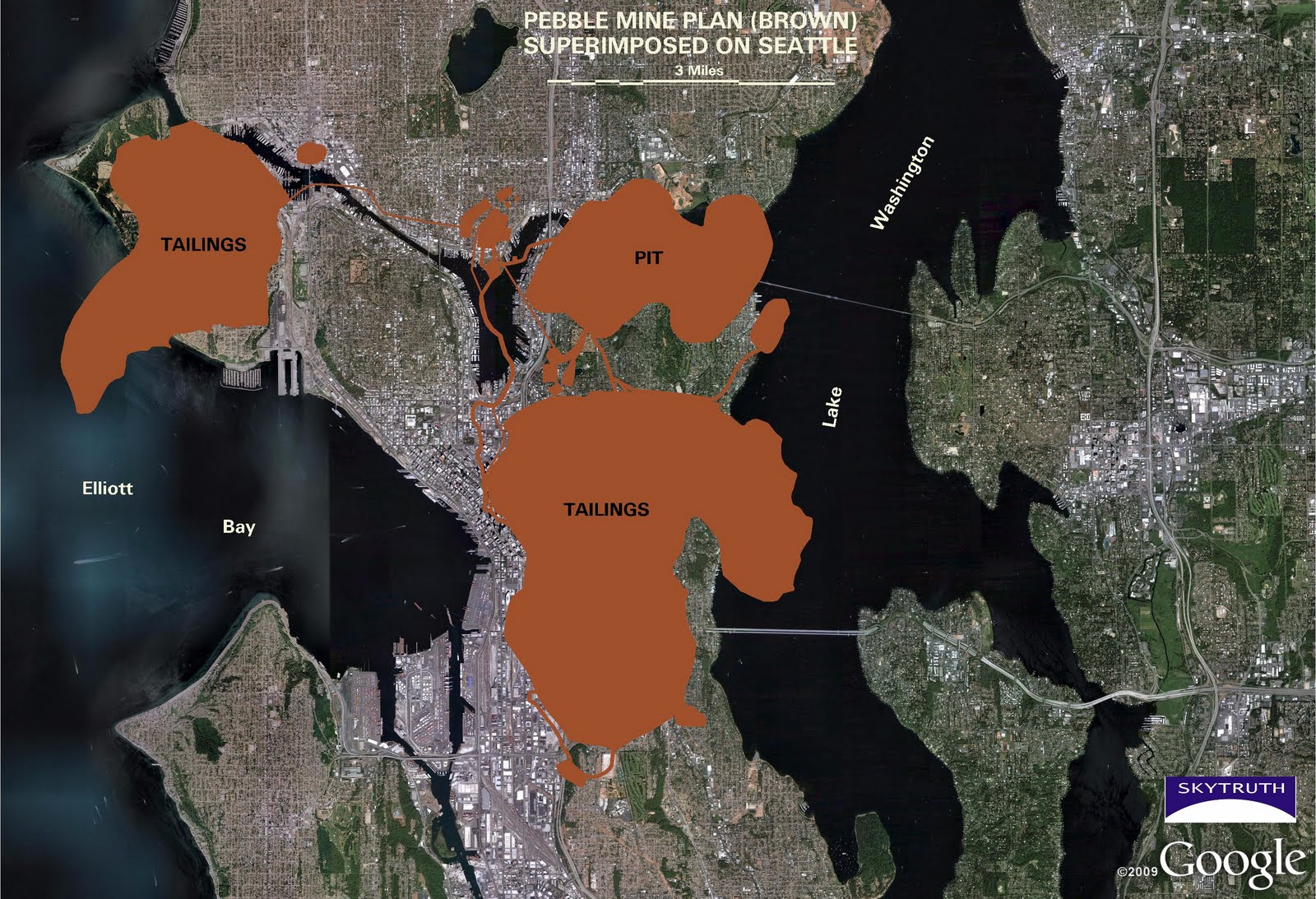
This is a Google Earth view of Seattle - the copper colored part is the Pebble Mine plan superimposed to show you just how big the mine would be. This was done by SkyTruth, a group that uses remote sensing and digital mapping to educate the public and policymaters about enviromental consequences of human activies.
From SkyTruth; [The Pebble Mine plan] features an open pit that would cover 1400 acres, and two huge tailings impoundments of 2500 acres and 5000 acres that are bounded by a series of 5 earth-and-rock-filled dams. The larger of the impoundments will feature a 700' tall dam almost four miles long - the largest dam in the world, ultimately holding back a 2.5 billion-cubic-yard slurry of tailings nearly 700' deep that covers more than 6 square miles. For comparison, China's Three Gorges Dam is 607' high and 7,575' long. And, like most of Alaska, this area is known to be seismically active, so these impoundments - which need to hold back the contaminated mine tailings for eternity - will likely experience major earthquakes.
For more images of the Pebble Mine plan from SkyTruth, click HERE.