Avalanche advisory: Big transition expected
WINTER SPORTS -- The Idaho Panhandle Avalanche Center has offered suggestions for winter backcountry travelers in its weekly advisory posted today.
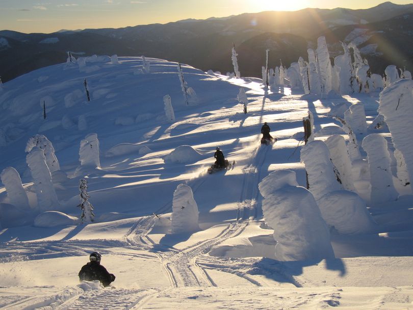
Overall, conditions are fairly safe -- for now!
"Be cautious near ridgelines and where wind deposited snow is deeper and possibly firmer overlying a weak layer fo surface hoar," says Kevin Davis. "We'll probably have another buried layer of surface hoar after the storm forecast for Saturday and this will set the stage for increasing avalanche danger in what looks to be a snowy week ahead....
"Be thinking more snow equals more instability on weak layers. You can check the weak layers pretty easily since they'll be easy to find in the sugary snow above the thick Thanksgiving ice crust, about the upper 1-2 feet of the pack."
Read on for the full 12-23-11 avalanche advisory:
|
AVALANCHE ADVISORY |
|
|
U.S. FOREST SERVICE |
FORECASTER: Davis |
|
IDAHO PANHANDLE AVALANCHE CENTER |
EFFECTIVE DATE: 12/23/2011 |
|
DATE ISSUED: 12/23/2011 0730 |
OUTLOOK: 12/23-25/2011 |
|
This report does not apply to local ski areas within the forecast region and the hazard rating will remain valid through midnight December 23, 2011. Special thanks to Idaho Parks and recreation for sponsoring this avalanche advisory. |
Thanks to Dave Alley and the Crew on Patrol for the pit data from Silver Mountain. Thanks also to Santa for the snow in our stockings, Merry Christmas! |
|
WEATHER |
|
|
TODAY: Partly sunny skies and mountain temperatures in the mid to high 20s with SE winds 5-11mph and stronger gusts to the south and light westerly winds to the north. TONIGHT: Becoming mostly cloudy as a weak weather system pushes into the northwest with temperatures in the high teens to low 20s and light winds. OUTLOOK: The NWS is forecasting light snowfall to begin on Saturday. This weak system is not enough to push the colder air out so temperatures with the snowfall should stay below freezing initially. More snow is expected with stronger systems pushing in off the Pacific so westerly winds will increase and temperatures may rise slightly by Sunday. The avalanche danger will increase with the expected weather for the outlook period. |
|
|
Selkirks and Cabinet mountains: In the Selkirk Mountains yesterday we found about 4 feet of snow on a NW aspect. Very cold and faceted snow above the thick and still hard T-day ice crust. The 12/15 surface hoar layer is intact about 4-6 inches deep and present on multiple aspects, mainly in sheltered terrain. Stability of this layer is good at present due to the light load of very low density snow on top. Another layer of surface hoar exists from the last few days of clear weather and may be more widespread once its buried due to colder temps. Keep a close eye on the temps and snow accumulation with the next storms. We have a structurally weak snowpack above the T-day ice crust and it sounds like next week we could have enough snow to create an unstable slab. Avalanche danger is rated MODERATE on windloaded aspects steeper than 35 degrees above 5,000 feet. The avalanche danger as LOW on non wind-loaded slopes less than 35 degrees. St. Regis Basin and Silver valley: A lot of observations from the Silver Valley yesterday. Carole and Dan were at Lookout Pass and found 3 feet of faceted snow on a SE aspect. The weakest layer they found was the faceted snow above the thick T-day ice crust. Shears were not clean on this layer but as the load increases on the structurally weak pack look for more energy in shears at this layer. Pits on Silver Mountain showed strong temperature gradients in the upper 1 foot of the pack, creating weaker bonds. They observed a new layer of surface hoar forming as did Eric Morgan at 5,500 feet on Sunset Peak. He got some rough shears on the buried surface hoar and felt some settlement of the pack as he traveled. Avalanche danger is rated MODERATE on windloaded aspects steeper than 35 degrees above 5,000 feet. The avalanche danger as LOW on non wind-loaded slopes less than 35 degrees. Mostly safe sliding out there today. Moderate means human triggered avalanches are possible on steep windloaded aspects above 5,000 feet. As we begin to get new snow be more cautious in your route selection. We will most likely be dealing with 2 layers of buried surface hoar. The more load from accumulating snow the more unstable these layers will become. We could be looking at widespread high avalanche danger by Sunday evening, it depends on how much snow we get. |
|
|
The next avalanche advisory will be issued December 30th. |
|
