BLM reopens Rock Creek-Escure Ranch; seeks leads on vandalism
PUBLIC LANDS -- A popular U.S. Bureau of Land Management recreation area about 20 miles south of Sprague has been reopened after the agency repaired about $5,000 in damages caused by vandals.
The Rock Creek/Escure Ranch suffered damage to fences and other facilities in a crime spree that occurred around March 15, said BLM recreation planner Steve Smith. A toilet was damaged, bridge signs were ruined and two kiosks were knocked, including one built by an Eagle Scout.
Report any tips that might lead to the arrest of the vandals to the BLM Spokane District Office, 1103 N. Fancher Road, Spokane, Washington, or call (509) 536-1200.
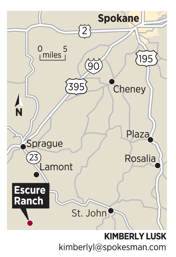
The Rock Creek management area, which straddles the Adams-Whitman county line, includes about 13,000 acres of grassland, basalt cliffs and glacial potholes managed as a sheep and cattle ranch for about 70 years before being acquired in 1999 by the BLM.
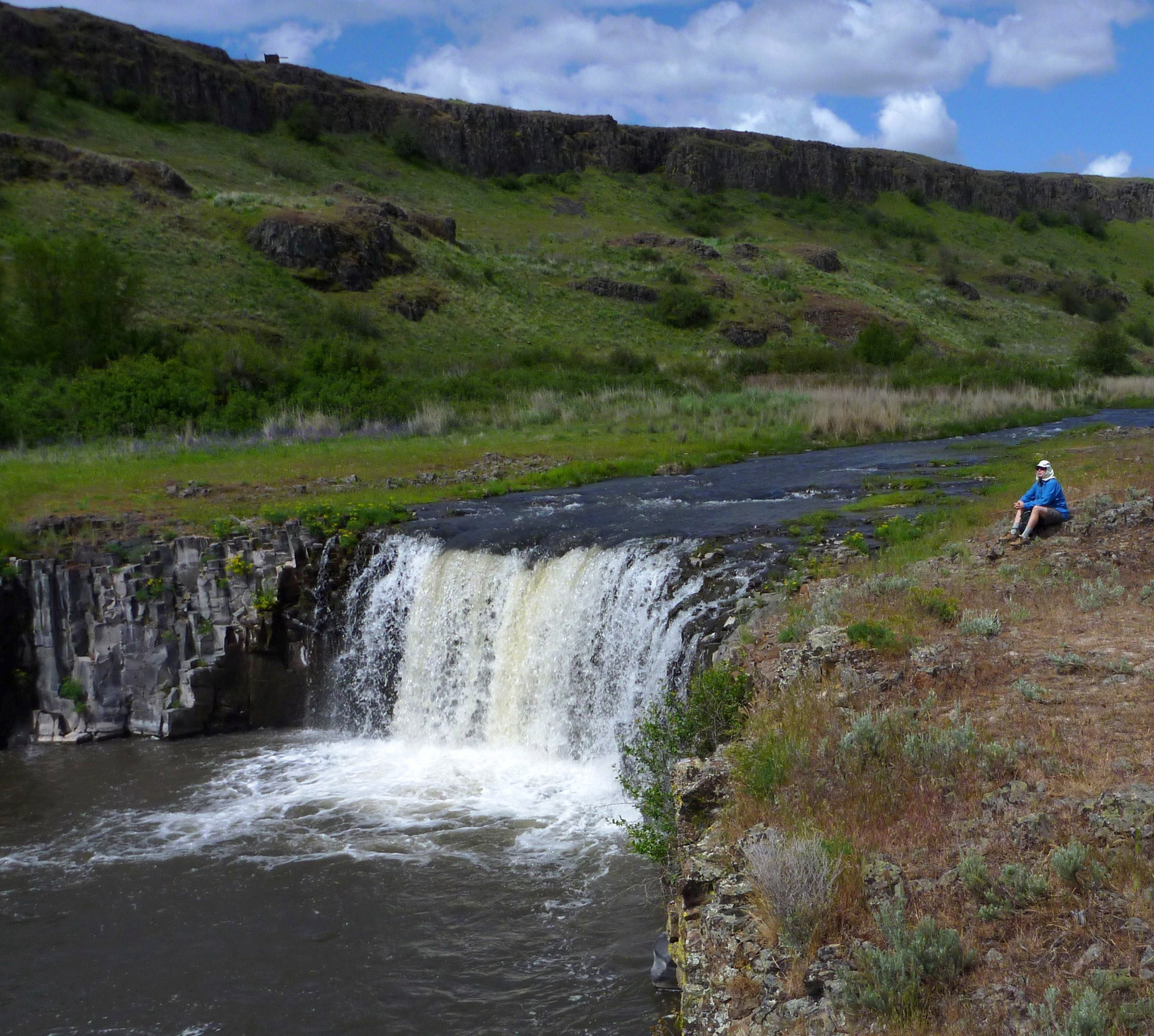
The area is popular with springtime hikers and mountain bikers. A network of roads and trails lace rangeland, leading to Wall Lake, Perch Lake, and Turtle Lake, as well Towell Falls on Rock Creek (pictured above).
The road that leads three miles to Towell Falls is ideal for hiking and biking at this time of year, before the road is open to motorized vehicle traffic in mid-April until a summer fire-season closure.
Rock Creek opens to fishing on June 2. The lakes are open year-round.
IF YOU GO
Towell Falls are an enjoyable destination 6-mile round trip from the ranch recreation parking area on an old ranch road. Be ready for ticks and aware that rattlesnakes are around.
Directions: From I-90 at Sprague, go about 12 miles south on state Highway 23 and at a sharp left turn in the paved highway, turn right onto graveled Davis Road. Continue about 6.5 miles south, staying on Davis Road past the Revere habitat management area. Turn left onto Jordan-Knott Road, cross the bridge over Rock Creek and continue a little more than 3 miles to the Escure Ranch access road, well-marked on the right.
From here, it's 2.5 miles in to the ranch houses and trailhead.