Fire activity causes Colville Forest to close huge areas to public access
WILDFIRES -- Much of the 1.1-million-acre Colville National Forest is off-limits to public access under six fire-related temporary closures, including the Vulcan closure posted today.
The closures restrict popular northeastern Washington forest areas for hunting, hiking and other recreation -- including most of the Salmo-Priest Wilderness.
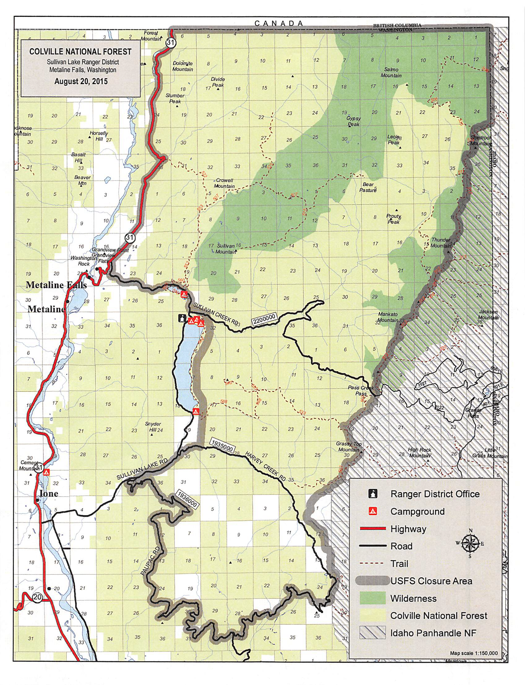
The closures are detailed on the forests "alerts and notices" webpage. For example, Sullivan Lake developed campgrounds remain open, but the roads, trails and area north, east and south of the popular lake are closed because of fire danger and firefighting activity.
Here's the official wording for the restricted areas where trails, roads and other travel are closed until further notice:
Colville National Forest land north of State Route 20, west of State Highway 21, South of the Canadian border and east of the Okanogan Forest Boundary is temporally closed to public access until further notice due to fire suppression activities and large fire activity. Forest Order 15-21-08
The temporary closure includes the Sullivan Lake Ranger District south of the U.S.-Canada border, west of the Idaho Panhandle National Forests boundary, north of Forest Service Road 1936 (Paupac Road) and north of Forest Service Road 1935 (Harvey Creek Road) and east of Forest Service Trail 504, Forest Service Road 2200-241 (Sullivan Creek Road) and Highway 31 north to the Canadian border. This closures does not affect Mill Pond, Sullivan Lake, Noisy Creek or Edgewater Campgrounds. Forest Order and Map 15-21-07
Swan Lake and southwestern Kettle Crest Closure
Colville National Forest land north of the Colville Indian Reservation, west of the Kettle Crest (district boundary), South of State Route 20 (Sherman Pass) and east of the Okanogan Forest Boundary is temporally closed to public access until further notice due to fire suppression activities and large fire activity. This includes, but is not limited to Swan Lake, Ferry Lake, Long Lake Campgrounds, Snow Peak Shelter and all trails, road and improvements within the closure area.
NOTE: State Route 20, 21 and Highway 395 are not affected by this closure. Any road closures will be reflected on the WADOT Website.
Colville National Forest land north of State Route 20 (Sherman Pass) to Canadian border, west of highway 395 and East of State Route 21(Curlew Highway) is temporarily closed until further due to fire suppression activities and large fire activity. Forest Order 15-21-05 PDF
NOTE: Highway 20, 21 and 395 are not affected by this closure. Any road closures will be reflected on the WADOT Website.
-
All methods of travel and use are prohibited on National Forest System Roads and Trails north of State Route 20 (Sherman Pass) to Canadian border, west of highway 395 and East of State Route 21(Curlew Highway).
Due to extreme fire behavior on the Tower Fire, a mandatory evacuation order has been issued for Browns Lake, North Skookum and South Skookum Campgrounds.
Closed along designated portions of National Forest area, East of the Forest Service Boundary along C 9445, north of C 4708 (Smackout Road), West of the BPA power lines and south of the Abercrombie Trail as shown on the attached map, on the Newport-Sullivan Lake Ranger District of the Colville National Forest. Forest Order 15-21-14 and Map PDF
Baldy Fire Closure - Forest Order
Starting Aug. 5, Pursuant to 36 CFR 261.58(b), 36 CFR 261.53(e), 36 CFR 261.54(b) and (e), 36 CFR261.55 (a) and (b) the following acts are prohibited on designated portions of National Forest area, East of the Forest Service Boundary along C 9445, north of C 4708 (Smackout Road), West of the BPA power lines and south of the Abercrombie Trail as shown on the attached map, on the Newport-Sullivan Lake Ranger District of the Colville National Forest.
