Video captures 2,600-mile hike of PCT in 4 minutes
TRAILS -- Andy Davidhazy hiked the 2,650-mile Pacific Crest Trail in 2013 and 2014 and snapped a selfie every mile to document the route.
He's compiled the images into a four-minute time-lapse video (below) that flies viewers ground-level from Mexico through Callifornia, Oregon and Washington to the trail's northern terminus near the U.S.-Canada border.
"The end of the trail is just the beginning of the story," says Davidhazy, who's producing a short film, Lost or Found: Life after 2600 miles on the Pacific Crest Trail, due for release this spring.
Here are more details about the time-lapse video (above) from Davidhazy:
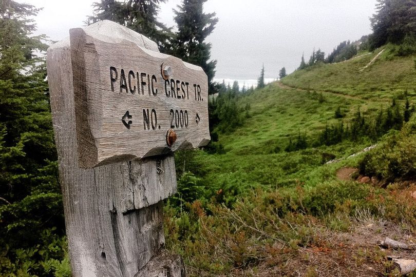
The Pacific Crest Trail travels 2660 miles through the mountains of California, Oregon and Washington, starting at the Mexico border fence near the small town of Campo, CA, and finishing just across the Canadian border in Manning Park, British Columbia. It took about 5 months to complete and I lost 50 pounds in process. Total elevation change was about 450,000 feet, with the high point being 13,200 feet at Forester Pass in the High Sierras. I documented the physical transformation of the environment and myself by taking a selfie on trail every single mile of the hike.
- Follow along with the trail and pictures in the video by viewing a map with mileage markers.
- The wonderful music in this video is the title track from Martin Sexton's album, IN THE JOURNEY.
The process of stopping to take a picture every mile had a big impact on my actual experience of doing the hike. I had to be well aware of where I was at all times, which was quite annoying in that it made it difficult to get in a zone and maintain good momentum. That said, I am happy to have done it, and it provided a good conversation starter with so many hikers that I would meet along the way. I love seeing so many wonderful faces popping up in pictures in unexpected places.
For the purposes of showing the Pacific Crest Trail in it's entirety, this video is actually a combination of two hikes. Mile 0 through 2424 was done in 2013, before an early snow storm dumped more than six feet of snow on the trail north of Snoqualmie Pass, WA making it impassable at the time. So I road walked the rest of the way to Canada along the Iron Horse Trail and Highway 97 north to Osoyoos, British Columbia. I went back in 2014 to hike the missed portion of the PCT from 2424 to the trail's Northern Terminus at mile 2660. The snow storm and road walk will feature in the upcoming short film, Lost or Found: Life after 2600 miles on the Pacific Crest Trail.
