Jon Snyder wants a bike path on Spokane’s railroad viaduct
A couple of weeks ago, I reported on the bevy of bike projects coming to Spokane this year, including a nearly nine-mile long north-south bikeway between the Nevada-Lidgerwood and East Central neighborhoods.
During my research, I spoke with Spokane City Councilman Jon Snyder about the year ahead. While he was enthusiastic, he said the city has a long way to go.
“Most of the easy things have been done. We need to start doing the hard stuff,” he said. “The city has to be bold.”
But what exactly did he mean by bold? I asked him what the biggest, greatest project in Spokane could be, and it didn’t take him long to answer.
“I’d love to see a bike-ped path on the viaduct downtown, from Maple Street to the University District,” he said. “I think there’s enough room up there to have a 12-foot path. I think it’s completely doable.”
Obviously, he’d thought about putting a path next to the trains before, but is it really possible?
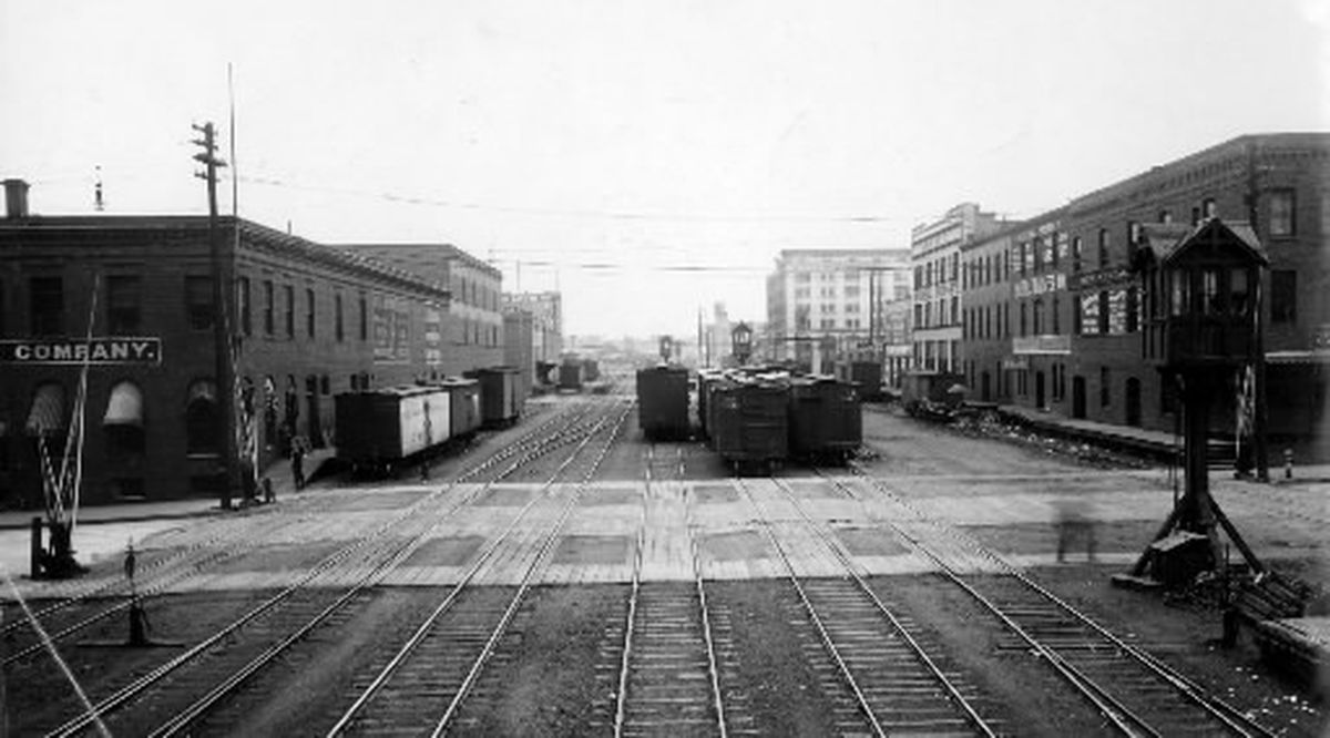
The railway viaduct near South Maple Street just so happens to be very near Frank’s Diner. At that point, two tracks share the space, and there appears to be graveled access roads on either side of the tracks. These roads offer the only plausible location for a path for people. The roads die at the bridge going over Maple, but heading east, the access roads remain and in fact grow wider (at first).

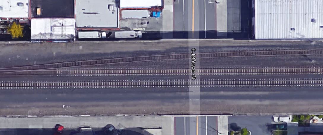
Near South Jefferson Street, a third rail spurs off the north tracks, and only one access road appears to remain on the viaduct. Jefferson just so happens to be my cycling route into downtown on my morning commute, but that has nothing to do with anything.
Above Madison and Monroe, the three rails get close enough to again have a second access road. Looking at Google Maps, and using my awesome power of guessing, it appears that the third, most northern, rail is used for parking maintenance vehicles.
Also, just east of Monroe, a mysterious fourth track appears, running flush with the buildings on the viaduct’s south side. This track ends up shifting north and joining with the existing tracks near Howard Street.
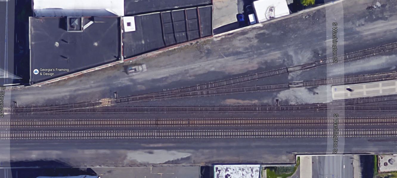
It’s near here, above Stevens and Washington streets, that the viaduct drastically widens. The explanation: the Intermodal Center and Amtrak.
It’s around here where Snyder’s idea seems especially difficult. The graveled roads shift, die out and reappear between tracks. But after a couple of blocks, all is well again, just in time for the University District.
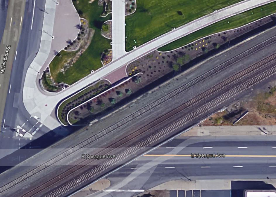
Snyder’s idea has one shot at existing on the north side of the viaduct. With a northerly placement, the path would zip by the Amtrak station, creating likely hazards for folks boarding a train (which only happens a few times a day, often between 2 and 3 a.m.). Total distance for Snyder's viaduct path: Less than 1.5 miles.
So what are the odds that Snyder’s plan has a chance?
Very little.
“We would not allow the public on the railroad property for obvious safety concerns,” said Gus Melonas, spokesman for BNSF, which owns the viaduct. “Sixty trains go daily through this corridor. That’s certainly not a good mix with the public.”
Melonas pointed out that the viaduct was originally built for a similar purpose.
“The reason it was designed was to keep the trains away from the public,” he said.
Snyder is unfazed.
“I think they need to start thinking about their public relations problems in Washington state,” he said, referring to recent discussions around oil and coal trains.