Storm nears coastal Carolina
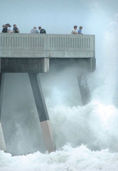

WRIGHTSVILLE BEACH, N.C. – Vulnerable islands were evacuated and mainland schools were closed Tuesday as Ophelia strengthened to a hurricane and wobbled closer to land with a threat of flooding rain.
The National Hurricane Center upgraded the storm’s status Tuesday evening, saying maximum sustained winds had reached 75 mph, with higher gusts. The center said further strengthening was possible.
A hurricane warning extended from the South Santee River in South Carolina north to Oregon Inlet at Pamlico Sound in North Carolina, meaning hurricane conditions were expected within 24 hours.
A hurricane watch and tropical storm warning were in effect from the Oregon Inlet north to the North Carolina-Virginia line and southward from the South Santee River to Edisto Beach in South Carolina.
After taunting coastal residents for days, the storm appeared ready to move ashore, as heavy rain battered South Carolina’s northern coast and the beaches of southeastern North Carolina.
In Carolina Beach, south of Wrightsville Beach, officials reported a foot of water on one road due to heavy wind and a high tide.
Unlike Hurricane Katrina’s devastating charge at the Gulf Coast, the week-old Ophelia had been following a meandering path, making predictions of its landfall difficult.
Its slow movement meant heavy rain could linger over land, possibly causing serious flooding. The hurricane center said up to 15 inches of rain was possible in eastern North Carolina.