From farms to salmon swamps in Svensen
ASTORIA, Ore. – The southern banks along Svensen Slough, a side channel of the Columbia River, have transformed over time from historic spruce swamp into fields diked off by European settlers for farming.
Clatsop County and three private property owners along Bear, Mary’s and Ferris creeks, all tributaries of the slough, have partnered with the Columbia River Estuary Study Taskforce and Bonneville Power Administration to bring more than 60 acres of the swamp back for salmon and wildlife habitat.
Nearly 80 percent of estuarine habitat along the Lower Columbia has been lost to development, said Jason Smith, a habitat restoration project manager with the task force. Salmon depend on the habitat as they move from fresh to salty water.
Aerial photos show portions of the land – diked and drained for agriculture by the 1930s and cut in half by U.S. Highway 30 by the 1970s – slowly returning to wetlands as levees broke down and breached. By the 1980s, most agriculture around the creeks had gone away, Smith said, leaving a crippled levee system too expensive to rebuild to modern-day standards.
“While we don’t want to be taking any serviceable (agricultural) land out of production, because there’s not a whole lot of it, this is no longer serviceable,” Smith said. “It kind of gives us a rare opportunity to bring back the other economic driver for our community, which is salmon.”
With funding from the BPA, the task force will hire contractors this summer to remove about 2,000 feet worth of levees and restore meandering tidal inlets. A Portland & Western Railroad spur, with trestle bridge crossings over the mouths of Bear, Mary’s and Ferris creeks, will not be affected by the project.
The former agricultural fields are mostly filled with reed canary grass, a largely invasive species used in pastures and for shore stabilization. The project will purposely alter the flattened fields with hilly hummocks meant to mimic the historic spruce swamps, promote diverse plant growth including wapato and cattails and phase out the canary grass. A diverse plant community will support bugs, rodents, birds and mammals. The improved nutrients from the wetlands will help provide food for salmon in the river’s main stem.
Much of the Pacific Northwest’s power is hydroelectric. Most of it is created at the BPA’s eight federal dams on the Columbia and lower Snake rivers. To offset their impact on 13 endangered species of salmon and steelhead, the agency funds approximately $500 million in restoration projects each year. BPA has paid for the restoration of nearly 4,000 acres of habitat in the Lower Columbia estuary, said spokeswoman Michelle Helms, and is providing $632,000 for the Bear, Mary’s and Ferris creeks project.
Voluntary flooding
Just as the task force depends on BPA to fund its projects, the group requires landowners willing to return their fields to the tides.
Scott Thompson, who owns Blackberry Bog Farm with his wife, Bonnie, along Bear Creek south of Highway 30 in Svensen, was one of the three private landowners to show interest in the project. Below the farm lies an L-shaped stretch of wetlands bounded by broken-down levees and the highway, which cuts off another small parcel of wetland he owns to the north.
“We bought this place three years ago, and it had been abandoned for 15 years,” Thompson said. “And we knew when we bought it that Bear Creek was a salmon stream.”
Thompson has taken part in other restoration along Bear Creek and hosts a screw trap to count juvenile salmon coming downstream.
“Part of what we wanted to do as a farm, we wanted to make sure we were good stewards of the land, including the creek, the wetlands and the like,” Thompson said. “We knew there were areas we weren’t going to be able to farm.”
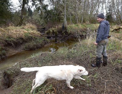
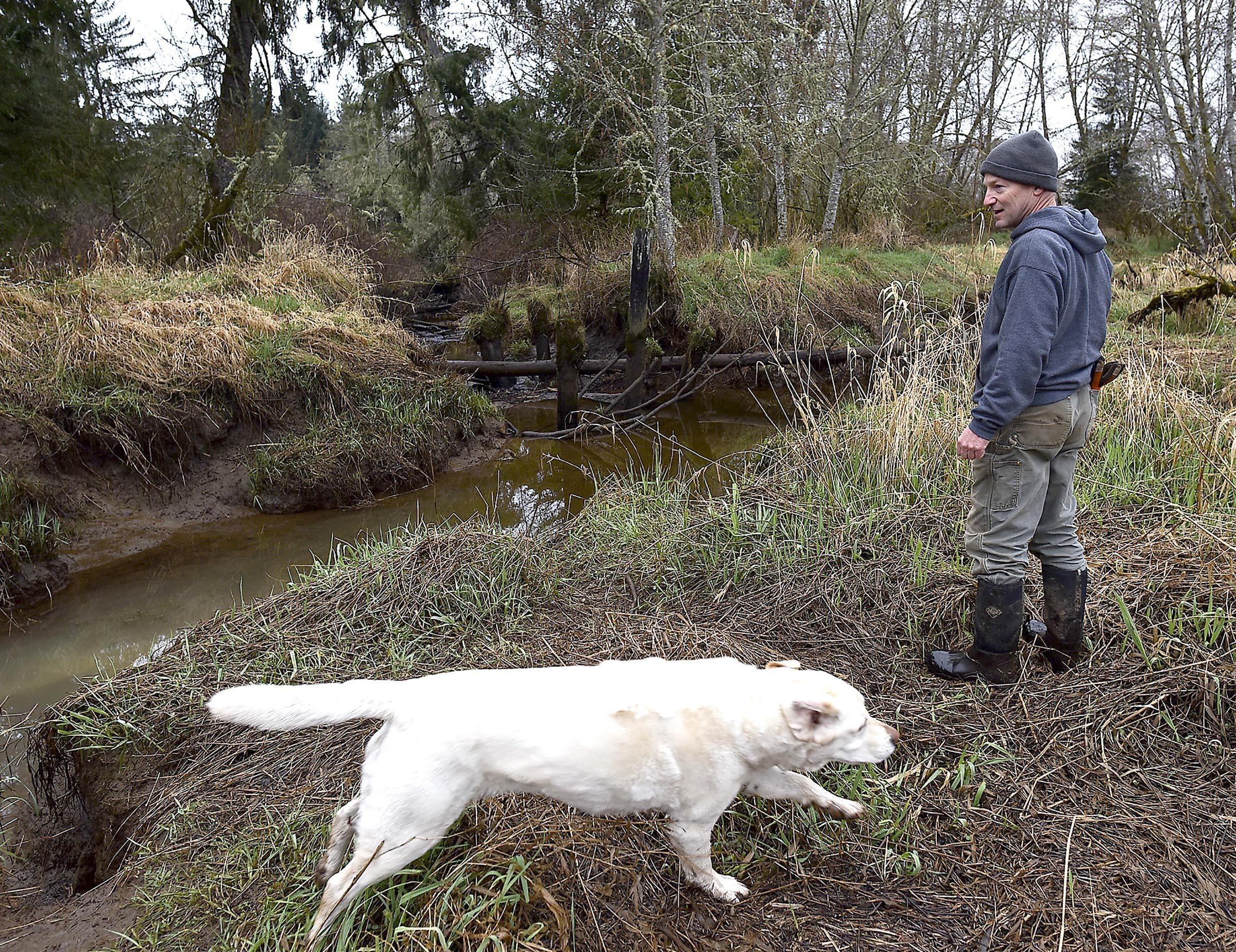
Tim Peitsch, a maintenance foreman at the Port of Astoria, bought his property along the upper reaches of Ferris Creek about five years ago and situated a house over a flood plain just below a bridge on Highway 30. With the task force paying to restore the flood plain and him retaining ownership afterward, there are no downsides to the project, Peitsch said.
“Part of the reason we bought the property and situated the house where we did is to be able to enjoy viewing the habitat,” he said.
Good projects
The project includes two large plots of land along Mary’s Creek, the farthest west of the three tributaries. The eastern bank is owned by Dean Budget and Sandra Gadwood. The western banks passed into Clatsop County ownership through tax foreclosure.
“This project is probably as good as any for stabilizing shoreline,” said Julia Decker, a county planner. “With all the changes going on in the world, anything we can do that keeps the flood plain intact, stabilizes shoreline, expands habitat, these are good projects.”