New Forest Service app puts more information at fingertips of Pacific Northwest adventurers
With Memorial Day weekend just days away, there is a new way to plan your three days of freedom: the Pacific Northwest Forests app.
Launched Monday, the app covers national forests in Washington and Oregon, giving users information about trails, campgrounds, permits, weather, fire, recreation activities, frequency of use and more.
Chris Bentley, a digital media specialist for the Forest Service, managed and oversaw the development of the app. Analytic analysis of the Forest Service website showed that most visitors were using their mobile phones, but the Forest Services website is not mobile friendly.
In many cases, Bentley said, users had to know exactly what they were looking for.
“We tried to organize the app in a logical way so that people would intuitively know where to go,” he said. “Basically, what we’re trying to do with the app is we’re trying to offer the most valuable info from our website in one place.”
Bentley hopes the app can help reduce congestion in the Northwests most famous and popular areas, such as the Enchantments. Driven by jaw-dropping photos on social media sites, this is known as the “Instagram Effect.”
“We’re hopeful that this will help spread out the crowds a little bit,” he said. “It will show people that there are lots of other areas.”
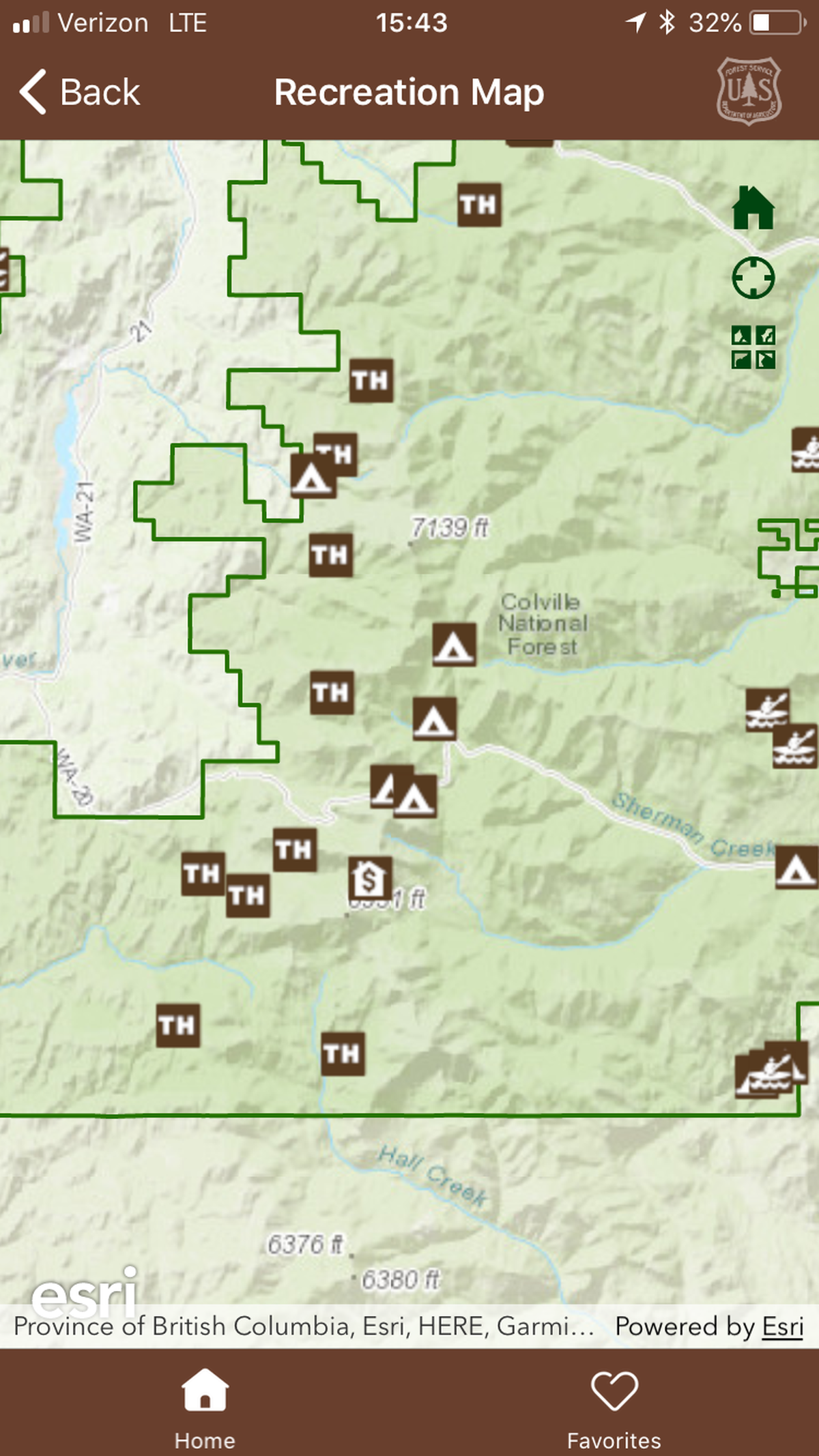
When you log in to the app, you’re presented with a map of the area in which you live. Nearby National Forests are listed. For the Spokane area, the nearest forest is the Colville National Forest. Once you click on the forest, an interface containing links to maps, things to do, fire warnings, photo galleries, passes, permits and more appears.
If you click on the map link, it gives you three options: recreation map, motor vehicle use maps and a link for ordering maps.
The recreation map shows all the forests campgrounds, trailheads and other amenities. Included is an evaluation of how busy the area is.
Bentley hopes this feature will allow recreationists to better plan their trips. Some may want to go to high-use areas. Others might realize there are nearby options that are quieter with less traffic.
“There are lot of recreation sites that don’t get a lot of use while there are some that get just hammered,” he said.
With outdoor recreation only increasing in popularity, a streamlined interface has become more important, Bentley said. As the Northwest population continues to grow, the demand and pressure put on natural areas will continue to increase.
“I think it’s clear that more and more people are interested in recreation,” Bentley said. “Across the board. The Northwest is also one of the fastest-growing areas, too.”
The app was designed and built in-house by Forest Service staff. It took six months of “intensive” work to build it, but the idea has been kicked around for years.
The app refreshes every 24 hours with up-to-date fire information, road closures, permitting consideration and more.
While there are many applications that provide similar data, Bentley said it was important that there be an “authoritative” option.
“This is the official Forest Service app,” he said.
The app is only available to iPhone users, but an Android version will be released within the next couple of months, Bentley said.