Housing development near Bigelow Gulch prompts flood worries among neighboring homeowners
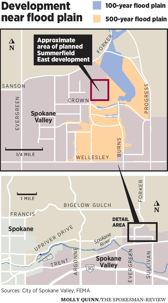
A developer’s plan to build more than 60 homes near a flood plain at Bigelow Gulch and Forker roads has some Spokane Valley residents concerned that it will increase flooding in their neighborhood.
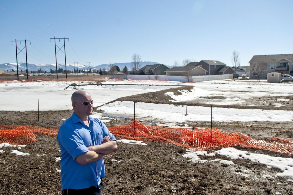
Resident David Klenda, who has been living on Crown Avenue near the Forker Draw flood plain for more than a decade, had floodwater in his backyard three times in five years.
Klenda said flooding was severe enough in 2012 that water flowed between homes and on the street. While there wasn’t damage to his home, several neighbors had to pump water out of their basements.
Although there hasn’t been flooding in the neighborhood for seven years, Klenda is concerned that recently approved changes to a Federal Emergency Management Agency flood plain map as part of developer Five Fifty LLC’s proposal to build more homes, along with Spokane County’s construction of the Bigelow Gulch-Forker Road interchange, could increase flooding in the area.
Klenda also raised concerns that environmental and flood studies were conducted for the potential development without taking the county’s road project into consideration.
“This development is based on past conditions, not current conditions,” Klenda said. “Everything should be revisited and restudied.”
Five Fifty LLC divided a portion of land south of Forker and Progress roads in 1979 to create the Summerfield East subdivision, which contains more than 200 homes.
The developer is now planning to build more than 60 additional homes north of Crown Avenue.
The developer submitted a flood plain map revision to FEMA in 2010, which was approved last year.
Spokane Valley indicates in a staff report “the applicant has undertaken considerable work and coordination with FEMA to revise the floodplain map by reducing the floodplain area and removing some lots out of the floodplain.”
Five Fifty LLC dug a 1,500-foot-long channel running southeast from the Forker Draw to capture floodwater, sending it to a pond with several dry wells before it reaches the neighborhood.
Deanna Horton, Spokane Valley floodplain manager, said if there’s excess water from the pond, it would travel west into the street system, flood into swales with dry wells and be absorbed into the ground.
“From a city standpoint, this has been reviewed by several engineers and we’re fairly certain the channel is going to hold the water,” she said. “We don’t expect any water to reach into the homes.”
Klenda is skeptical, saying excess water likely will flow right through the neighborhood.
Horton said the more-than-27-acre site owned by Five Fifty LLC has remained an open field for years.
“People have gone out there with big trucks, decimated properties and run channels towards those homes, directing water down to where it wouldn’t normally go,” she said.
The homes on the east end of Crown and Olympic avenues are in a moderate- to low-risk flood area with a 1-in-500 annual chance of flooding, according to FEMA maps.
Resident Trudy Rogers has lived in the neighborhood for more than 25 years and observed streams and pools of runoff water in the fields south of Forker Road.
“We were concerned as they built the housing behind us, because we knew they would get flooded. Which they have and are,” she said in an email.
“Do I think it is wise to build more homes, and have more families victimized by this decision that they will not know of until they, too, have flooding in their homes? No.”