October trip of the month: Liberty Lake Loop a gorgeous shoulder-season romp
It’s shoulder season.
That means Spokane-area hikers and outdoor enthusiasts are looking for something to do in that awkward, sometimes hard-to-fill gap between warm-weather hiking and cold-weather sporting.
The 8.5-mile Liberty Lake Loop trail offers an easy, close-to-home option.
It’s a popular trail, with a little bit of something for everyone. During warmer months, the Liberty Lake Regional Park parking lot can fill up quickly.
That wasn’t the case Saturday. Nneka Palmer and I shared the parking lot with two other vehicles. Although some guides recommend hiking the loop counterclockwise, we opted to go clockwise.
The first mile of the trail is flat and wide. Keep an eye out for an abandoned beaver complex. About a mile in, we passed the junction with signs pointing toward the Edith Hansen Trail to our right. We continued straight and started gaining elevation, following roughly the course of Liberty Creek.
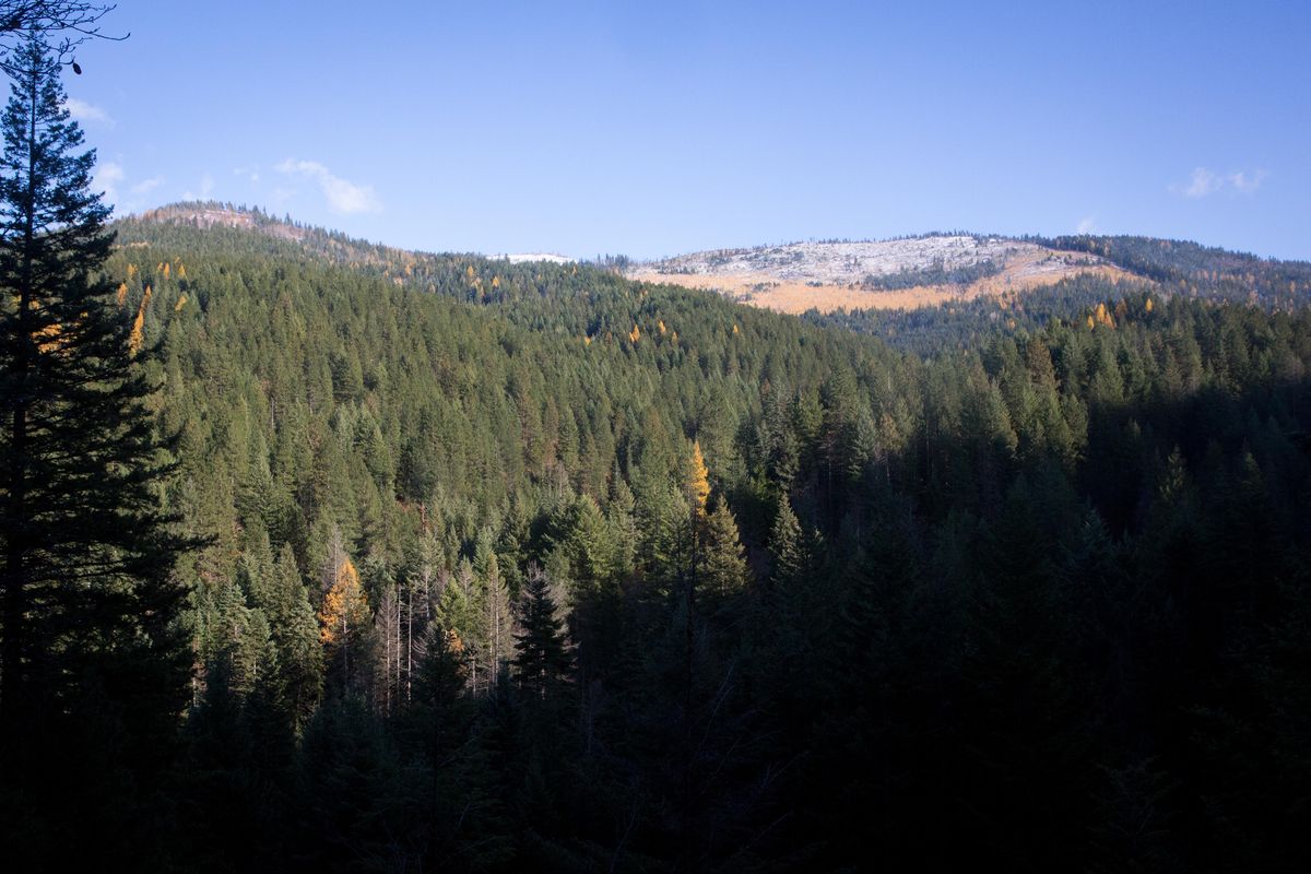
It’s an enchanting and varied hike through lush vegetation. About 2 miles in, we reached the cedar groves. The 87-acre grove was purchased by Spokane County in 1993 by the Conservation Futures Program, another testament to the program’s importance to local recreation. From there, we really started gaining elevation, the switch-backed trails reminding us we had legs.
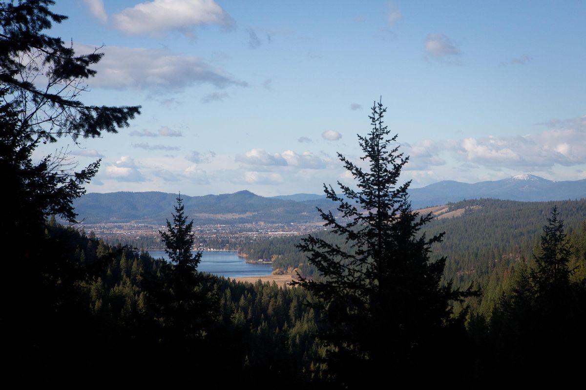
Keep an eye out for two nice views of Liberty Lake and Mount Spokane. The trail eventually took us by a charming waterfall, about 2.5 miles in. This would be an enjoyable out-and-back hike for those so inclined.
This steep uphill deposited us on the eastern flank of Mica Peak, which we followed for about a mile. Finally, at roughly the halfway point, we came to the apex of the hike. From here, it’s a short hike to Hughes Cabin. The cabin, first built in 1987 by Eagle Scouts, was restored in 2010.
Follow signs toward the Edith Hansen Trail, which heads steeply downhill from the Hughes Cabin junction.
The next 4 miles are all downhill, the only bummer on this hike. The Edith Hansen Trail is shared use, so keep an eye out for bikers and horse riders. It’s a wide, rather boring path, but there are some good views and plenty of big trees to enjoy.
Within a 100 yards of starting downhill, look for a split with signs pointing toward Mica Peak. It’s possible to hike to the peak from here, although we opted not to.
Car-to-car the hike took us 3 hours. We moved at a good pace, but still took time to enjoy the views. This is also a good hike for snowshoeing, although keep in mind some sections of the trail are steep and icy. It would also be a fun trail run, albeit steep in places.
In total, it was a rewarding shoulder season hike, one that’s close to home and accessible all year.