After third-warmest October start on record, old man autumn plots his revenge
Grab a fleece blanket and queue up an episode or 10 of the Great British Baking Show – summer is over.
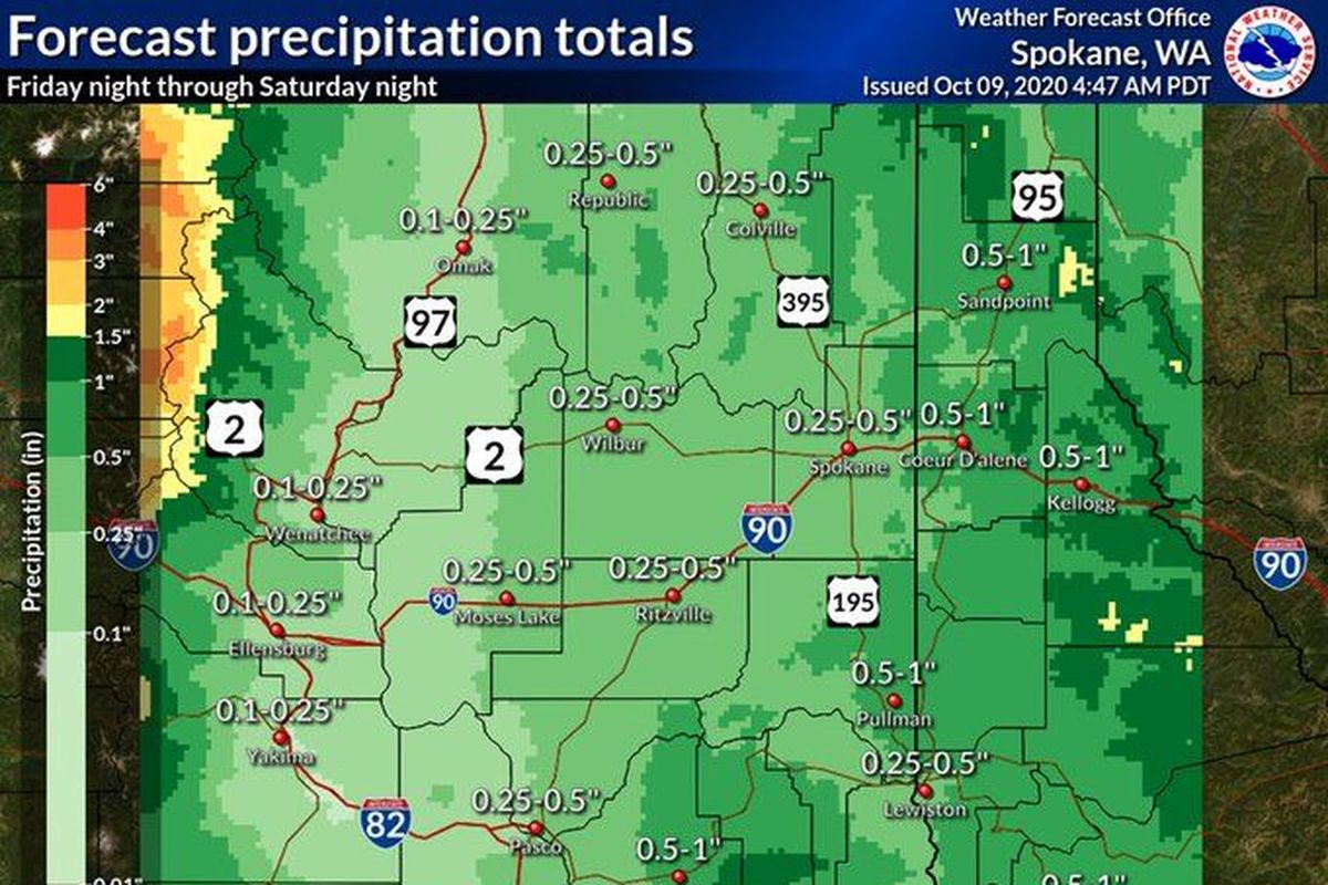
The recent stretch of abnormally warm and dry weather will come to an abrupt halt this weekend, when a new weather system is expected to bring up to a half-inch of rain to Spokane Friday night and into Saturday, according to the National Weather Service office in Spokane.
After topping out in the 70s on Friday, temperatures will struggle to reach 60 degrees on Saturday and through early next week.
The mid-month cool down follows near-record warmth in early October along with a long dry spell.
The 99-day stretch from July 1 to Thursday was the third driest on record, with only 0.4 inches of rain measured at Spokane International Airport. The last time Spokane experienced a comparable dry spell during those months was in 1917.
As of Friday, the average temperature has been at least eight degrees above normal every day so far this month, according to Jon Fox, a meteorologist with the National Weather Service in Spokane.
The 63.8 daily average temperature in October thus far is the warmest since 1943.
“Our days of seeing 70 degree temperatures are probably done with for a while,” Fox said.
Of course, it could be worse.
It was a year ago Friday that a surprise snowstorm in Spokane weighed down the branches of deciduous trees still gripped by green leaves, causing them to snap and litter the streets and yards of the South Hill.
The wintry weather caused more than 30,000 Avista customers to lose power and, during the pre-pandemic utopia in which children attended school in person, prompted Spokane Public Schools to call a snow day.
For most areas in Eastern Washington, this weekend’s precipitation will stay wet and unfrozen. Areas east and south of Spokane, including North Idaho and Pullman, could see up to an inch of rain starting Friday night.
Temperatures, meanwhile, will drop 10 to 15 degrees from Friday to Saturday highs, and gusts between 30 and 40 mph will make it feel even cooler.
Portions of Northeast Washington and the Idaho Panhandle could see thunderstorms on Saturday.
Travelers beware – light snow could fall in areas of the Cascades above 4,500 feet.