Remnants of Fred enter lower Gulf, expected to restrengthen
FORT LAUDERDALE, Fla. – Remnants of Fred entered the lower Gulf of Mexico late Saturday amid forecasts it would regain tropical cyclone strength Sunday as it moves toward the northern U.S. Gulf Coast.
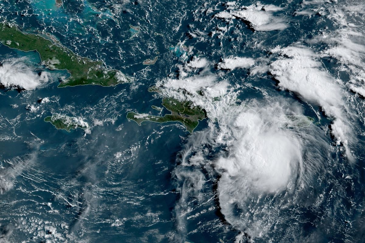
Elsewhere, Tropical Storm Grace, which formed Saturday morning in the Atlantic, was slightly weaker by nightfall and showing signs of poor organization as it kicked up sea squalls off the island of Guadeloupe. Grace was forecast to be nearer to South Florida by mid-week.
Forecasters said the disorganized remnants of former Tropical Storm Fred passed by the Florida Keys on Saturday and then moved into the southeast Gulf of Mexico later in the day.
At 5 p.m., Fred’s remnants were about 150 miles west-northwest of Havana and moving west-northwest at 13 mph. It had top sustained winds of 35 mph. It also was about 510 miles south-southeast of Mobile, Alabama.
Forecasters said they believed Fred would regenerate into a tropical storm on Sunday and urged people from Mississippi to the central Florida Panhandle to begin monitoring the storm’s progress.
Fred is expected to bring heavy rain to the Southeastern U.S. by Monday but is not projected to reach hurricane strength.
Already anticipating Fred, Florida Gov. Ron DeSantis had declared a state of emergency for the state’s Panhandle region. In Alabama, Gov. Kay Ivey issued a statement Saturday that her administration is monitoring the storm and “will be ready to act from the state level if needed.”
Meanwhile, a tropical storm warning in effect earlier for the Florida Keys was canceled Saturday as the storm began moving into the Gulf. All told, Fred was expected to bring 3 to 5 inches of rain to the Keys and southern Florida through Monday.
A tropical storm earlier in the week, Fred weakened to a depression by its spin over Haiti and the Dominican Republic, where it knocked out power to some 400,000 customers and caused flooding that forced officials to shut part of the country’s aqueduct system, interrupting water service for hundreds of thousands of people. Local officials reported hundreds of people were evacuated and some buildings were damaged.
On Saturday, Fred was downgraded to a tropical wave with top winds around 35 mph. Tropical waves can contain winds and heavy rain, but do not circulate around a center point or an “eye” that a tropical storm or hurricane has.
Both Grace and Fred, regardless of their storm status, posed a heavy rain and flood threat, forecasters said.
Grace was forecast to bring 3 to 6 inches of rain to the Leeward Islands, Virgin Islands and Puerto Rico into Monday.At 5 p.m. PDT, Grace was centered 15 miles north of Guadeloupe. It was moving west at about 23 mph with top sustained winds of 40 mph, down from 45 mph earlier in the day.
Grace prompted a tropical storm warning to be issued for the British Virgin Islands, the U.S. Virgin Islands and Puerto Rico, as well as a stretch of coast in the Dominican Republic.