Only one of four proposals for Washington’s congressional boundaries would significantly change Eastern Washington districts
OLYMPIA – Proposals to shift boundaries of Washington congressional districts mostly keep the status quo in Eastern Washington, but one would significantly change things.
Every 10 years, the State Redistricting Commission is tasked with redrawing the boundaries for the 49 legislative and 10 congressional districts in the state. Each of the four commissioners – two Democrats and two Republicans – released their proposed congressional district maps on Tuesday.
All proposed maps and descriptions from each commissioner can be found at redistricting.wa.gov.
The final maps must be submitted to the Legislature by 11:59 p.m. on Nov. 15 and will go into effect next year. The commission’s goal is to create 10 districts, as close to equal in population as possible. Based on the 2020 Census, the population goal for each district is 770,528 people, about 100,000 more than 10 years ago.
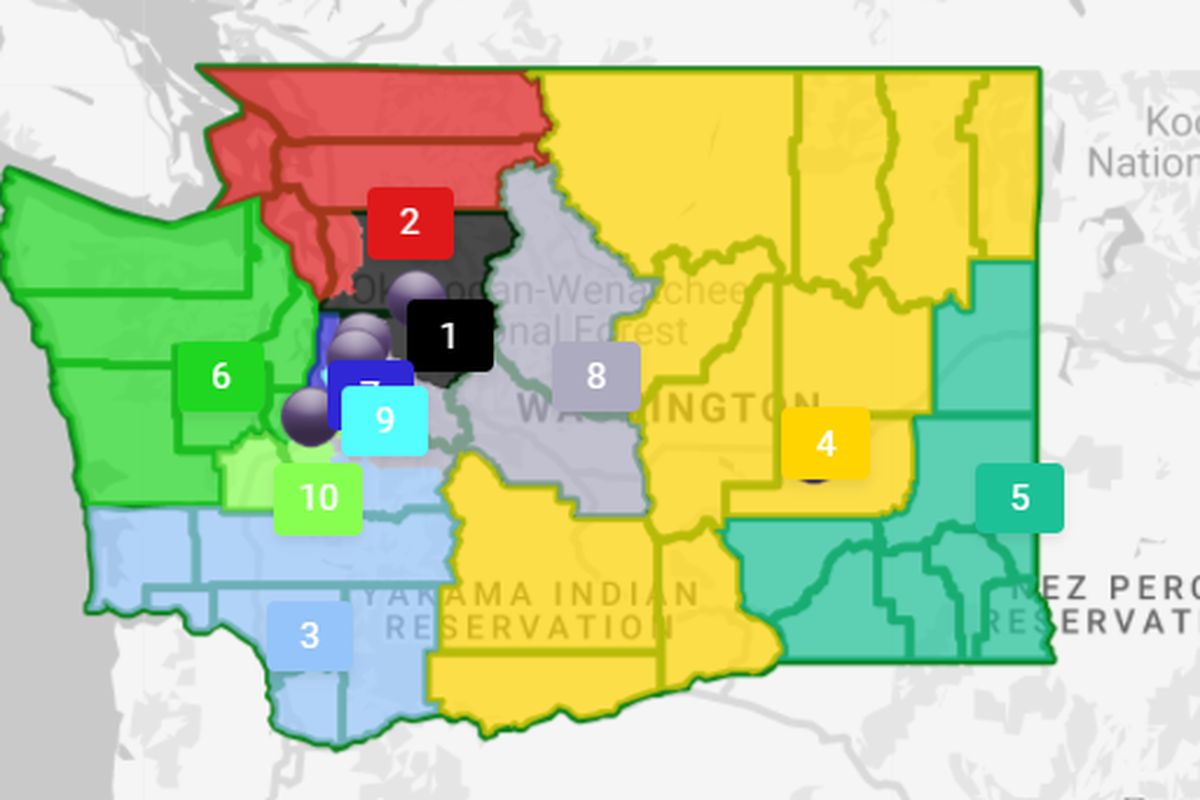
In most of the maps, the 4th and the 5th districts – currently represented by Republicans Rep. Dan Newhouse and Rep. Cathy McMorris Rodgers, respectively – look similar to what exists now.
5th District
In three of the four maps, the 5th District boundaries don’t change much. As the easternmost district, the current boundaries include Canada, Idaho and Oregon.
Republican commissioner Joe Fain, a former state senator, has proposed a map with a western boundary that adds Adams County into the 5th District and extends it to encompass all of Walla Walla County, which is currently split between two districts.
The other Republican commissioner, former Rep. Paul Graves, similarly adds Adams to the 5th District while also adding most of Franklin County, although he keeps Pasco in the 4th District.
Democratic commissioner April Sims keeps most of the western boundaries the same but, like her Republican colleagues, adds most of Adams County to the 5th District.
Unlike his Democratic counterpart, however, Brady Piñero Walkinshaw’s 5th District proposal is significantly different. Walkinshaw keeps Spokane County in the 5th District but uses its northern border as the northern border of the district.
He then uses the Columbia River as the western boundary, encompassing Franklin and Walla Walla in the 5th but leaving Adams and Lincoln in the 4th District. Walkinshaw’s proposal for the 5th District only keeps seven counties in the district as opposed to the current 10 counties.
Walkinshaw said the goal of his proposed maps is to reduce the number of counties that are split and to “draw more logical lines that reflect the reality of communities,” according to a statement. County governments maintain roads, provide services and are responsible for public safety, he said.
Although he takes out mainly Republican counties, by adding in Adams and Lincoln, he’s not likely to make the 5th a Democratic or swing district.
4th District
Because of his changes to the 5th District, Walkinshaw’s 4th District proposal has the most changes.
It would gain Ferry, Stevens, Pend Oreille and Lincoln counties while also adding Klickitat County as its southern border, something all four commissioners proposed.
Walkinshaw’s proposal would keep the Colville and Spokane reservations together in the 4th District, which would include 12 counties.
He said he tried to keep communities of interest together, such as keeping the Colville and Spokane reservations together. His map also keeps the Yakama reservation and tribal lands south to the Columbia River together in the 4th District.
“The congressional maps we are proposing today build upon the core values that we bring to the redistricting process: responsiveness to public input, prioritizing the needs of historically underrepresented groups and keeping communities together to give them the best footing for fair and effective representation at all levels,” Walkinshaw said in a statement.
The other commissioners mainly keep the 4th District boundaries the same, although they all add Klickitat County.
Both Republican commissioners’ proposals also add Skamania County to the 4th as its western-most county. Fain’s proposal keeps Franklin County in the 4th, while Graves’ proposal moves it to the 5th.
How to participate
The public has numerous ways to comment.
The commission will hold a public comment meeting virtually at 10 a.m. on Oct. 9 during which the public can share with the commission their thoughts on the congressional maps. To sign up, visit redistricting.wa.gov.
The public can also comment directly on the proposed maps, which can be found at redistricting.wa.gov/commissioner-proposed-maps.
Residents also can draw their own map for consideration, but it must be submitted by Oct. 22 for full consideration.