Weathercatch: Unusual, localized storms during May bring tornadoes, fierce cloudbursts
Those two tornadoes that touched down in the Spokane area last Friday evening? Yes, it was an unusual occurrence. Although Eastern Washington averages nearly one tornado a year, two don’t usually happen in the same general vicinity, 17 minutes apart.
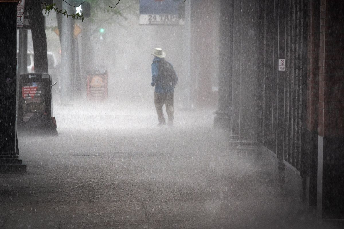
While it’s common to see a bump in turbulent storms during May, occasionally the Inland Northwest gets ones that aren’t run-of-the-mill springtime events. The parent storm system that fueled those back-to-back tornadoes less than a week ago is an example. Another is a brief yet furious downpour that sped across the Inland Northwest on May 16, 2019, flooding roads, sending pedestrians scurrying for cover and causing power outages.
Although the fast-moving storm that struck the Spokane area three years ago didn’t produce a tornado, it unleashed lightning, thunder, wind gusts and a fleeting, torrential rainfall – all during the evening commute.
Following several weeks of warm weather (unlike this May), an abrupt change occurred a little before 5 p.m., when a swift-moving mass of dark clouds caused a rapid plunge in solar radiation, compared to a more typical gradual decrease. In addition, wind gusts blowing from the northeast since late morning changed direction, approaching the region from the southwest instead.
By 5:10 p.m., rains pounded with ferocity amid lightning, thunder and wind gusts up to 35 mph. The temperature, which had held steady in the upper 60s that day, quickly dipped into the upper 50s – a drop of nearly 10 degrees in 15 minutes. Although rainfall totals varied in the localized storm, an inch of rain fell in some parts of Spokane. Other areas reported a half-inch or so. Considering that the average precipitation total is 1.12 inches for the entire month of May, it was a vigorous amount of rain to fall in less than a half-hour.
Not surprisingly, rush-hour traffic was slowed by standing water on busy roadways. Downtown, pedestrians shielded themselves from pelting rain with newspapers and plastic bags as cars navigated intersections submerged in several inches of water. The storm also caused about 2,000 customers to lose power.
A powerful cold front accompanied by a strong, unstable air mass was responsible for that volatile but brief blast of rain nearly three years ago.
This May, our prolonged span of wet, cool and windy weather is largely the product of a progressive weather pattern as multiple Pacific storms pass through the Pacific Northwest.
Not only has it been dreary and turbulent at times, but also downright chilly. Overnight lows this week have run in the low 30s, cold enough to produce areas of frost across parts of the Inland Northwest. Scattered snowflakes were reported on Mother’s Day, when the daytime high barely broke 50 degrees. The average daytime high for the date is 65 degrees.
Temperatures are running 5-10 degrees below normal this workweek, but some relief may arrive this weekend when the weather is expected to warm to 60 degrees on Saturday and the mid-60s on Sunday. What’s more, the sun may actually show itself for longer than two-hour intervals.
Bring it on.
Nic Loyd is a meteorologist in Washington state. Linda Weiford is a writer in Moscow, Idaho, who’s also a weather geek. Contact: ldweiford@gmail.com.