Avalanche advisory: snowpack has weak layers
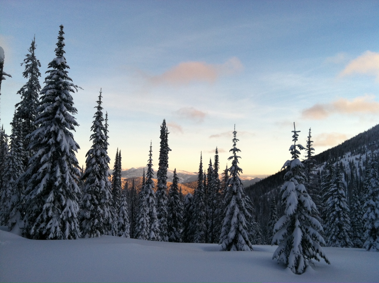
WINTER SPORTS — Storms helped the region’s mountains catch up on precipitation in the past two weeks — as you can see from powder piled deep in this Selkirk Mountains sunrise photo iPhoned to me this morning by backcountry skier Alison Boggs.
But the snowpack also developed some weak layers, avalanche experts say.
Technicians from the Idaho Panhandle Avalanche Center observed natural avalanches during their Thursday survey and documented some persistent weak layers.
“Falling snow won’t be a concern for a while, but the sun and rising temperatures could be,” said technician Kevin Davis. “Break out you’re spring travel tricks if it’s getting too warm or if we get inversions. Those crusts are becoming more of a concern as they continue to break down.”
Read on for the full advisory posted this morning, or click here to check out the center’s new website under construction.
AVALANCHE ADVISORY |
|
U.S. FOREST SERVICE |
FORECASTER: Davis |
|
IDAHO PANHANDLE AVALANCHE CENTER |
EFFECTIVE DATE: 02/03/2012 |
|
DATE ISSUED: 02/03/2012 0730 |
OUTLOOK: 02/04-05/2012 |
|
This report does not apply to local ski areas within the forecast region and the hazard rating will remain valid through midnight February 3 rd , 2012. Special thanks to Idaho Parks and recreation for sponsoring this Avalanche advisory. |
Thanks to everyone for sending in pit data this week. Some observations of natural slide activity from earlier in the week across the forecast region and from yesterday on a N aspect in the Selkirks. Check out our new site @ idahopanhandleavalanche.org. |
|
WEATHER |
|
TODAY: Sunny with temperatures in the mountains into the high 20s to the north and low 30s to the south. Light E winds.TONIGHT: Should be clear tonight, temperatures dropping to low 20s and steady E winds. SATURDAY: High pressure ridge seems to be parked over the Northwest giving us plenty of sunshine and warmer temperatures well into next week. For the outlook, sunny and warm days with cold and clear nights will create periods of unstable snow, especially above freezing temps on southerly aspects. The avalanche danger will increase if day time temperatures rise above freezing, especially on slopes in direct sun. |
|
|
Selkirks and Cabinet mountains:
We motored about the Cabinets yesterday and found ample powder on all aspects. Snowfall for the week from snotel was about 15 inches of new and in the Selkirks you’ll find from 5 to16 inches, southern Kirks a little deeper. We were in about 2 feet on a N aspect at 6200’ and found a weak layer of surface hoar about 1.5 feet deep that failed with moderate force. On an E aspect we found a moderate weak layer on graupel about 10 inches deep. S aspects are collapsing at the late December ice crust which is rotten. Report of a natural slide off Keokee above the Caribou Hut yesterday. Possibly running on surface hoar layer or a slight crust about 1.5 feet deep. Avalanche danger is rated
MODERATE
on aspects steeper than 35 degrees above 5,000 feet. Pockets of
Considerable
avalanche danger may exist especially with above freezing temperatures or direct solar radiation.
|
|
The next avalanche advisory will be issued February 10 th .Have a safe and pleasant weekend!!!! |
|
|
Contact: Kevin Davis (208) 265-6686, Ed Odegaard (208) 245-6209, or John Olson (208) 265-6635 This message is available by calling (208) 765-7323 or toll-free at 1-866-489-8664. E-mail address: kevingdavis@fs.fed.us , eodegaard@fs.fed.us , jrolson@fs.fed.us , ebmorgan@fs.fed.us |
 St. Regis Basin and Silver valley:
At Silver Mountain, patrol was getting some easy shears about 1 foot deep in the new snow. In the Basin Carole was finding consistent shears with moderate force on a weak layer over a crust at 2.5 feet deep. 1.5 feet of new snow was firmer at the bottom and seemed to be bonded well. They also noted signs of strong wind-loading. On Moon Pass Ed got hard but clean shears on a crust just over 2 feet deep. All pit observations are confirming that the numerous crusts we have in the pack are decomposing and getting weaker. The forecast weather will break these crusts down further. Avalanche danger is rated
MODERATE
on aspects steeper than 35 degrees above 5,000 feet. Pockets of
Considerable
avalanche danger may exist especially with above freezing temperatures or direct solar radiation.
St. Regis Basin and Silver valley:
At Silver Mountain, patrol was getting some easy shears about 1 foot deep in the new snow. In the Basin Carole was finding consistent shears with moderate force on a weak layer over a crust at 2.5 feet deep. 1.5 feet of new snow was firmer at the bottom and seemed to be bonded well. They also noted signs of strong wind-loading. On Moon Pass Ed got hard but clean shears on a crust just over 2 feet deep. All pit observations are confirming that the numerous crusts we have in the pack are decomposing and getting weaker. The forecast weather will break these crusts down further. Avalanche danger is rated
MODERATE
on aspects steeper than 35 degrees above 5,000 feet. Pockets of
Considerable
avalanche danger may exist especially with above freezing temperatures or direct solar radiation.
* This story was originally published as a post from the blog "Outdoors Blog." Read all stories from this blog