Tracking Kootenai Fatalities 2001-09
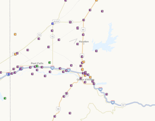
KXLY’s Nicole Hensley provides this map re: location of Kootenai County road fatalities from 2001 to 2009 from ITO World Ltd, using data from the National Highway Traffic Safety Administration and the U.S. Transportation Department. Not surprisingly H95 & I-90 appear to easily lead the stretches of roadway with the most fatalities. You can get a closer look at the number and place of fatalities, as well as type (vehicle, pedestrian, motorcycle, bicycle, etc.) here.
* This story was originally published as a post from the blog "Huckleberries Online." Read all stories from this blog