Spokane Valley travels rocky road to success

‘Pepper” Dave Kinyon looked over his first plot of Spokane Valley farmland and saw the fertile promise by which the old-timers swore. His brother Roger saw a field of rocks.
“We’re from Genesee (Idaho). We’d never seen anything like this before,” Dave Kinyon recalled. “My brother Roger said, ‘You’d better do something with this soil.’ He thought I was crazy.
“It’s a different kind of ground, but it’s damn good ground.”
Pepper Dave sings the praises of the soil – if you can call it “soil,” as most Spokane Valley residents do. In truth, Spokane Valley soil is more stone than loam. It is so rock-ridden that one Valley city found itself with a cash savings three years ago when road contractors announced they wouldn’t need gravel after all – they would just use the dirt on site instead.
The farm theory is that the rocks store heat and keep plant roots toasty through the night, no matter how cool the evening breeze. The legend also says that root rot is not a problem because water drains better in the rocky ground. Run a hose all night on a Spokane Valley garden and a puddle hardly forms.
“There are so many rocks, the farmers would have to dispose of the bigger ones before they could farm successfully,” said Florence Boutwell, publisher of three books on Spokane Valley history.
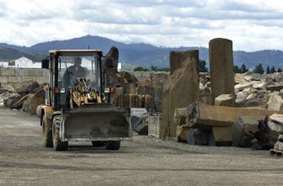
The rocks pulled out – at least the ones resembling mammoth Idaho baking spuds – were used in house, fence and well construction. Spokane people moving east into the Valley referred to the move as “going out to the gravel,” Boutwell said.
The depth of the matter may best be understood near the palm of a calloused industrial neighborhood north of Auto Row. There, where Broadway Avenue bisects Interstate 90 like fate crosses the head line in palmistry, lies a watery hole deep enough to swallow an 11-story building. Central Pre-Mix Concrete Co. and its predecessors have mined rocks there for more than 20 years, first by truck and hydraulic shovel but more recently by dredge.
Mounted to a floating platform, a giant straw protrudes 110 feet downward, sipping rocks from the bottom of the pit. On the surface, the oddly turquoise water covers 44 acres, but below, the water continues through the earth for miles. This is the Spokane Valley-Rathdrum Prairie Aquifer, exposed at the nerve like an overbrushed bicuspid.
When the last rock trundles up the straw, the man-made lake will be fenced off and left to wildlife. A sizable flock of geese already lives there. State law prohibits the aquifer from being exposed to human contact for, say, boating, once the mining equipment has left for good. The body of water, easily visible on satellite maps, also is off-limits to fish.
There’s a question here – and it’s not whether the pit has an ending; the digging stops in 2010 by permit. Rather, the question is whether Spokane Valley has an identifiable beginning, a place older than stone, where the rocks give way to loam or even basalt.
The answer has not been found by Central Pre-Mix, which dispatches truckloads of rocks from the pit daily. Environmental engineer Jana McDonald, who monitors the pit’s health for Central Pre-Mix, said the company has not hit soil, just bands of rock. She has more definitions for the different types of rock in those bands than a weatherman has for rain.
“There are coarse, sandy layers and pea-gravel layers. We prefer the well-rounded rocks. We pull big rocks out, rocks the size of Volkswagens,” McDonald said. “It’s all part of the great flood.”
The flood is the chapter of natural history that most Valley residents know something about. Schoolchildren who can’t explain their own genealogy beyond two generations can tell you that the Spokane Valley rocks were purged onto the landscape 11,500 to 17,000 years ago by a massive lake, Glacial Lake Missoula, that overcame its ice dam at least every 70 years or so for roughly 2,800 years.
Scholars, such as geologist John Buchanan, will tell you that Lake Missoula, 2,000 feet deep and 200 miles long, filled until its own water level forced its icy gate to float upward, allowing an inconceivable amount of boulder-ridden water to flush underneath it. Whenever the ice relented, water in the lake, named after the modern-day Montana city at its epicenter, was purged at a rate 10 times greater than the combined flow of all the rivers on Earth today.
The floods left their mark all the way to Oregon’s Willamette Valley, but in Spokane Valley, the floods left a heart of stone.