Spokane sets heat record for consecutive days with temperatures in 90s
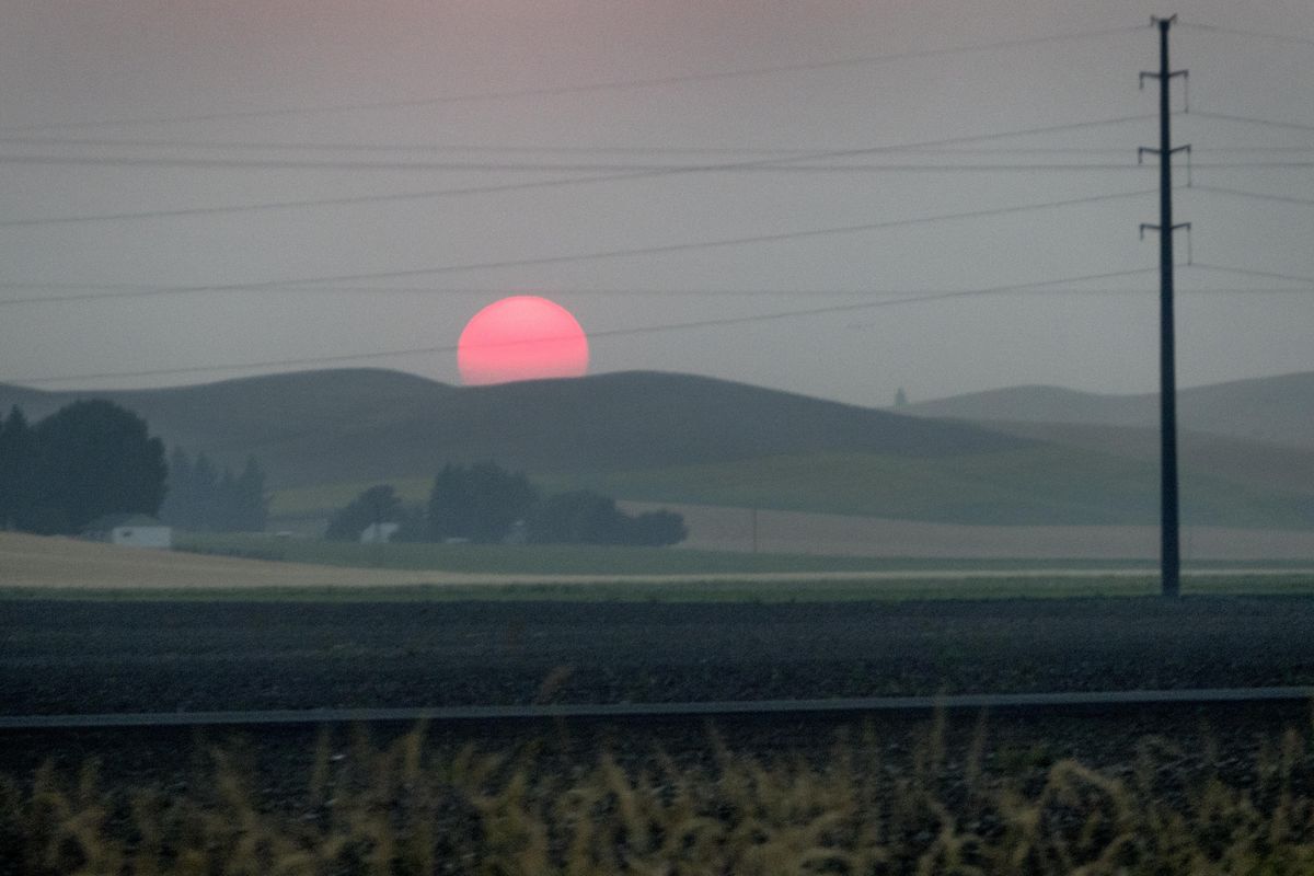
Fire smoke in the skies have given our region spectacular red sunsets, but also unhealthy air. This sunset was over the Palouse Wednesday, Aug. 3, 2017. Jesse Tinsley/THE SPOKESMAN-REVIEW (Jesse Tinsley / The Spokesman-Review)Buy a print of this photo
As Spokane set a record for a string of days in the 90s on Friday, forecasters were looking ahead to late Saturday and Sunday when temperatures will break and winds will clear the region of smoke.
But the change will bring an increase in fire danger this weekend.
Friday was the 15th day in a row when the high temperature reached the 90s. It was 92 at 2 p.m. and growing warmer.
The previous record was in 1894 at 14 days.
The city could see one more day in the 90s before an approaching low pressure area from the Gulf of Alaska pushes into the region.
An air quality alert, which has been in effect since the start of August, expires at noon Saturday ahead of a cold front expected later in the day.
The front brings a threat of more thunderstorms mainly in the mountains.
National Weather Service forecasters said afternoon highs will drop from the mid 90s on Saturday to the lower to mid 80s Sunday through Tuesday.
Winds will be out of the southwest 10 to 20 mph with gusts 25 to 30 mph Sunday and Sunday evening through the Cascade gaps, the Basin and the Palouse, according to the weather service.
Forecasters went on to say that the wind will shift to the southwest and cut off the heavy smoke out of British Columbia where more than two dozen fires were burning this week.
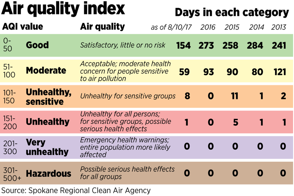
Air pollution in Spokane rose into the category of unhealthy for all after dropping into the category of unhealthy for sensitive groups on Tuesday and Wednesday.
The pollution measured 158 on the air quality index on Friday morning, which is below the peak for the year of 174 on Aug. 4.
From wet spring to wildfire conditions
The heavy precipitation from winter through spring set the stage for trouble. In wildlands, it triggered dormant seeds to sprout and grow new plants among perennial grasses, adding fine fuels to spark fires, officials said.
Conditions began to dry out in June and got downright arid in July when the humidity dropped into the teens.
The last rain fell in Spokane 44 days ago. That’s still far short of the 73-day dry spell of 1917.
During this time, the region enjoyed bright blue skies on many days. It was classic Inland Northwest summer.
But a weak weather disturbance July 15 sparked a conflagration from lightning in British Columbia.
In Washington, the Noisy Creek fire at Sullivan Lake was also started by lightning and is also still burning.
With the arrival of August came the smoke. The beautiful summer weather went away.
A huge area of high pressure and hot air bubbled up from the south and turned steering winds out of the north to northwest, bringing smoke southward and pressing the smoke toward the ground.
Adding to that was the smoke from fires in northern Washington, central Idaho and western Montana.
Spokane has seen 26 days in the 90s, well above the average of 19 for an entire season.
August is now 7.5 degrees above the average temperature for the first 10 days of the month.
Looking ahead, the Climate Prediction Center is calling for temperatures a little above normal with precipitation near normal from September through November.
Winter looks to be warmer than normal with normal precipitation, the center said in its outlook charts.