
Enchanted hike
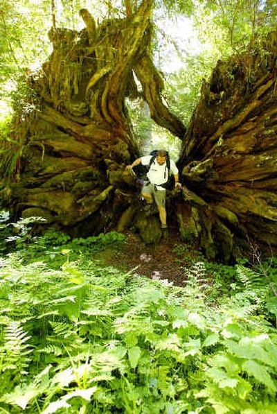
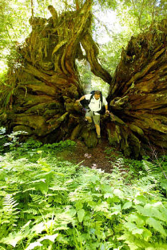
The black spot at the base of the mossy old bigleaf maple turned its head and looked as our party of five made its way down the trail through the meadow.
Fifty yards off, its fur was shiny black, as vivid as the greens of the grass, wood sorrel and vanilla leaf plants that carpeted the lush meadowy rain forest.
“Is it a cub?” Jean asked. “It’s a cub.”
“It isn’t a cub,” said Terry.
“Maybe a yearling,” Bryn said.
The bear looked at us, then up into the tree, then at us, then back up the tree.
“Its mama could be around,” I said.
We moved on, hoping for a better look as the trail turned closer. In a flash, the bear hopped up the trunk of the maple, in two graceful bounds into the leafy canopy.
It was a fascinating moment, nothing extraordinary, but the kind you come to expect in this niche of Olympic National Park called Enchanted Valley.
You expect to see things on the 13-mile trail along the East Fork Quinault River, like a herd of huge Roosevelt elk cooling off on a snowfield in the sun, or beautiful harlequin ducks feeding in a riffle.
It is one of the classic hikes of the Olympics, in one of the wildest valleys, along one of the wildest rivers in the Pacific Northwest. This is a temperate rain forest, where precipitation can be measured by the bucket, and the forests and meadows are unbelievably verdant. Western red cedar, hemlock, Douglas fir, silver fir and spruce grow eight or more feet thick at the base and tower 200 or more feet into wet mists.
Enchanted Valley, 13 miles in, is a series of meadows wedged at 2,000 feet between the 6,000-foot-plus peaks of the Burke Range on the northwest and a slightly smaller range on the southeast. It has been called the “valley of 1,000 waterfalls” thanks to waterfalls showering down the 3,000-foot cliffs of the Burke Range in spring. While that is a bit of an exaggeration, the place is no less beautiful.
“It’s just kind of like a religious experience,” said Jean James of Montesano, a member of the Grays Harbor Olympians hiking club who first visited the valley when she was 14. “Every time I’ve come in, I’ve seen deer and elk and bear. It’s such a beautiful hike.”
It also can be a difficult hike, because the place is so turbulent.
The East Fork Quinault repeatedly has washed out the gravel Graves Creek Road that leads to the trailhead; it currently is in good shape after rerouting last fall. Heavy snow during the winter of 1998-99 knocked out a scenic swinging footbridge over the East Fork just before the trail reaches Enchanted Valley. Until last October, that required a sometimes dicey fording of the East Fork, which claimed a woman’s life in 2001.
But last fall’s rains — torrential even by Quinault standards, at 20 inches in five days — sent the river and its tributaries on a frenzied tear through the valley. Rampaging flows knocked out footbridges across Graves, Fire and Pyrites creeks, uprooted old-growth trees, sent slides across the trail and shouldered a channel of the East Fork threateningly near the historic Enchanted Valley Chalet.
The floods did, however, leave a network of trees across the braided channels of the East Fork, upstream from the old swinging bridge site. These are limbed and marked by rangers, and can now be used to cross.
So the trail — an already rugged, often muddy, up-and-down path despite gaining only 1,300 feet of elevation in the 13 miles to Enchanted Valley — is now only a little more difficult than before last October’s storms.
By next year it may well be in its best shape in years. A crew is working to restore damaged stretches and footbridges.
We set out on a sunny afternoon, the trail lined by delicate vine maple and alternating patches of sword and maidenhair ferns, and made good progress despite circuitous detours here and there around parts of the trail swallowed by the river. We camped on a gravel bar along the river — littered with elk tracks — about a mile past O’Neill Creek, seven miles in. While we prepared dinner, a pair of harlequin ducks swooped upstream and landed along the river. The male of this species is stunning, with white bars offsetting a blue-gray and rufous-colored body. They waded into shallow riffles to feed, at times the flow cascading over their backs.
Next morning we packed camp three more miles up-valley to chattering Pyrites Creek, a designated camping area complete with “bear wires” equipped with pulleys for hanging food away from the bruins. After setting up camp, we hung most of our food, packed a lunch and hiked the three miles to Enchanted Valley.
Here the forest eases and mountain views open up.
Dozens of waterfalls paint fluttering white ribbons down the cliffs of the Burke Range, which separates the north and east forks of the Quinault and cradles some of the park’s most remote, little-visited high country. The North Fork Quinault Trail to Low Divide is another superb rain forest hike; a classic cross-park hike is to go from there out the Elwha River Trail.
As we negotiated downed trees over the channels of the East Fork, a doe wandered across the river. As we broke out into the meadows across the river, we could see glaciers atop 7,033-foot Mount Anderson at the head of the valley. Anderson Pass separates the Quinault and Dosewallips drainages, the latter flowing east to Hood Canal — another premier cross-park hike.
Soon the trail approached the old chalet.
“Oh my God, I can’t believe how far the river has come,” said Terry James, pointing toward the channel now 10 or 15 feet from the chalet. “That all used to be meadow. The river was 200 feet away when I was here two years ago.”
The chalet was built in 1930 of native silver fir logs as a private enterprise. After the park was created and took over the chalet, for many years hikers were allowed to stay there, until things got out of hand in the 1970s.
Now it is used as seasonal rangers’ quarters, with a corner of it walled off for emergency use by hikers. But when we arrived, the place was locked and shuttered tight. We lunched at the edge of the river, then waded to the base of a waterfall that splattered the valley floor next to a snowfield with dark snow caves dripping showers.
On the way, Terry James spotted a herd of elk cooling off on another snowfield about 300 yards off. The Jameses credit the Park Service for changing its policies on bear management and for educating hikers on minimizing impacts on the wilderness. Bears in the valley were a much bigger problem in the 1960s, when garbage was dumped in pits not far from the chalet.
“The bears used to be really aggressive,” said Jean James. “They would literally run hikers into the river. Since the park got rid of the pits and educated hikers, the bears are not a bother.”
The park now requires that hikers either use the wires equipped at many campsites, keep their food in bear-proof canisters, or hang it in a tree at night. Usually those methods work well.
It’s important to keep a clean camp and set up your cooking area well away from your tent.
Litter was scarce. I found one candy bar wrapper and, curiously, a $5 bill on a gravel bar. Terry James found a 10 euro coin on the ground.
“We get folks from all over the world,” said Quinault subdistrict ranger George Leite. “The name and the descriptions in the guidebooks — like it’s a mystical experience, and it really is like that when you’re up there — draw newcomers from around the country.”