Rising water level swamping Boundary County farms
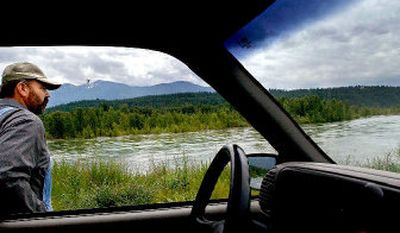
Bonners Ferry farmer Bill Michalk has a brand new pond on his property. It is tucked neatly into a dip in his field full of high-value wheat – a crop losing value every second that high waters flow from Libby Dam in Montana through the Kootenai Valley.
Waterfowl float gently on his new pond, but it’s a sight Michalk can’t really appreciate.
“A guy shouldn’t have to see geese swimming across his field,” he said with a smile.
Since Friday, when high waters began plaguing this North Idaho valley, local and federal officials have been trying to understand why the flooding is happening on a river that has flood control – and what can be done to curb damages. It would seem that water from the river should not seep through levees and into farmers’ fields when the snowmelt is slightly below the annual average, Michalk said.
He and other farmers in this Boundary County town believe they know why: fish and faulty weather forecasting.
The longer answer involves years of studies, politics and public comments that have led to more water remaining in Lake Koocanusa, the Montana reservoir behind Libby Dam.
The dam began operations in the early ‘70s to generate power and prevent flooding downstream. Before that, Bonners Ferry was hit by floods at least once a decade, Michalk said. After the dam went in, flooding was rare until heavy snowfall in 1996 and ‘97 led to spring floods.
Then the Endangered Species Act came into play.
Salmon, bull trout and white sturgeon all have been severely depleted because of dams around the West, according to studies by the U.S. Fish and Wildlife Service and the National Oceanic and Atmospheric Administration. White sturgeon runs have been significantly depleted because of Libby Dam, federal studies indicate. But the dam also affects the flows of the Columbia River, which means salmon have been hurt, too.
The government’s latest environmental impact study on water flow from the dam states that sturgeon number about 500, down from 5,000 to 6,000 in the 1980s. The sturgeon was listed as endangered in 1994, and federal law prompted new policies at certain dams to improve spawning environments.
The flows provide the necessary velocity, depth and temperature for more pristine spawning conditions, according to the study. But because more water must come out of the dam during certain times of the year, it has the potential to leave Lake Koocanusa too low.
In 2003, the Army Corps of Engineers adopted a temporary practice of variable discharges at Libby Dam. The agency keeps more water in the reservoir year-round so the increased flows for fish do not deplete the reservoir.
But it’s a policy with the potential for disaster, some Bonners Ferry residents say. An unexpectedly large spring runoff could swamp an already full reservoir, forcing the corps to release even more water and raising the level of the Kootenai River.
While the flood mark is 1,764 feet above sea level in the valley, farmers actually begin to feel the effects at about 1,755 feet. At that level, groundwater begins to surface, causing crops to drown and turn yellow.
“You walk down in that yellow stuff,” Michalk said, “you will sink right down to your knees.”
The devastation to his land is readily apparent at the banks of his 1,200-acre farm. Where once 2,000 feet of riverbank was armored by hundreds of thousands of dollars worth of large rocks known as riprap he paid for there is now only sheared dirt walls. The river took the rest downstream toward Canada.
“We’re providing premium topsoil to Canada,” Michalk said. “You’ve got to keep a sense of humor about this.”
But a sense of humor won’t help pay the bills. As of now, crop damage to the more than 30,000 acres in the valley is estimated by the corps at about $2.5 million. That figure could be low, compared with past losses.
During the floods of 1997, about 14,000 acres were damaged for a total loss of more than $6.2 million. The water level at that time was even lower than now. Michalk said he has only about 40 percent of his crops covered by insurance. If he spent any more, he wouldn’t profit from his farm, he said.
But the corps does not believe that its water flow policy is completely to blame. They also point to the inability of forecasters to accurately predict the weather.”I wouldn’t just blame it on the policy,” said Tom Buckley, a U.S. Fish and Wildlife spokesman in Spokane. “It does give them the flexibility to pull the plug on it when they need to make room for more water.”
The problem, he said, is that forecasters underestimated the unseasonably warm temperatures in May that caused massive runoff.
Corps Col. John Leighow, commander of the Seattle division, said the situation up north is “pretty close to worst-case scenario.”
“My understanding is that the weather … that hit us was unexpected,” Leighow said during a briefing in Bonners Ferry on Tuesday. “I don’t want to say it was too late.”
As far as Michalk is concerned, too late has been since 1990, when he began arguing with the federal government about flows from the dam.
Even in his public comments to the agency this past January, Michalk decried past studies from 1999 to the present. He pointed out that computer modeling to predict flooding did not take into account “worst-case inaccurate water supply forecast,” and the corps did not ask for outside, independent review of its study.
Michalk said he predicted exactly what is happening now.
Leighow said his agency would review the variable flow policy. “This was our first real test.”
“Well, it’s failing miserably,” said Bob Olson, a farmer and president of the Kootenai Valley Reclamation Association.
The corps is working long days in Bonners Ferry to battle the waters that are forecasted to rise slightly above flood stage early this Friday. Dikes may collapse, and drains at the Kootenai River Inn and Casino, which sits next to the river, may begin bubbling with backed-up water.
For several weeks, workers have been bolstering the dikes with rocks. About 50,000 sandbags have been deployed to the area in case of massive flooding.
Bonners Ferry Mayor Darrell Kerby said the corps is focusing on downtown. Dikes in rural areas are not being reinforced right now, Kerby said.
“How do we get out there and fix those dikes before the floods hit?” he said. “We don’t.”
Kerby said there’s not much the city can do but hope the impact is less significant than what everyone fears. The next step, he said, will be to assess why this happened and get rid of the variable discharge policy.
“Because of (that policy), the safety of the dam has been greatly lowered. The percentage that there will be flooding in Bonners Ferry has increased,” the mayor said. “And any chance of flooding my community – that’s unacceptable, period.”