Freezing fog causing widespread power outages
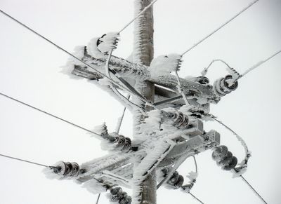
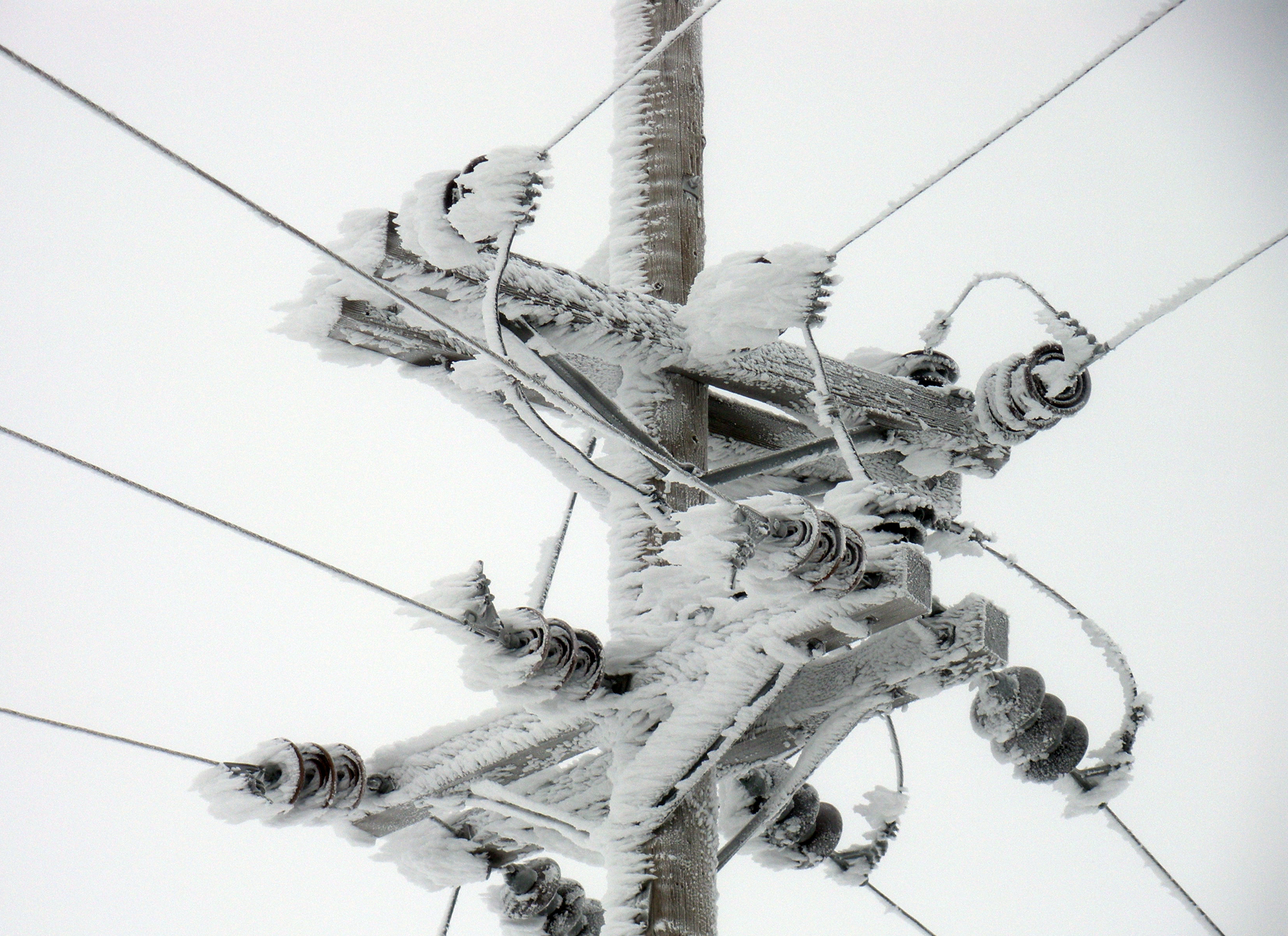
Dense fog freezing to power lines continued to cause widespread outages in northern Lincoln County on Tuesday while weather forecasters said the fog should disappear by Thursday, to be replaced by a chance of snow and renewed cold over the weekend.
Nearly 2,200 customers of Avista Utilities and Inland Power and Light Co. were without power for part of the day on Tuesday. Avista reported that it shut down a major transmission line to remove ice that was weighing on the lines. Power to about 1,600 customers was restored shortly before 3 p.m.
Problems with ice on power lines in Lincoln County started last week, several days after the National Weather Service issued dense fog and air stagnation advisories for the Inland Northwest.
The cities of Davenport, Wilbur and Harrington and the wheat farming areas around them have been hardest hit by the ice-caused outages. The problems raised comparisons with an ice storm that cut power to much of the Spokane area in November 1996, although that storm was caused by freezing rain rather than freezing fog and drizzle.
Avista and Inland had more than 50 crews working on repairs and ice removal Tuesday. They had to bring in plows and some tracked vehicles to reach remote outages, both utilities reported.
“It’s a tough go,” said Catherine Markson, communications manager for Inland.
Avista late Tuesday reported an outage affecting 900 customers in the Chewelah area.
John Livingston, forecaster for the National Weather Service in Spokane, said a series of weak weather disturbances starting on Thursday should break up the high pressure system that’s brought the fog and stagnant air. Snow is expected on Saturday and an arctic front on Sunday.
In Spokane, lows Sunday night should drop into the teens, he said.
Computer forecast models show a chance that additional snowstorms could move across the region next week into early February, and the Weather Service outlook for Jan. 28 through Feb. 3 calls for below-normal temperatures and above-normal precipitation in the region.
Over the past week, high pressure that moved northward from off the California coast has left skies clear above about 3,500 feet in elevation, but kept the lowlands socked in with fog, low clouds and cold air.
Temperatures have been warmer aloft. Mullan Pass on the Idaho-Montana border reached a record 52 degrees on Monday.
Air quality in Spokane slipped into the moderate range on Tuesday as cold air hugged the ground, not allowing pollutants to disperse.