Forest Service plans peg potential wilderness in North Idaho
A newly revised Forest Service management plan outlines 161,400 acres suitable for official wilderness designation in North Idaho.
That’s 22,000 acres more than were recommended in the draft plan put out for public comment in January. More land in the western half of the Mallard-Larkins Pioneer Area was added to the wilderness-ready list following public comment, officials said.
In September, Idaho Panhandle National Forests Supervisor Mary Farnsworth released the major overhaul to the 1987 plan. The 60-day comment period for the revised plan ends next week.
The plan lays out general guidelines – and some specifics – for the next 10-15 years of forest activities in categories such as timber, grazing, fire, water quality, wildlife, recreation and ecosystems.
Land-use allocation portions of the plan affect everyone who uses the forests. The least restrictive category is “general forest,” which accounts for 60 percent of the 2.5 million acres in the IPNF.
The most restrictive categories are wilderness or recommended wilderness. Use of motorized vehicles and equipment, including chainsaws, is prohibited in wilderness areas as well as mechanical equipment such as mountain bikes.
Nearly 7 percent of the IPNF is recommended for wilderness or wilderness study in the 2013 plan – an acreage increase of 8 percent since the last plan was approved 25 years ago.
The Forest Service can recommend and protect roadless areas that have all the qualities suitable for wilderness, but official designation requires Congressional approval.
The only official wilderness managed by the Idaho Panhandle National Forests actually is in Washington — the 9,900-acre sliver of the Salmo-Priest Wilderness that laps across the boundary of with the Colville National Forest to the Idaho state line. The revised plan recommends a total of 18,600 acres in the Salmo-Priest extending into Idaho.
In a compromise worked out among conservation and recreation groups, the recommended wilderness boundary was adjusted so that mountain biking would be allowed on the trail along the Upper Priest River.
Three other areas recommended for wilderness are:
• Scotchman Peaks, 25,900 acres – northeast of Lake Pend Oreille.
• Selkirk Mountains, 36,700 acres – the crest from Long Canyon south to Harrison Peak, excluding the upper Pack River area.
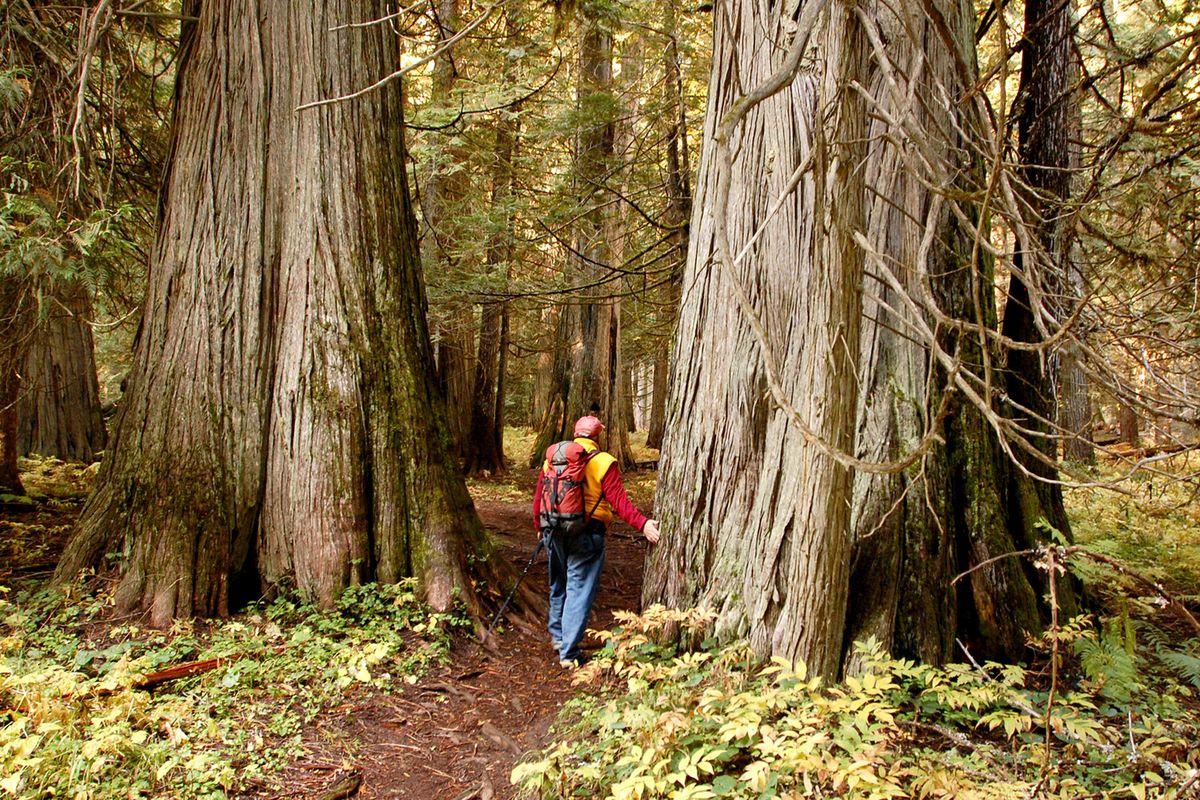
• Mallard-Larkins, 80,200 acres – the St. Joe River roadless area upstream to St. Joe Lake plus areas to the west in the Little North Fork Clearwater drainage, including Mallard Peak and Larkins Lake.
The Scotchman Peaks wilderness recommendation has generated the most consensus. Conservation groups promoting a wilderness proposal have garnered widespread approval in Bonner County and beyond.
The Mallard-Larkins and Selkirks recommendations are the most contentious.
In the draft plan, Forest Service officials had recommended wilderness for the upper St. Joe River area. However, they proposed managing the west half of the Mallard-Larkins area as wilderness while officially giving it less-restrictive “primitive” status to allow chainsaws and ease concerns in wilderness-wary rural communities.
“But after hearing comments, we decided if it walks like a duck and acts like a duck, we should call it like it is, so we recommended the entire area as wilderness,” said Jason Kirchner, Panhandle Forests spokesman in Coeur d’Alene.
“The agency’s wilderness recommendations are very important,” said Brad Smith, Idaho Conservation League staffer in Sandpoint who was pleased with the change. “Even if land is being managed as wilderness, if an agency doesn’t officially recommend that status the likelihood of Congress including it in a wilderness bill down the road is far less.”
In the Selkirk Mountains, Long Canyon and Parker Creek northwest of Bonners Ferry were included in wilderness recommendations. This change from the draft plan delights conservationists who’ve worked since the 1970s to protect the old-growth trees and other virtues of the only remaining unroaded drainages in the Selkirks.
“But we’re disappointed that the wilderness recommendation for the upper Pack River has been dropped,” Smith said. “We support the current access to snowmobiles in the McCormick Creek drainage, but the Chimney Rock, Beehive Lakes and Harrison Peak areas are important to hikers, climbers and skiers as well as to rare species like the wolverine.”
The change reflects the large increase in snowmobiling use in the region and the increased range of snowmobiles since the last plans were created.
Dropping the upper Pack from recommended wilderness opens the door to allowing motorized use when the IPNF revises its Travel Management Plan.
“This could irretrievably close the door on wilderness in the upper Pack even though it includes some of the highest quality hiking destinations in the area,” Smith said.
The IPNF plan has numerous other land classifications that offer various protections. For example:
• Wilderness study area status has been recommended for 6,900 acres near Grandmother Mountain southeast of St. Maries.
• Primitive status is recommended for 19,730 acres, primarily in Selkirk Mountains roadless areas where mountain biking could be allowed in summer and snowmobiling during winter.
• Wild river status is possible for portions of drainages including the Upper Priest, Little North Fork Clearwater, North Fork Coeur d’Alene, Kootenai, Hughes Fork and Long Canyon Creek. A wild designation prohibits activities such as motorized use, timber harvest, mining and grazing.
• Backcountry status is favored by forest officials for most roadless areas to allow a variety of trail-oriented motorized and non-motorized recreation and the presence of lookouts, cabins or other structures.
The plan specifies that “five new loop circuits” for motorized travel will be developed. “These trails will most likely be created by making connections between current motorized trails,” Kirchner said, citing examples in the St. Joe River region.
Forest managers also must factor in court-mandated access restrictions dealing with grizzly bears, woodland caribou and other species protected under the Endangered Species Act.
Road access has been reduced since 1987 as the Forest Service has closed roads that were causing watershed damage that impact fisheries, including threatened bull trout. In some cases road systems have been consolidated to save money.
Access issues spark the most interest in terms of recreation, Kirchner said
“We think this plan is the best possible balance for all the varied forest users,” he said. “The plan does not pick sides in debates on various issues; it picks the best balance based on the science.”