Water management affects every living thing
California is dominating the headlines in this year’s drought, but other western states, including Washington, also have costly major ongoing issues with water management. Everyone’s affected in one way or another, and so are fish and wildlife.
The latest expensive water delivery project in the Columbia Basin is related to the unsustainable deep-well “groundwater mining” that’s been lowering the water table in the Odessa Sub Area for decades.
The fix, with cost estimates to $700 million, may over decades restore groundwater as well as surface water that attracted flocks of waterfowl before it was drained from scabland potholes.
But anyway it’s examined, the costs are huge and nothing is guaranteed.
The fix, which involves pumping more water from the Columbia River, soon will substantially increase flows in Rocky Ford Creek, a spring-creek-like trout fishery near Moses Lake. The jury’s out on whether that will be good for fly fishers who prize the stream.
Water didn’t come and go naturally from this region.
“If you haven’t visited the Columbia Basin since the 1940s, you wouldn’t recognize it,” said Guy Gregory, senior hydrogeologist for the Washington Department of Ecology. “Water transformed the landscape.”
The Columbia Basin Project, authorized by Congress in 1943, converted arid sage-steppe lands into a productive agricultural region – creating extraordinary fish and wildlife habitat as a byproduct.
Developed through the U.S. Bureau of Reclamation starting in the 1950s, the project serves 671,000 acres in portions of Adams, Douglas, Franklin, Grant and Lincoln counties. Project irrigators use about 2.5 million acre-feet of Columbia River water a year – enough to totally drain Lake Coeur d’Alene.
Water is pumped uphill from the Columbia to Banks Lake and distributed through 300 miles of main canals and 2,000 miles of laterals.
Most of the water is used by farmers at least twice. Runoff from north-end irrigators is channeled through 3,500 miles of drains and wasteways mostly to Potholes Reservoir – another excellent waterfowling and fishing area – where the water is pooled for distribution to south-end irrigators.
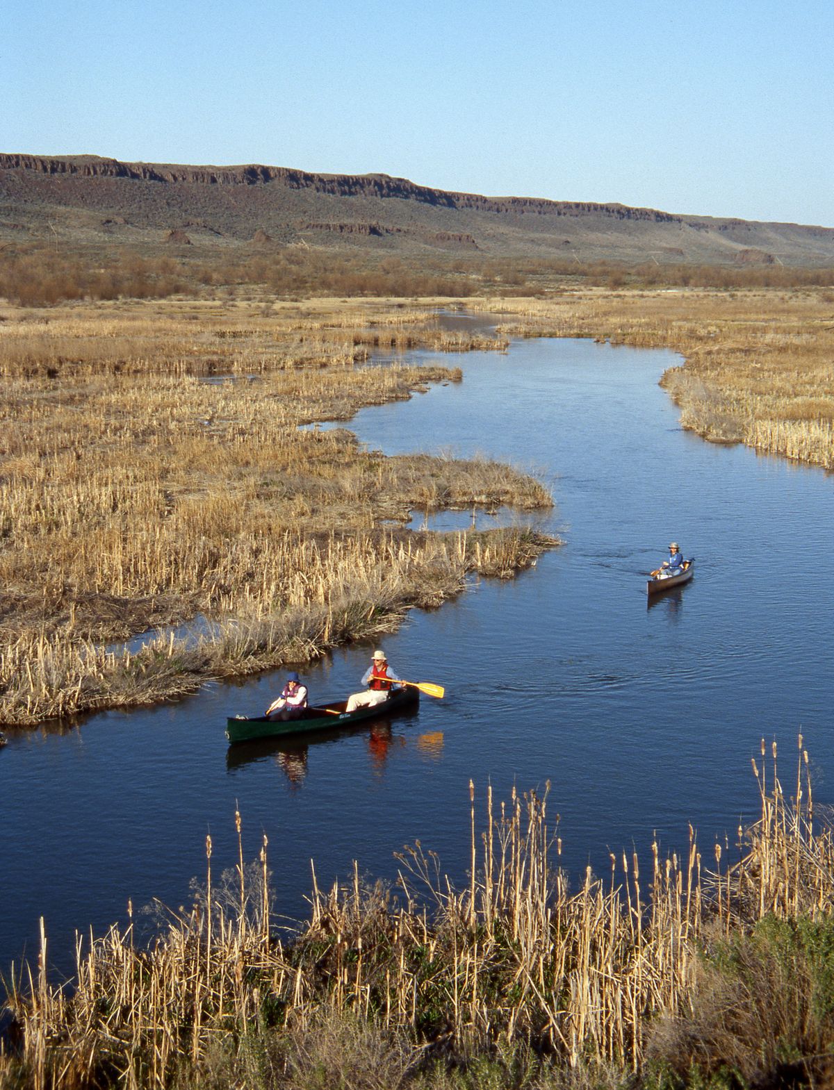
The Winchester Wasteway that flows into Potholes provides big-game and waterfowl hunting in the protected Desert Wildlife Area plus spiny ray fishing. The wasteway also is a unique canoe route through the dunes southwest of Moses Lake.
The Columbia Basin Project raises the water table in some areas creating “seep lakes” that hold trout and bass.
The Columbia National Wildlife Refuge was created to protect waterfowl and other migratory species attracted to the seep lakes.
In addition to supplying water for irrigation and power production, the project helps with flood control. It provides recreational opportunities such as boating and Columbia River flow assurance for salmon and steelhead migrations.
A major downside to the Columbia Basin Project began in the 1960s.
Irrigators on the developed west side of the project were flush with water and making big money on their crops. The more expensive plan to develop the higher east portion of the project stalled for lack of federal funds.
Irrigators in what’s called the 94,200-acre Odessa Sub Area saw the wealth federal water was bringing the west-siders and wanted a piece of the bounty.
State lawmakers and regulators gave them permission to tap groundwater with deep-well irrigation despite studies that confirmed aquifer levels would decline. It’s the only Washington area where “groundwater mining” is allowed.
“Everyone believed the wells would be temporary and that the east-side of the project would eventually be completed,” Gregory said. “But the cost would have been astronomical. It never happened.”
As deep wells began pumping irrigation water, homeowner wells soon began going dry.
Aquifer levels declined in tested areas as much as 100 feet by 1985, with numerous wells dropping 150-246 feet in the past 30 years, Gregory said.
Roughly 500 deep wells continue drawing down the aquifer in the Odessa Sub Area.
“The math is pretty simple,” Gregory said. “The wells are taking about 30 inches of water per acre a year, but it rains only about 6 inches per acre. Some wells are reaching 3,000 feet deep and pumping 1,200-1,500 gallons a minute.”
In all, the Odessa irrigators are using a half a million acre-feet of water a year – that’s nearly half the volume of Banks Lake, the 27-mile-long reservoir between Coulee City and Grand Coulee.
“That water in the Columbia Plateau might date back 80,000 years to the glaciers,” Gregory said. “We don’t know for sure, but we do know the water table is not recharged by the Columbia River.”
These industrial withdrawals from the aquifer are not sustainable. The most politically expedient solution is the Columbia River water that had already been reserved for the Odessa area. The challenge has been how to get it there.
Meanwhile, Pacific Lake, a once-popular trout fishery between Odessa and Wilbur, disappeared in the ’90s. Deer Springs Lake is a puddle.
Thousands of ducks, geese and swans that had evolved to pit-stop or nest around hundreds of scabland potholes had to adjust their migrations to other areas, including waters created by the Columbia Basin Project.
“What people don’t realize is that deep-well irrigation captures surface water,” Gregory explained. “As the wells increased and pumped more groundwater, a lot of the surface water disappeared.
“Lake Kahlotus is not a lake anymore. (Lower) Crab Creek flows as measured at Irby dropped like a set of car keys.
“Coffeepot Lake is on the edge of the impacts. There’s deep-well irrigation in the vicinity and there’s likely to be some impact, but it’s hard to say how much. We really haven’t had a wet year in awhile. We’re in the second year of drought and it’s worse than droughts of 1963 and 1981.
“That could be the main reason Coffeepot is so low.”
But decades ago, sportsmen had to abandon traditional hunting areas in many areas influenced by deep-well irrigation, especially in western Lincoln County, as streams and potholes shrank or went dry.
Some conservation groups consider the impacts of deep-well irrigation an ecological disaster.
Ditto for some landowners.
Creston-area ranchers, who hold water rights, lost a 1990s lawsuit against deep-well irrigators as they saw their livelihood drying up with the flows of Sinking Creek. The courts ruled in this case that the state did not have the authority to curtail the deep-well farmers’ junior water rights.
Columbia River Basin Water Supply rules were approved by the Washington Legislature in 2006 to develop new water supplies and storage for agriculture, communities and stream flows for fish.
The Odessa Groundwater Replacement Program is part of that project, led by the Department of Ecology. The Washington Legislature voted to provide $200-$250 million in bonding to find new water supplies in Washington, providing an alternative for ground-water use in the Odessa Sub Area, said Melissa Downes, DOE manager for the Odessa expansion.
Norman Whittlesey, retired agricultural economist from Washington State University, wrote a critical review of the project analysis, saying the expansion likely is a waste of taxpayer money.
DOE officials say the project will benefit about 30 irrigators. Not every operator is eligible and no acres that aren’t already being irrigated can be added.
The federal water is reserved only for pumping uphill to 87,000 acres of circles on Odessa Sub Area farm land within the footprint of the Columbia Basin Project. Much of Lincoln and Adams counties is excluded.
The cost-benefit ratio doesn’t pencil out, critics say.
About $31 million of state money has been obligated so far as the East Low Canal has been widened and extended more than 40 miles. Infrastructure will continue to be installed over roughly three years.
The first Columbia River water, diverted at Grand Coulee into Banks Lake and the canal system, is being served to Odessa Sub Area irrigators this year as contracts have been entered with a handful of irrigators to cover about 1,800 acres.
The Bureau of Reclamation has funded some infrastructure, but future federal funding is uncertain, Downes said.
The cost of pumping water uphill to their farms is planned to be picked up by the irrigators. Cost estimates range from about $1,500 to $7,000 an acre.
Some irrigators say they can’t pay that much.
“There’s a lot still being worked out,” Downes said.
Coming Thursday: Water issues’ impact on fishing.