Clark Fork Delta ducky for paddlers
A $6 million project to arrest erosion in the Clark Fork delta has a multitude of beneficiaries, including paddlers.
Waterfowl and hunters, fish and fishermen, birds and birdwatchers are finding more attraction to the area as a partnership of agencies and groups works to restore islands and wetlands through which the Clark Fork River pours into Lake Pend Oreille.
Several hundred acres of land has gradually sloughed and washed away since dams began unnaturally fluctuating the level of Lake Pend Oreille in the 1950s. Along with the land and islands, the delta farming disappeared, habitat diversity was lost and waterfowl production plummeted.
That’s why Idaho Fish and Game, and Ducks Unlimited, are among the project partners engineering an ambitious project that hit the field two winters ago.
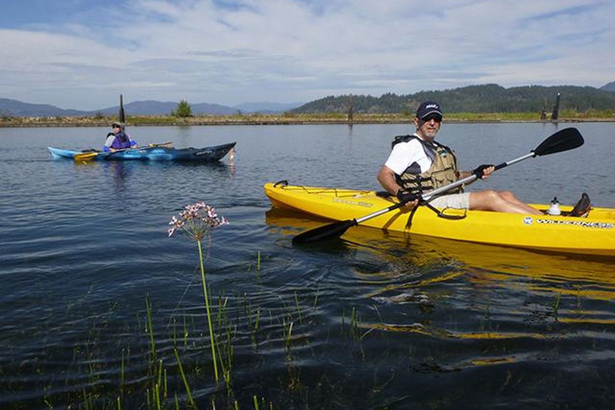
Kayakers and canoeists also are finding their niche among the first phase of newly landscaped breakwaters, weirs and restored land forms that make the delta more interesting – and safer should the wind pick up.
Kathy Cousins, Idaho Fish and Game Department biologist, recently led a group organized by the Idaho Conservation League on a paddling tour of the ongoing restoration effort.
The project is designed to slow erosion while also restoring banks and some islands, protecting native riparian and wetland vegetation and improving the quantity and quality of fish and wildlife habitat.
“We want people to enjoy this,” she said as they launched from the Drift Yard boat access of U.S. 200 east of Hope. “It’s a remarkable area.”
About 80 percent of all water entering Lake Pend Oreille is from the Clark Fork River, and the river delta is the largest area of contiguous wetlands in the Pend Oreille system.
The delta forms where the Clark Fork River enters the lake, about three miles west of Clark Fork, Idaho. It ranges to about three miles wide.
Paddlers can get a top-to-bottom look at the delta by launching at the Johnson Creek boat access and going with the flow through channels about four miles downstream to the lake. Leave a shuttle vehicle at the Drift Yard boat access to avoid a return paddle.
The Drift Yard is a Corps of Engineers facility that traps logs from going into the lake – especially during spring runoff.
Strong paddlers can head down the South Fork to the rock spit at Lee’s Point and then make a loop in good weather by paddling back upstream to Johnson Creek in the gentler summer current of the Clark Fork side channels.
Much of this area’s landscape architecture owes to glaciation and the catastrophic Ice Age floods.
Paddlers in the Clark Fork delta can look up and imagine 2,000 feet of water rushing overhead. The ice-dammed glacial Lake Missoula reached elevations up to 4,260 feet in the Clark Fork Valley and blew out numerous times over centuries. The summer level of Lake Pend Oreille is about 2,062 feet.
Cousins led the ICL paddling group for a pleasant out-and-back trip from the Drift Yard launch into the first phase of the project on the westernmost delta lands exposed to the moods of Lake Pend Oreille.
“We call it the ocean,” Cousins said of the lake. “It can have that kind of power.”
Heavy equipment was unleashed in the winter of 2014-15 to build the breakwaters and harden shorelines with rock.
But unlike the bomb-proof all-rock jetties and harbor protections built by the Corps of Engineers, the delta restoration sites are “softened”’ with soils and plantings of willows, sedges and other plants.
“The idea is to make them wildlife friendly,” Cousins said. “We’re restoring habitat for a wide range of critters.”
When spring arrived, Cousins organized volunteers – including area students – to plant 90,000 trees and shrubs in the restored delta areas. “We couldn’t have done this without the kids and other volunteers,” she said, noting that volunteers are still needed for ongoing work.
The unusually dry winter, spring and summer that followed provided poor conditions for establishing native plants on all of the bare rocks and soil, “but it’s amazing how well they did,” Cousins said.
Then the big storm of November 2016 gave the construction a full-on test.
“In most places, the project stood up, but we have some areas where we need to use bigger boulders,” she said as the group paddled around a breakwater. “In many cases we’re learning by doing.”
On the other hand, the big storm also helped the project by rolling logs and blowdown trees up onto newly hardened shorelines. “That’s all adding to the stability and the habitat,” Cousins said.
Humans also were in the project plans. Kayakers paddling along the structures will find naturalized landings for pulling small boats out of the water.
“A lot of the project sites involve large riprap rock that has to be angled in a certain way to hold in place,” Cousins said. “Those angles aren’t accommodating to boats. So we planned areas where we used smaller river rock sloped to allow access.”
Paddling the delta is appealing throughout summer after Clark Fork River runoff subsides along with the currents through the delta channels.
“Morning is the best time to paddle,” Cousins said, noting that boating traffic is lighter and wildlife activity is higher. “Even with the protection you get with the project structures, the wind tends to pick up in the afternoons.”
Prime time for scenery may be a sunny day in October when the leaves of the cottonwoods are turning yellow over the palette of autumn colors beneath them.
“We’re trying to protect what’s remaining of the land those cottonwoods are on,” Cousins said pointing to one of the shored up islands.
“We still have a lot to do,” she said, holding up some invasive reed canarygrass she’d plucked from the ample crop along the shore.
“It’s very good at what it does,” she said. But after crowding out native sedges and other plants and taking over shorelines, the non-native plant doesn’t sprout in time each spring to shelter nesting waterfowl. “We have to keep fighting it and keep planting native species,” she said.
She alerted paddlers to flowering rush, another invasive that shoots a slender bloom above water to indicate where it’s gobbling up large areas of aquatic habitat below.
Then she paddled along native sedges and bullrushes that had been planted by volunteers and were flourishing in some spots. As if on cue, a pair of mallards burst from the cattails. Tadpoles were swarming in the few inches of water at the base of the new vegetation.
She pointed out a vole scurrying through the newly established breakwater grasses. An hour later, the group saw a harrier hunting over the same area.
“You’re already seeing the reward for all of this work,” Cousins said.
“We want people to enjoy this and compare the maturing project lands with the collapsed shores we haven’t yet been able to protect.”
Visitors will see the difference even though they may not fully understand that productive wetlands consist of abundant plant communities that convert carbon dioxide to oxygen, producing energy and food for the entire food chain.
The wetlands being protected in the delta slow river flows so sediments can settle out. The native plants absorb nitrate and phosphorous and bacteria in the wetland’s water and soils can neutralize animal and human wastes.
The result is cleaner water flowing into Lake Pend Oreille.
Cousin’s message through the paddling tour was that countering the impact of the dams is expensive but allowing the delta to be washed away would be even more costly in the long run.